Name/Title
1862 Maine Johnson and Ward mapEntry/Object ID
WHC 2022.1Scope and Content
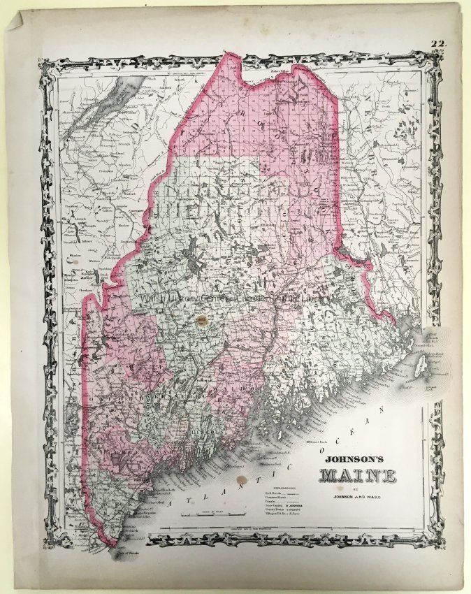
"Johnson's Maine," published by Johnson and Ward. Four-color map of Maine, "22" in upper right-hand corner. Counties differentiated by color; pink border around land boundaries of the state. Scale bar, Lat. & Long. Scrollwork border. Accompanying sales description dates it to 1862, noting that this map was included in the 1862 edition of Johnson's New Illustrated Family Atlas as Plate Number 31 of the 1862 ed. However, this is labeled 22 in the upper right-hand corner, which suggests this particular plate was from a different edition. It is clearly after 1861, when Ward bought part of the firm, and it also shows Knox County, dating from 1860. Note bent upper LH corner & 3 brown spots in map area of the sheet.
Donor Jane Mackay, 2021.Collection
Camden Public Library Map CollectionCataloged By
Donovan BowleyLexicon
Nomenclature 4.0
Nomenclature Secondary Object Term
MapNomenclature Primary Object Term
CartographNomenclature Sub-Class
Graphic DocumentsNomenclature Class
Documentary ObjectsNomenclature Category
Category 08: Communication ObjectsSearch Terms
Maine, Knox CountyDimensions
Dimension Notes
Size: 14x18"Location
Location
Building
Map File Folder PCategory
PermanentDate
October 21, 2025Inventory
Inventoried By
Ken GrossInventoried Date
Apr 13, 2022Condition
Overall Condition
GoodDate Examined
Dec 22, 2021Examined By
Ken GrossRelationships
Related Person or Organization
Person or Organization
Johnson and WardGeneral Notes
Note
Status: OK
Status By: Ken Gross
Status Date: 2022-04-13Created By
admin@catalogit.appCreate Date
April 13, 2022Updated By
admin@catalogit.appUpdate Date
October 27, 2025