Name/Title
Plan of the town of Wayland in the year 1776 made by J.S. Draper Dec. 17 1881 - map copy by G.B. SmithEntry/Object ID
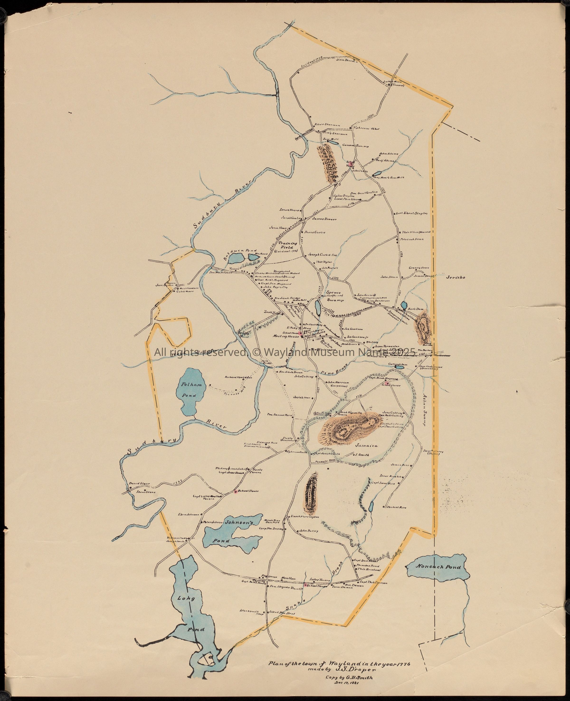
587cDescription
James Sumner Draper (1811–1896) was a Wayland farmer, local historian, and neighbor who devoted himself to preserving the town's past. In 1881, he drew this map looking back to 1776—the year independence was declared. Ponds, rivers, roads, dwellings: a town made visible, bounded, known.
Maps have always been instruments of power. They define borders, assign ownership, establish who belongs where. In the new republic, cartography helped transform land into property and maps record choices. In 1776, Wayland had farms, mills, meetinghouses. It also had enslaved people, unnamed in most records. A map shows property lines and landowners. It doesn't show who worked the land, who couldn't own it, who wasn't counted and whose land it once was. What does it mean to put a place on a map? What locations do you recognize? What would a map made 100 years from now look like of Wayland?
_____
Plan of the town of Wayland in the year 1776 made by James Sumner Draper (1811-1896).
Dec. 17 1881 - map copy by G.B. Smith
Color added. Illustrations including ponds, river, mountains, roads, dwellings
Map given to Society in 1960s. Seems to be a modern copy of the 1881 work by G.B. SmithCataloged By
Jo Goeselt, Fran PollittLexicon
Nomenclature 4.0
Nomenclature Secondary Object Term
MapNomenclature Primary Object Term
CartographNomenclature Sub-Class
Graphic DocumentsNomenclature Class
Documentary ObjectsNomenclature Category
Category 08: Communication ObjectsMap Details
Scale
not givenDate Published
1900 - 1969Medium
Ink, wash, on paperDimensions
Dimension Notes
21 x 17 inchesGeneral Notes
Note
Notes: "537e" written in pencil on back of map. No associated accession record seems to apply.