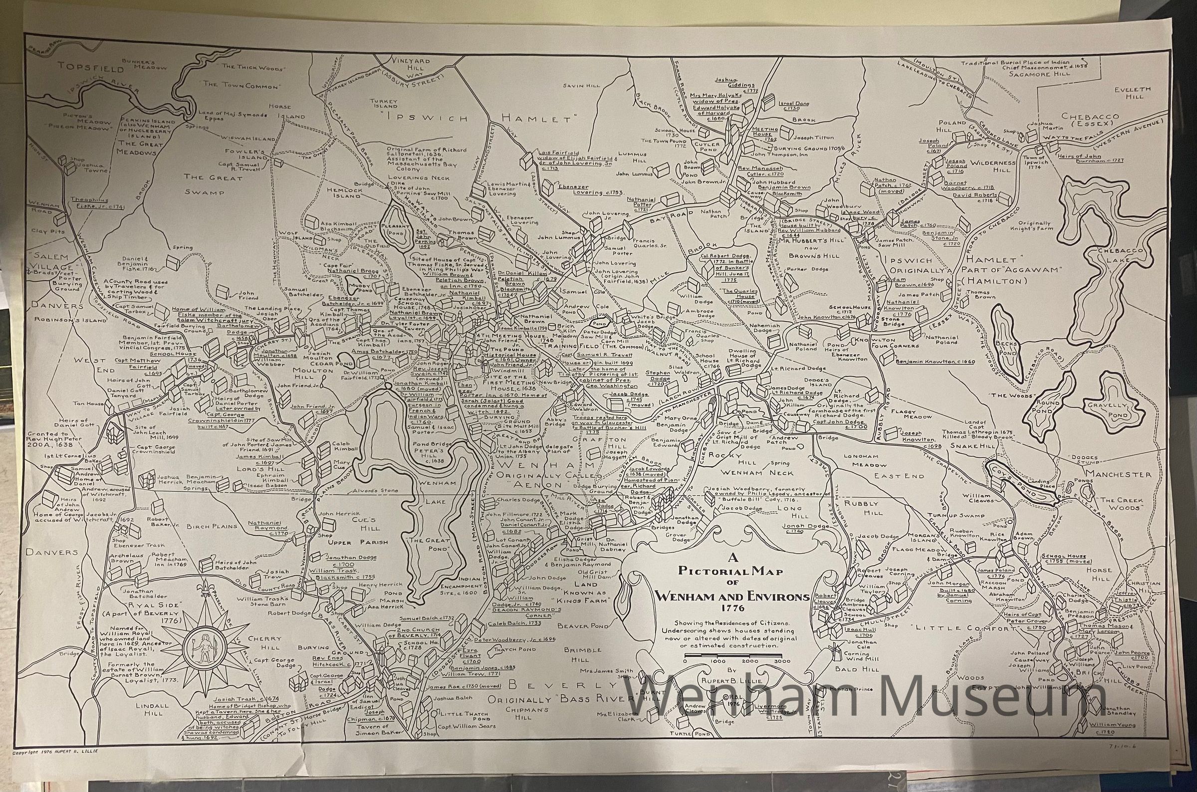
Name/Title
Pictorial Map of Wenham and Environs, 1776Entry/Object ID
1971.10.006Description
A pictorial map of Wenham and Environs, 1776. Showing the residences of Citizens. Underscoring shows houses standing now or altered with dates of original or estimated construction. By Rupert B. Lillie. Printed 1976 for the bicentennial. (These maps catalogued in 1982 using previous accession number allotted in 1971).