Name/Title
Notes regarding Stringham & Everetts, Madam Denn, Jerrard & Bull PatentEntry/Object ID
002529Tags
Bull Family, Stringham, EverettsScope and Content
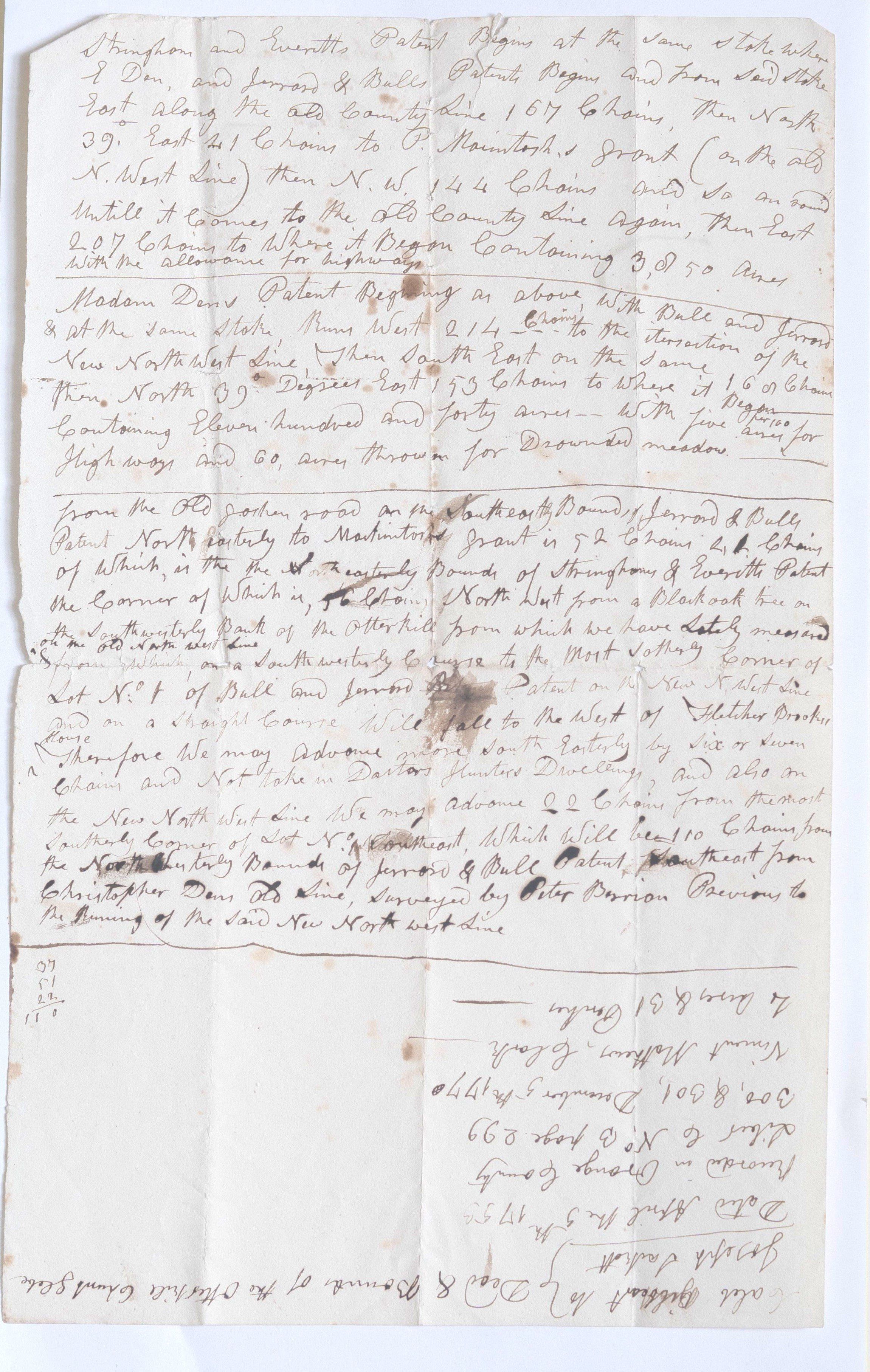
This document appears to be an 18th-century survey description or property deed related to land patents in Orange County, New York (likely the Goshen or Otterkill area).
Below is the transcription of the handwritten text. Please note that some words are difficult to decipher due to archaic cursive and ink fading; these are indicated with brackets or best-guess interpretations.
Transcription
[Top Section]
Stringham and Everitt’s Patent Begins at the same Stake where C. Denn, and Jerrard & Bulls Patents Begins and From Said Stake East along the old County Line 167 Chains, then North 39∘ East 41 chains to P. Macintosh’s Grant (on the old N. West Line) then N.W. 144 Chains and so on [round] until it comes to the Old County Line Again, then East 207 chains to where it Began Containing 3,050 Acres with the allowance for highways.
Madam Dens Patent Beginning as above with Bull and Jerrard & at the same stake Runs West 214 chains to the intersection of the New North West Line, then South East on the same 116 chains Then North 39∘ Degrees East 153 chains to where it began [containing] eleven hundred and forty acres—with five acres per 100 for Highways and 60 acres thrown in for Drowned meadow.
[Middle Section]
From the Old Goshen road on the South Easterly Bounds of Jerrard & Bulls Patent North Easterly to Macintosh’s Grant is 52 chains, 41 chains of which is the North Easterly Bounds of Stringham & Everitt’s Patent the Corner of which is [56 chains] North West from a Blackoak tree on the Southwesterly Bank of the Otterkill from which we have Lately measured on the old north west line on a South westerly Course to the Most Southerly Corner of Lot No. 1 of Bull and Ferrard’s Patent on the New N. West line and on a Straight Course will fall to the West of Fletcher Brooks house. Therefore we may Advance more South Easterly by Six or Seven Chains and Not take in Doctors Hunters Dwelling, and also on the New North West Line We may Advance 22 Chains from the Most Southerly Corner of Lot No. 1 Southeast, Which Will be 110 Chains from the North Westerly Bounds of Ferrard & Bull Patent, Southeast from Christopher Dens Old Line, surveyed by Peter Berrian Previous to the Running of the Said New North West Line.
[Bottom Right - Written Inverted/Upside Down]
Caleb Gilbert to } Desr & Bounds of the Otterkill [Grand Stake]
Joseph Sackett }
Dated April the 5th 1735
Recorded in Orange County
Liber C No. B page 299
300 & 801, December 5th 1770
Vincent Matthews, Clerk
2 Acres & 31 Perches
Key Details Found
Locations: Otterkill, Orange County, Goshen Road, "Drowned Meadow" (a common term for the Wallkill River marshlands).
Key Names: Stringham, Everitt, Christopher Den, Ferrard, Bull, P. Macintosh, Doctor Hunter, Fletcher Brook, Peter Berrian (Surveyor), and Vincent Matthews (Clerk).
Dates: The original survey data mentions April 5, 1735, while the recording or later notation is dated December 5, 1770.