Name/Title
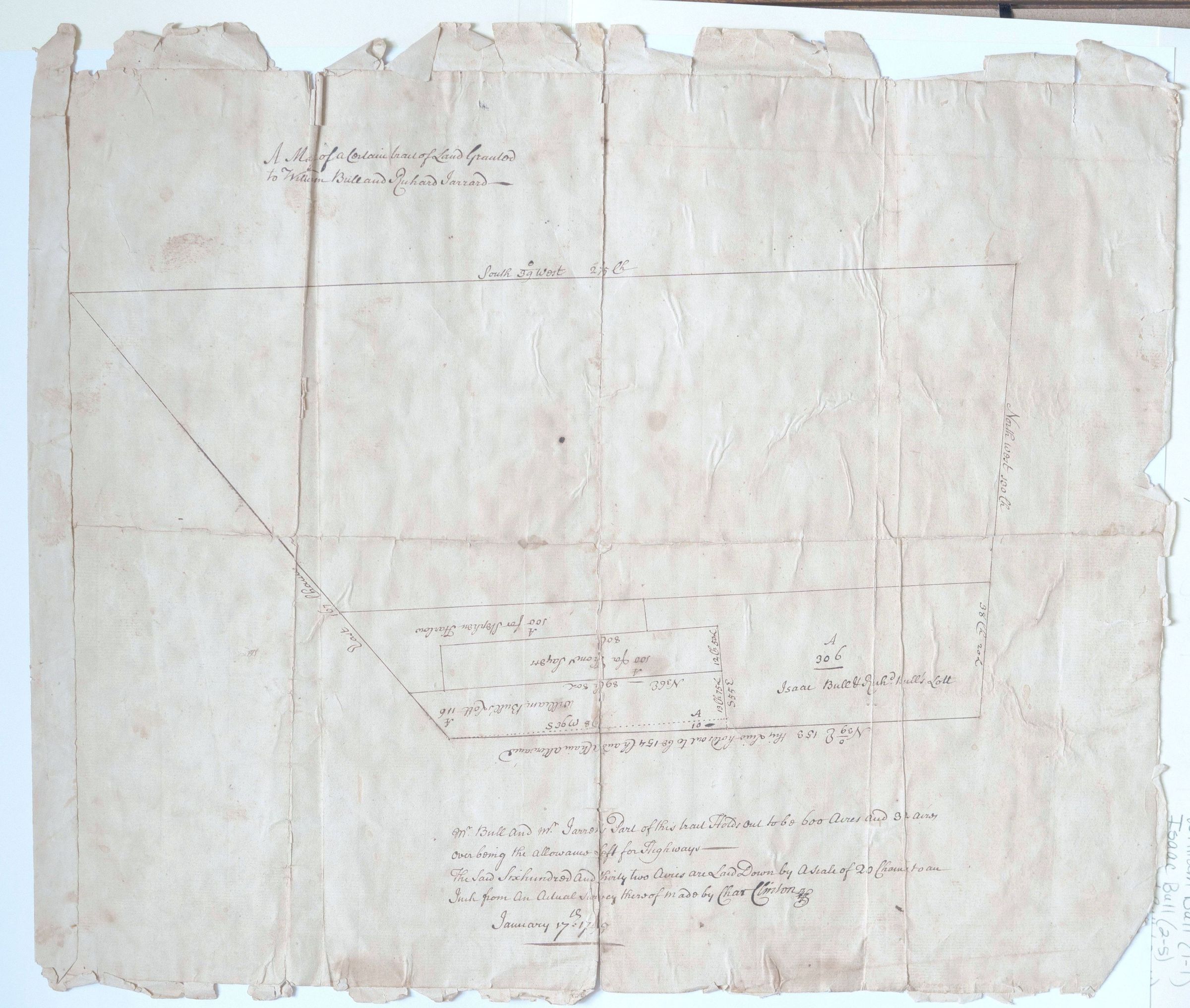
Map of land patent for Jerrard, Bull, Thomas Sayer/SayorrEntry/Object ID
002530Tags
Jerrard Family, Bull FamilyScope and Content
This is an original 18th-century hand-drawn land survey map (plat), specifically recording a tract of land granted to members of the Bull and Gerrard families.
Based on the handwritten notations and historical context common to this style of document, here is a breakdown of what you are looking at:
Document Overview
Date: January 17, 1724 (written as "January 17th 1724/5" in the bottom right corner, using the old-style dating system).
Significance: This is a primary historical record used to establish property boundaries, often for colonial land grants.
Surveyor: Signed by Charles Clinton, a notable colonial surveyor (and father of Revolutionary War General James Clinton and Governor George Clinton).
Key Details from the Map
The document contains specific names and measurements that provide a glimpse into early American land ownership:
Primary Names: The map mentions William Bull and Richard Jerrard. Within the sub-plots, you can see names like Isaac Bull and Stephen Hoe.
Acreage: The text describes a "Certain Tract of Land... to be 600 Acres," with specific mentions of 100-acre sections for individuals like Stephen Hoe and Isaac Bull.
Geographic Markers: The map uses "Chains" as the unit of measurement (a standard surveying tool where 1 chain equals 66 feet). You can see notations like "North West 100 Ch" and "South 33 West."
Note on Highways: There is a specific legal note stating, "being the allowance of 5% for highways," which was a common colonial practice of reserving a portion of granted land for future public roads.
Historical Context
Documents like this are often associated with the Wawayanda Patent or similar early settlements in Orange County, New York. The Bull family, specifically William Bull and Sarah Wells, were prominent early settlers in that region (famous for the "Bull Stone House").
Conservation Status
The document shows significant age-related wear, including foxing (the brown spotting), creasing, and tattered edges. Because this is a unique legal and genealogical record from 1724, it is historically valuable.