Name/Title
Town of Goshen Feb 23, 1759 John Bull to house of Isaac BullEntry/Object ID
002535Tags
Isaac Bull, John BullScope and Content
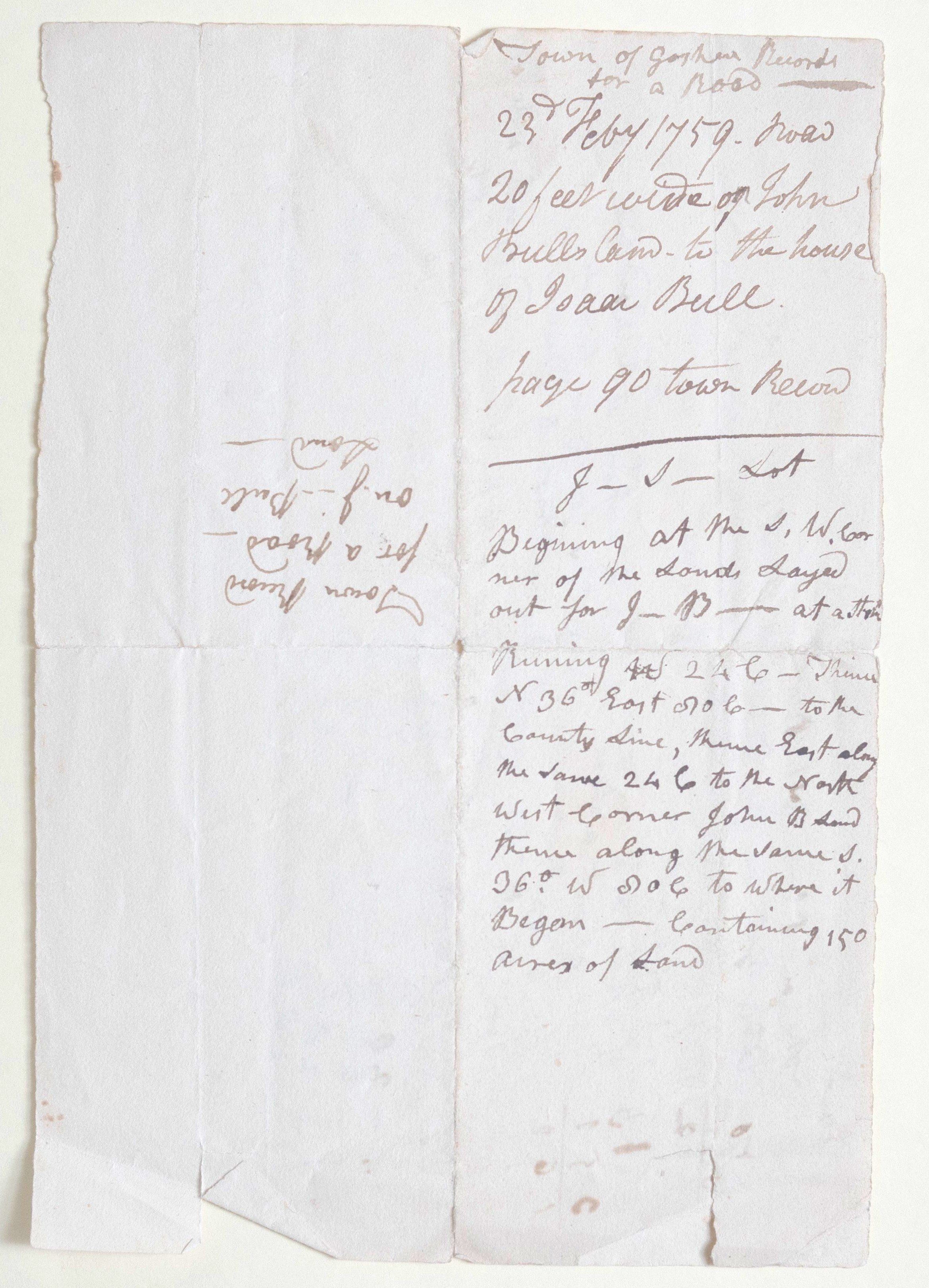
Document 1: Town of Goshen Records
Top Section:
Town of Goshen Records
for a road
23rd Feby 1759. road
20 feet wide on John
Bull’s land - to the house
of Isaac Bull.
page 90 town Record
Bottom Section:
J — I — Lot
Beginning at the S.W. corner
of the Lands Layed
out for J— B— at a [stone]
Running [S] 24 E — thence
N 36° East 100 C — to the
County Line, thence East along
the same 24 C to the North
West corner John B land
thence along the same S.
36° W 100 C to where it
Began — Containing 150
acres of Land
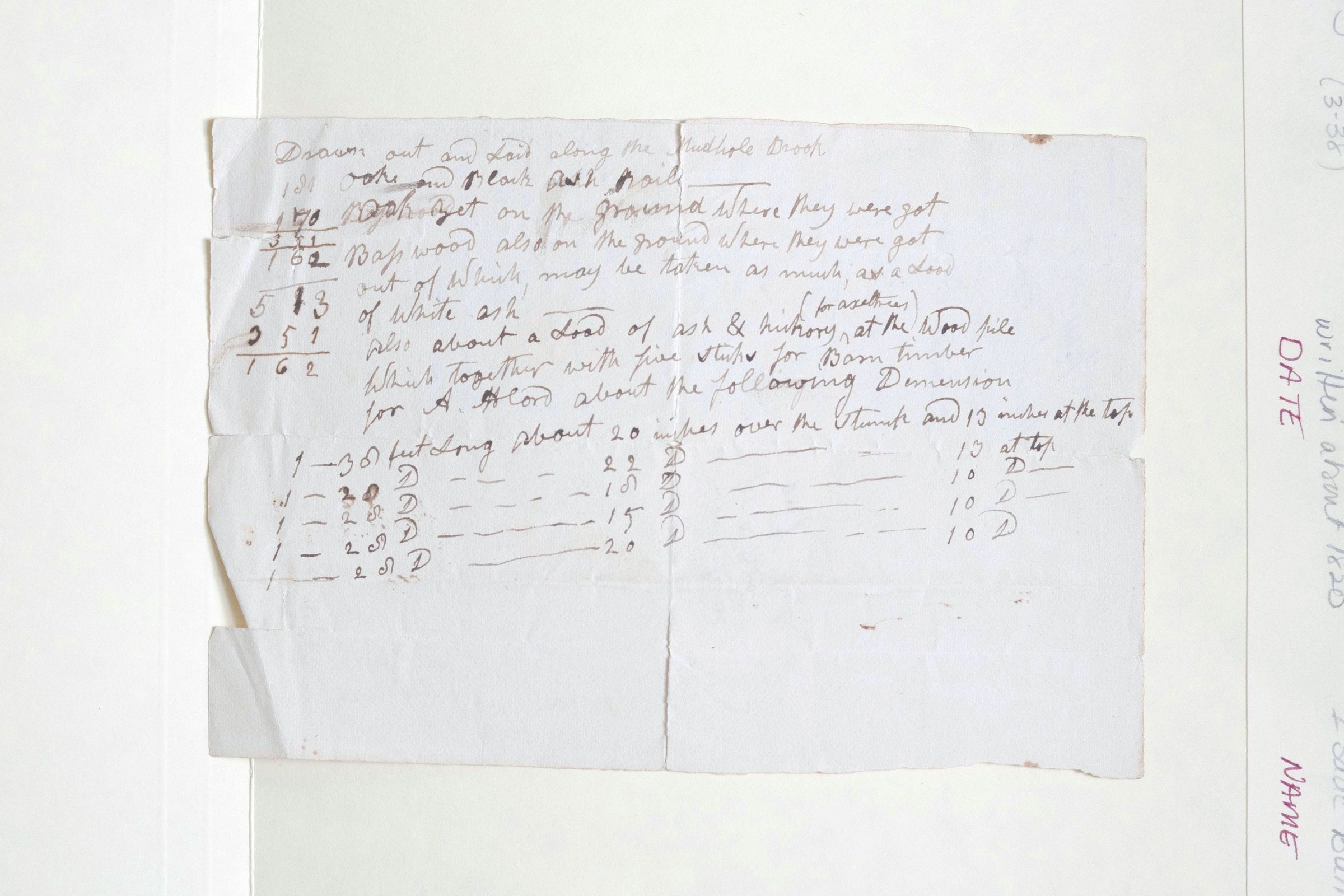
Document 2: Timber Inventory
Note: This document contains several mathematical calculations in the left margin.
Drawn out and Laid along the Mudhole Brook.
red oaks and black oak rail
[170] Basswood yet on the ground where they were got
[162] Basswood also on the ground where they were got
out of which may be taken as much as a Load
of White ash (for axeltrees)
also about a Load of ash & hickory at the Wood pile
Which together with five sticks for Barn timber
for A. Wood about the following Demension [Dimension]
Timber Dimensions:
1 — 30 feet Long about 20 inches over the Stump and 13 inches at the top
1 — 20 [do] — — 22 [do] — — 13 at top
1 — 25 [do] — — 18 [do] — — 10 [do]
1 — 25 [do] — — 15 [do] — — 10 [do]
1 — 25 [do] — — 20 [do] — — 10 [do]
Key Details & Observations
Locations: Mention of "Mudhole Brook," the "County Line," and land belonging to John Bull and Isaac Bull.
Dates: The road record is explicitly dated February 23, 1759.
Units: In the survey (2535), "C" likely refers to Chains, a standard unit of length for surveyors (1 chain = 66 feet).
Purpose: Document 2535A appears to be a bill of materials or an inventory for construction, specifically mentioning "Barn timber" and "axeltrees."