Name/Title
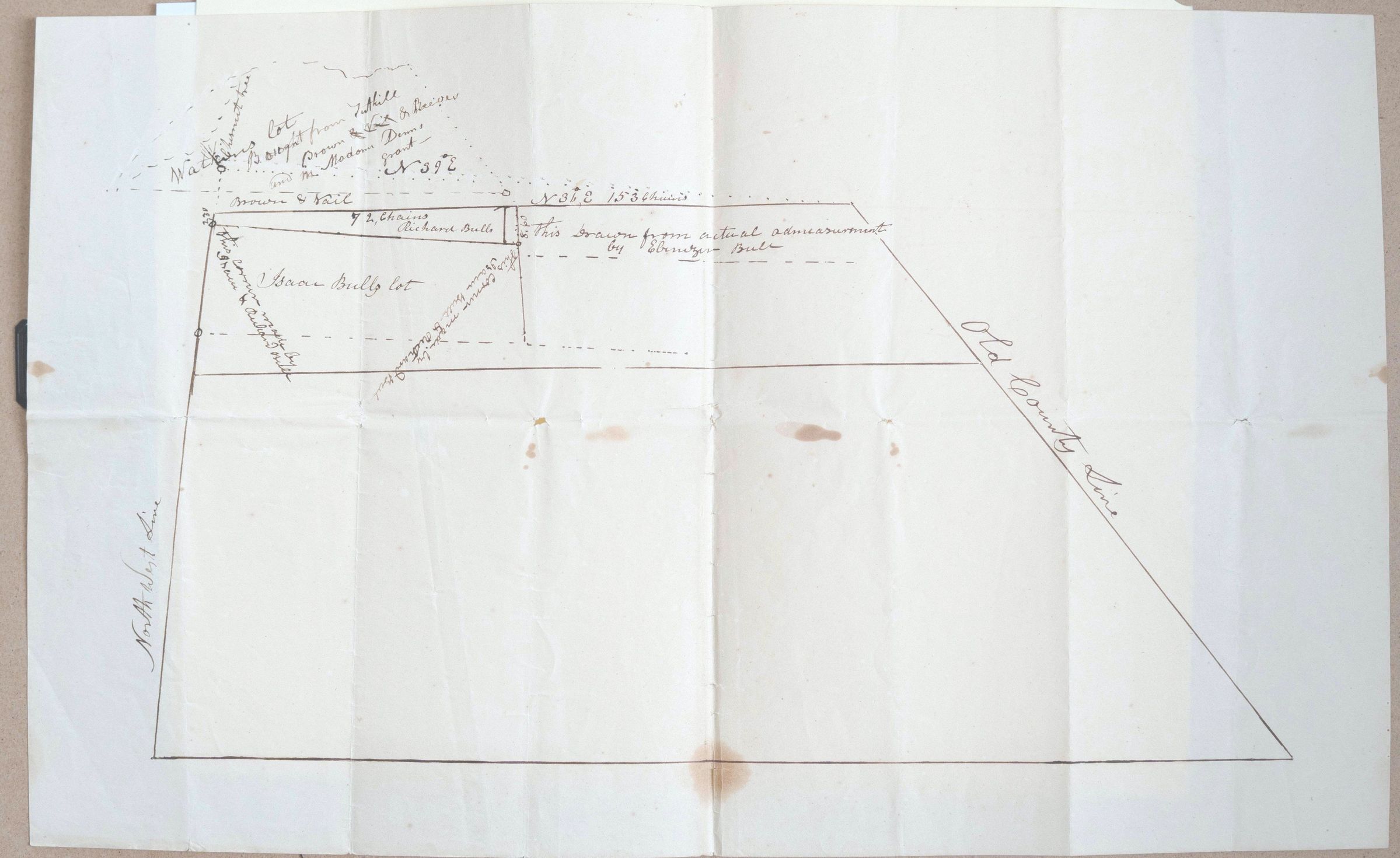
Map drawn by Ebenezer Bull showing Isaac Bull's propertyEntry/Object ID
002586Tags
Isaac Bull, Richard G Bull, Ebenezer BullScope and Content
This appears to be a historical hand-drawn land survey or plat map, likely from the late 18th or 19th century. It outlines specific property boundaries, neighboring landholders, and geographical markers.
Here is a breakdown of the key elements visible in the document:
1. Key Text and Names
Property Owners: The map mentions a few specific names, notably "Isaac Bull’s lot" in the center-left. Above that, there is a reference to land bought from "Hill, Brown & Vail" and "Richard Bull."
Surveyor’s Note: A note on the right side of the central plot states: "This drawn from actual admeasurement [measurement] by Ebenezer Bull." * Geographic Markers: The right boundary is clearly labeled as the "Old County Line," and the left vertical boundary is marked as the "North West Line."
2. Measurements and Technical Details
The survey uses historical units of measurement. You can see notations like "72 Chains," which was a standard unit for surveyors (one Gunter's chain is 66 feet).
Compass bearings are noted along the top boundary, such as "N 31° E" (North 31 degrees East).
3. Purpose of the Document
This document was created to legally define a parcel of land, likely for a deed transfer or a property dispute. The mix of solid and dashed lines suggests:
Solid lines: Established or current boundaries.
Dashed lines: Projected boundaries, previous divisions, or neighboring claims.
4. Contextual Clues
The names (Bull, Vail, Brown) and the style of the "Old County Line" notation are very common in early American colonial or post-Revolutionary land records, particularly in the Northeastern United States (such as New York, Connecticut, or Pennsylvania).