Name/Title
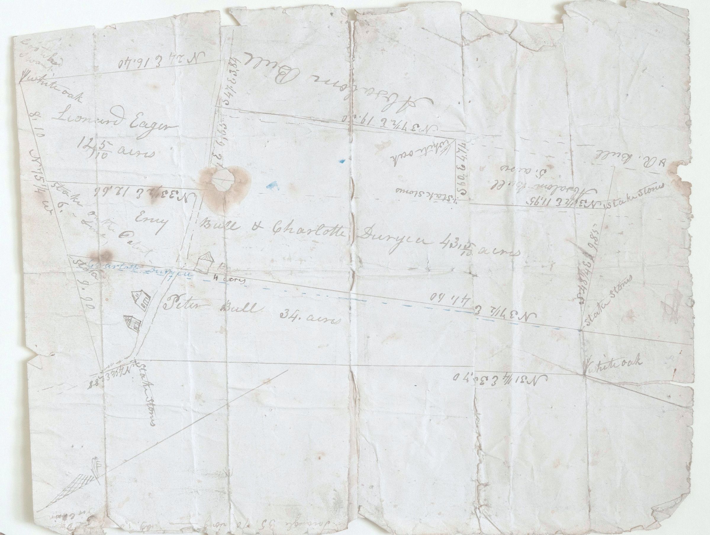
Map od properties of Absolum, Peter & Ency Bull, Leonard Eager, Charlotte DuryeaEntry/Object ID
002621Tags
Absalom Bull, Peter Bull, Charlotte Durlyea, Leonard EagerScope and Content
Key Features of this Map
Plat maps like this were essential for establishing property lines in early settlements. Here is a breakdown of what you are seeing:
Landowners: You can see several specific names associated with different parcels of land, including:
Absalom Bull
Peter Bull
Leonard Eager (associated with 12105 acres)
Ency Bull & Charlotte Duryea (associated with 4321 acres)
Metes and Bounds: The map uses the "metes and bounds" system of surveying. You’ll notice notations like "N 37 1/2 E 19.30" along the lines. These represent compass bearings (North 37.5 degrees East) and distances (likely in "chains" or "rods").
Natural and Artificial Markers: Before modern GPS, surveyors used physical landmarks. On this map, you can see notations for:
"White oak" trees used as corner markers.
"Stake & stones" used to mark specific boundary points.
Topographical Details: There are small, hand-drawn sketches of houses or structures (small rectangular icons with peaked roofs) located on the parcels belonging to Peter Bull and Ency Bull/Charlotte Duryea.
Historical Context
The names (specifically Bull and Duryea) are very common in early American colonial history, particularly in the Orange County, New York area. The "Bull" family was one of the founding families of that region in the early 1700s.
Documents like this were often kept by families or filed with a County Clerk to prove land claims or to settle inheritance disputes among heirs.