Name/Title
Original Colonial Land Patents in Orange and Uster CountiesEntry/Object ID
002392Tags
Orange County History, Ulster County HistoryScope and Content
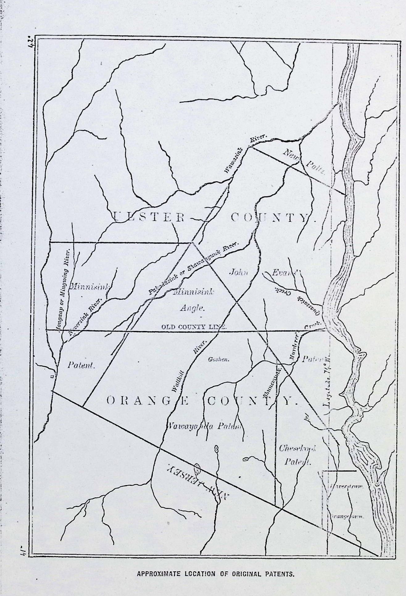
This map shows the approximate location of original colonial land patents in Orange and Ulster Counties, New York.
Based on the layout and the specific land grants shown, this is a historical reference map (likely from a 19th-century county history book or atlas) illustrating the boundaries of major 18th-century royal patents.
Key Features of the Map:
The Minnisink Angle: This is a prominent triangular land dispute area. The "Angle" was a central point of contention between the owners of the Minisink Patent and the Wawayanda Patent during the 1700s.
John Evans Patent: Shown in the center, this was a massive, controversial grant given to Captain John Evans in 1694. It was famously vacated (canceled) by the colonial government in 1699 because it was considered too large and a hindrance to settlement.
The "Old County Line": The horizontal line across the middle marks the original 1683 boundary between Orange and Ulster Counties. In 1798, the boundary was moved significantly further north, which is why towns like Newburgh and Montgomery are in Orange County today despite being in Ulster on this map.
Wawayanda Patent: Located at the bottom, this covered much of what is now central and southern Orange County.
Chesekook Patent: Visible in the lower right, covering the southeastern portion of Orange County (near the Hudson River).
Geographic Markers: You can see the Hudson River on the right, the Wallkill River running through the center, and the Quassaick Creek near the Hudson.
Historical Context:
This map is frequently found in historical texts like Eager’s History of Orange County (1846) or Ruttenber & Clark’s History of Orange County, New York (1881). It was created to help readers understand the complex and often overlapping "metes and bounds" that defined property ownership before the American Revolution.