Name/Title
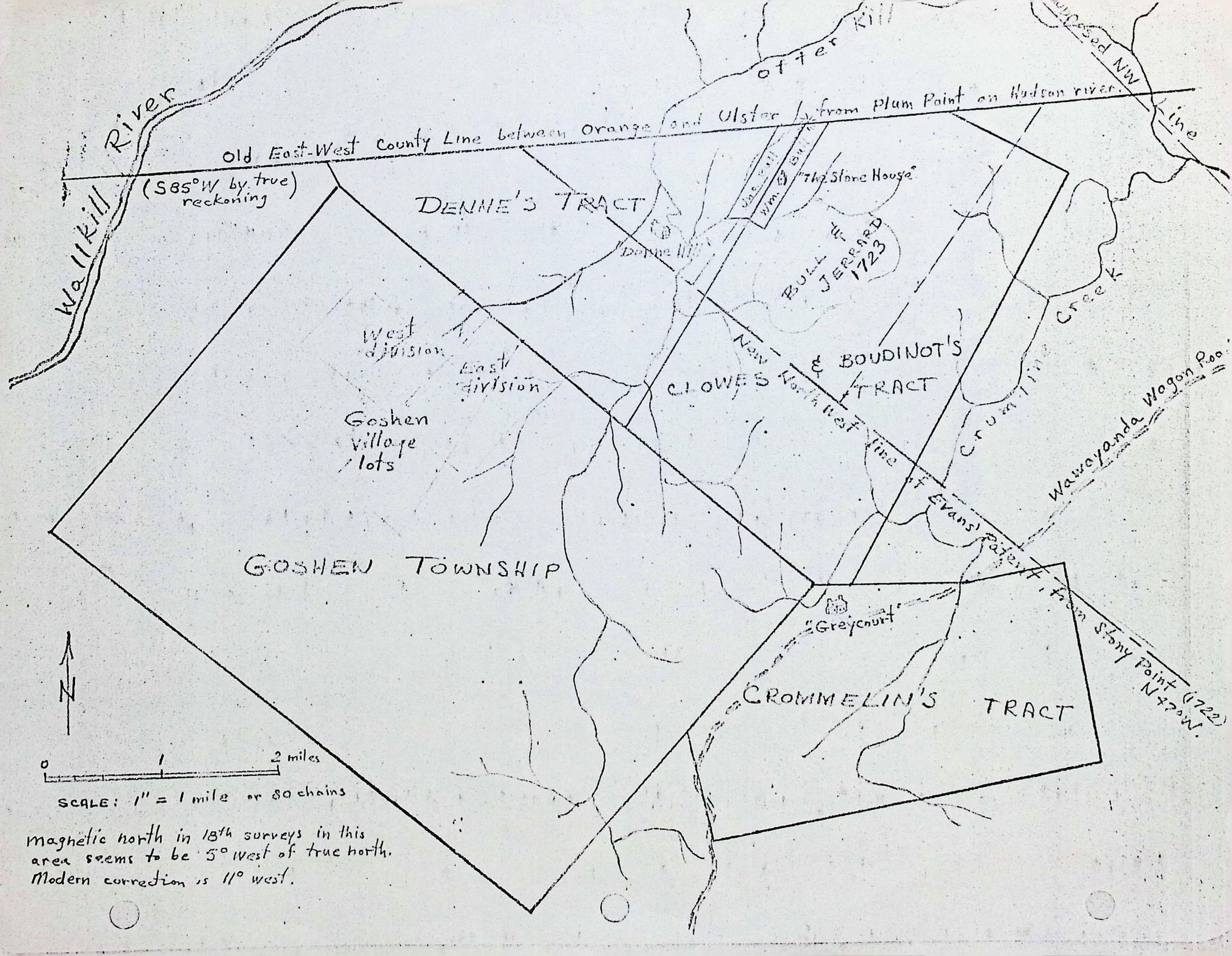
Map of the tract of lands for the Denne's, Clowes, Boudinot's, Crommelin's, Bull's and JerrardEntry/Object ID
002390Tags
Christopher Denne, Daniel Crommelin, William Bull, Samuel Clowes, Elias Boudinot, John JerrardScope and Content
This image is a historical survey map (likely a modern reconstruction or hand-drawn copy) depicting land tracts and colonial boundaries in Orange and Ulster Counties, New York.
The map focuses on the early 18th-century settlement patterns of the Goshen area, showing how various land patents and "tracts" intersected.
Key Geographic Features
Waterways: It shows the Wallkill River on the left, Otter Kill at the top, and Crumline Creek on the right.
Township & Tracts: The map outlines Goshen Township (divided into East and West divisions), along with several prominent colonial land grants:
Denne’s Tract
Clowes & Boudinot’s Tract
Crommelin’s Tract
Bull & Jerrard (1723)
Historical Landmarks: It notes the location of "The Stone House" and "Greycourt," which are significant historical sites in the Hudson Valley region.
Notable Historical Annotations
County Lines: The top horizontal line is labeled "Old East-West County Line between Orange and Ulster," running from Plum Point on the Hudson River.
Surveying Details: The map includes specific notes on magnetic declination, stating that magnetic north in 18th-century surveys was 5° west of true north, while the "modern" correction (at the time this map was drawn) was 11° west.
Patent Lines: It marks the "New North East line of Evans’ Patent from Stony Point (1722)."
What it tells us
This document is an architectural or genealogical tool used to trace the original property boundaries of the Wawayanda Patent and the development of the Town of Goshen. It serves as a bridge between 1700s surveying and modern geography, helping researchers identify exactly where early settlers like the Bull or Denne families established their homesteads.