Name/Title
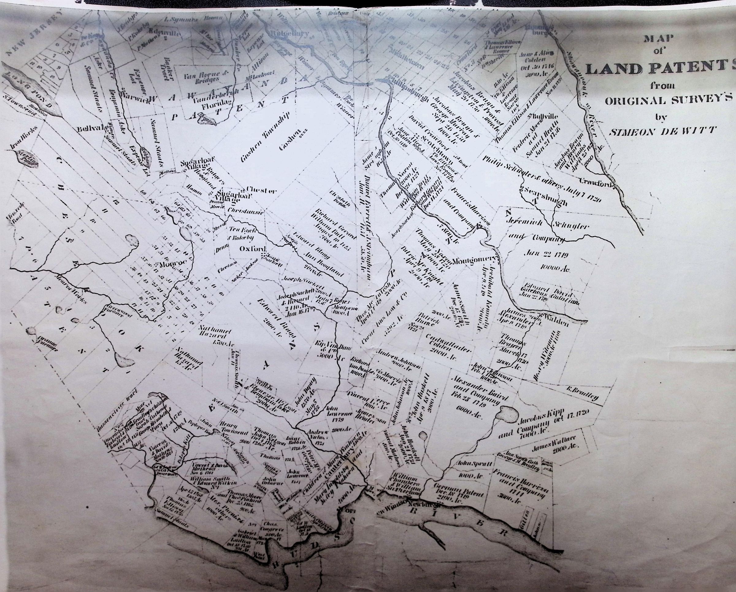
Map of NY Land Patents from Original Surveys by Simeon DeWittEntry/Object ID
002257Tags
MapsScope and Content
This image is a historical Map of Land Patents covering portions of Orange and Rockland Counties, New York. It was compiled by Simeon DeWitt, who served as the Surveyor General of New York for over 50 years starting in the late 18th century.
Key Features of the Map
Geographic Scope: The map depicts the region between the Hudson River (bottom right) and the New Jersey border (top left). Key landmarks include "Long Pond" (now Greenwood Lake), the Ramapo River, and the Wallkill River.
Land Grants & Patents: The primary purpose of the map is to show the original colonial land grants (patents). These were large tracts of land granted by the British Crown or the State to individuals or groups of investors.
Townships & Settlements: Several early settlements and townships are visible, including:
Goshen and Goshen Township
Monroe and Monroe Works
Chester and Sugarloaf
Montgomery and Newburgh (near the Hudson)
Prominent Families: You can see the names of famous colonial-era landowners, such as Schenck, Van Cortlandt, Schuyler, Livingston, and Cadwallader Colden.
The "Cheesecocks" Patent: A large portion of the lower-left section is labeled "Cheesecocks," which was a massive land patent that covered much of what is now southern Orange County and northern Rockland County.
Historical Significance
Maps like this were essential for resolving property disputes and determining tax boundaries in the early United States. Because the "Original Surveys" were often imprecise, DeWitt’s work was crucial in consolidating these overlapping claims into a single, authoritative record.
Note on the Surveyor: Simeon DeWitt was a pivotal figure in American cartography; he served under George Washington during the Revolutionary War and played a major role in the grid planning of New York City.