Name/Title
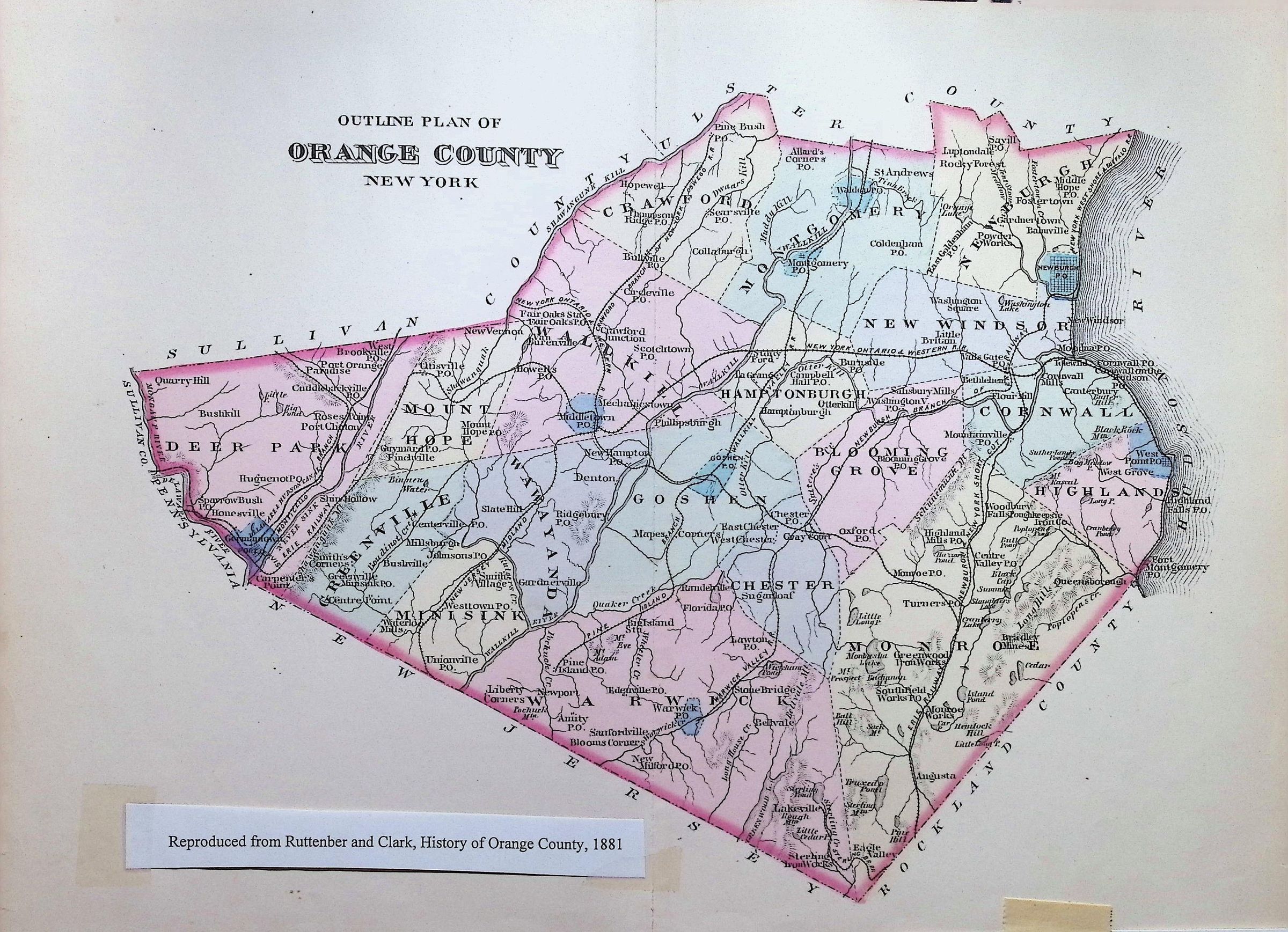
Outline Plan of Orange County New YorkEntry/Object ID
002262Tags
MapsScope and Content
This is an 1881 Outline Plan of Orange County, New York, reproduced from the historical text History of Orange County by Ruttenber and Clark. It provides a detailed snapshot of the county’s political and geographical landscape during the late 19th century.
Key Features of the Map
Township Divisions: The map is color-coded to delineate the various towns within the county, including Deer Park, Wallkill, Goshen, Warwick, Newburgh, and Cornwall.
Topography & Hydrography: * The Hudson River defines the eastern border.
The Delaware River sits on the western edge.
Significant inland bodies of water, such as Greenwood Lake (bottom center) and Glenmere Lake, are clearly visible.
Infrastructure: The map tracks the vital transportation networks of the era, specifically:
Railroads: Lines like the Erie Railway and the New York, Ontario & Western Railway are marked, showing how they connected rural hubs like Middletown and Goshen to the larger region.
Post Offices: Numerous small villages and local P.O. locations are labeled, indicating the density of local settlements.
Borders: It shows Orange County’s neighbors during this period: Sullivan County to the northwest, Ulster County to the north, Rockland County to the southeast, and the state of New Jersey (and a sliver of Pennsylvania) to the southwest.
Historical Context
At the time this map was published (1881), Orange County was a critical agricultural and manufacturing hub. The map highlights the "Mid-Hudson" transition where the rugged terrain of the Highlands (near West Point and Cornwall) meets the fertile black dirt valleys of Goshen and Warwick.