Name/Title
Survey of Denne Hill copyEntry/Object ID
001932Tags
Daniel Crommelin, Christopher DenneScope and Content
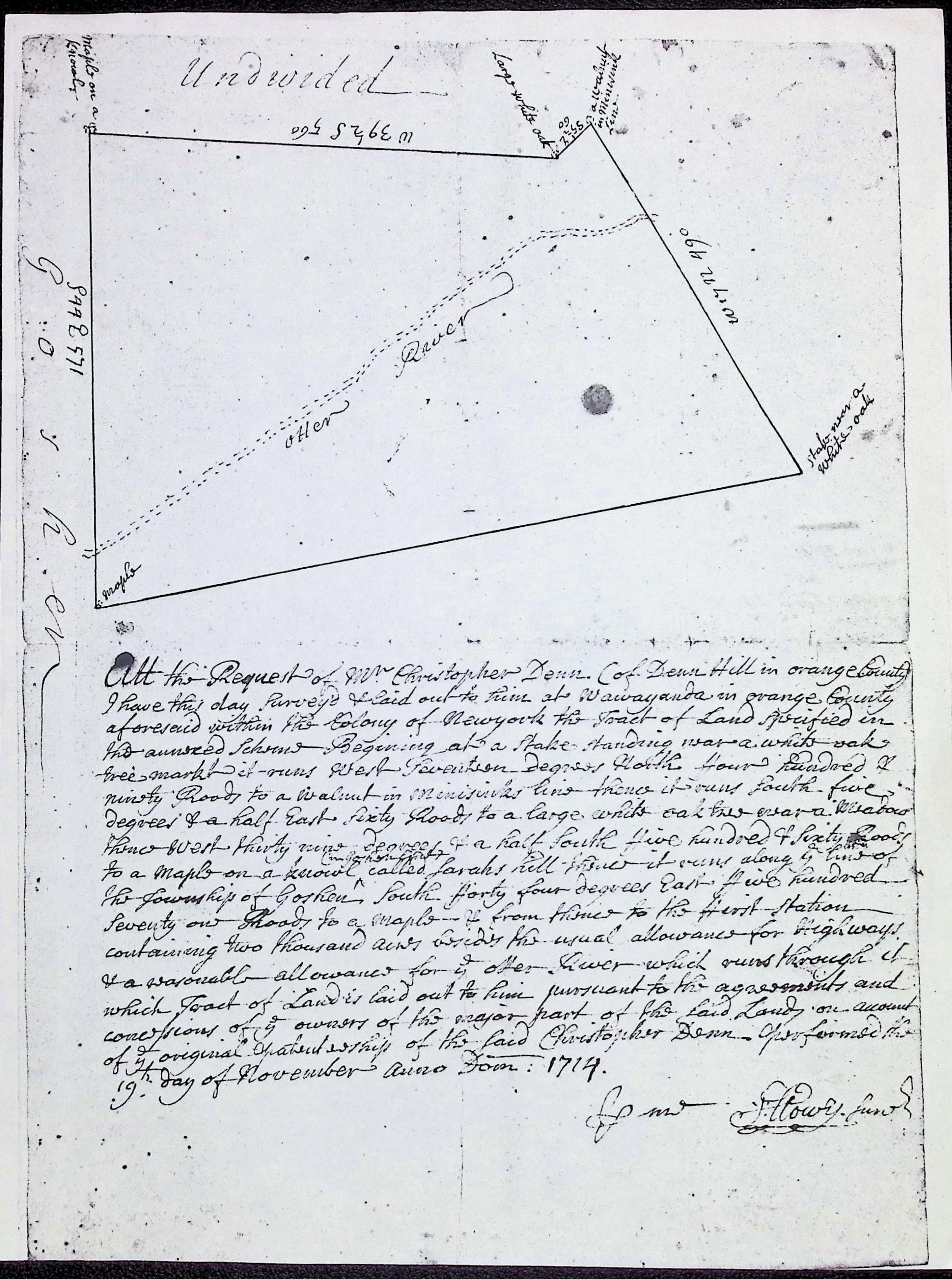
At the Request of Mr. Christopher Denn of Denn Hill in Orange County I have this day Surveyed & laid out to him at Wawayanda in Orange County aforesaid within the Colony of New York the Tract of Land specified in the annexed Scheme Beginning at a Stake standing near a white oak tree marked—it runs West Fourteen Degrees North Four Hundred & ninety Roods to a walnut in Minisink line—thence it runs South five degrees & a half East sixty Roods to a large white oak tree near a Meadow—thence West thirty nine degrees & a half South five hundred & sixty Roods to a Maple on a knoll called Sarah's Hill—thence it runs along the line of the Township of Goshen South forty four degrees East five hundred seventy one Roods to a Maple—& from thence to the first station containing two thousand acres besides the usual allowance for highways & a reasonable allowance for the Otter River which runs through it...
Performed the 19th Day of November Anno Dom: 1714.
By me, J. Lowry Junr.
Key Features of the Map
The "Otter River": The map clearly shows the "Otter River" (now known as the Otter Kill) flowing through the center of the property.
Survey Markers (Metes and Bounds): In the early 18th century, surveyors used natural landmarks. You can see labels on the corners of the "Scheme" (the map) such as:
Large white oak
Walnut in Minisink line
Maple on a knoll
The Wawayanda Patent: Christopher Denn was a central figure in this famous (and often legally contested) land grant. This document is a primary record of how that massive patent was subdivided among its owners.
Units of Measurement: The distances are given in Roods (a unit of length, though often used for area; in this context, it likely refers to rods, where 1 rod=16.5 feet).
Historical Significance
This document dates back to the reign of King George I. At this time, Orange County was the "frontier" of the New York colony. The mention of "Sarah's Hill" is particularly interesting—this likely refers to Sarah Kierstede, a woman who was famously gifted land by the Lenape (local Native Americans) for her work as an interpreter, though the patenting process often ignored those earlier indigenous grants.
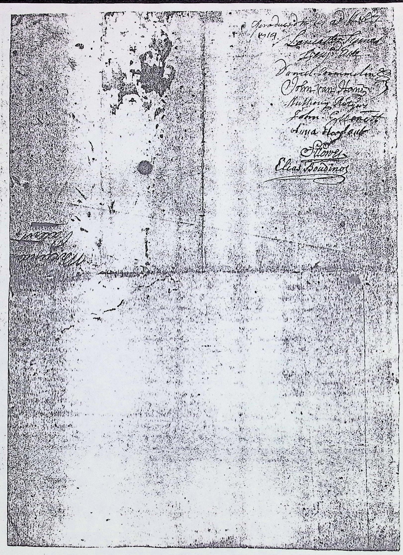
Lancaster Symes: A major land speculator and officer in the British Army in New York.
Daniel Crommelin: A wealthy merchant of Huguenot descent (the town of Cromline/Cromwell Creek in Orange County bears his name).
John Van Horne: A prominent member of a Dutch merchant family in New Amsterdam/New York.
Anthony Rutgers: A well-known brewer and landowner (Rutgers University is named after his descendant).
John Corbett: Another primary patentee of the Wawayanda grant.
Anna Hayward: Likely representing the interest of a deceased patentee or her own share.
J. Lowry: The surveyor (whose signature matches the front).
Elias Boudinot: A very famous name in American history; this is likely the father or grandfather of the Elias Boudinot who served as President of the Continental Congress.