Name/Title
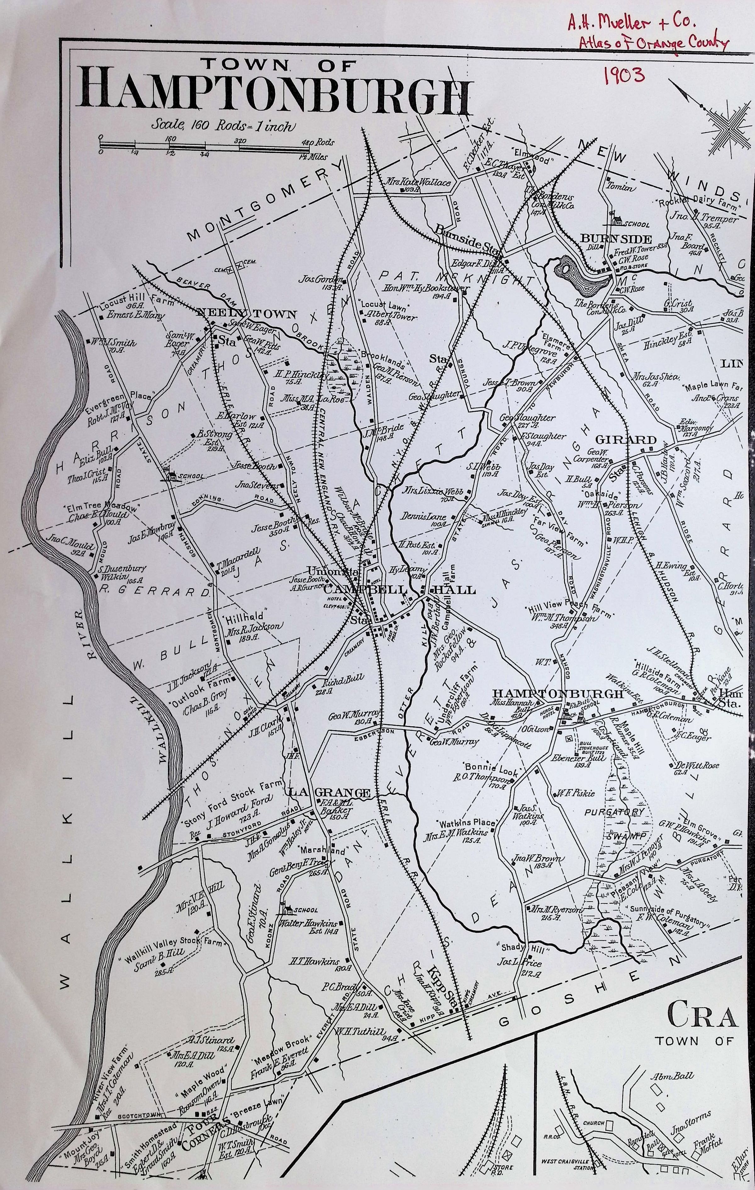
Town of Hamptonburgh A H. Miller & Co. Atlas of Orange County 1903Entry/Object ID
002258Tags
Maps, HamptonburghScope and Content
This is a historical cadastral map of the Town of Hamptonburgh in Orange County, New York, published in 1903 by A.H. Mueller & Co. Maps like this were primarily designed to show land ownership, infrastructure, and the layout of rural communities at the turn of the century.
Here is a summary of the key features shown:
1. Geography and Boundaries
Waterways: The Wallkill River serves as the prominent western border. Other notable water features include the Otter Kill creek running through the center and the Purgatory Swamp in the southeast.
Surrounding Towns: The map indicates neighboring borders with Montgomery (northwest), New Windsor (northeast), Goshen (south), and Blooming Grove (east).
2. Transportation Infrastructure
Railroads: The map highlights Hamptonburgh’s historical status as a rail hub. It shows the intersection of several lines, including the Erie Railroad, the New York, Ontario & Western (NYO&W), and the Central New England line.
Key Depots: Major stations and junctions include Campbell Hall (the central hub), Hamptonburgh Station, Burnside, and Kipps Station.
3. Land Ownership and Settlements
Property Details: The map identifies specific farmsteads and estates by the names of the owners (e.g., Stony Ford Stock Farm, Hillhead, Bonnie Brook).
Acreage: Small numbers next to the names often denote the total acreage of the specific land parcels.
Villages/Hamlets: The primary population centers shown are Campbell Hall, Burnside, and La Grange.
4. Community Landmarks
Public Buildings: Small black squares represent individual structures, including schools, churches, and post offices scattered throughout the township.
Topography: While mostly flat property lines, there are slight indications of elevation changes and wooded areas, such as Locust Hill Farm.
Map Context
Scale: 160 Rods = 1 Inch (1 rod=16.5 feet).
Source: From the Atlas of Orange County, a common reference for local historians and genealogists tracing family land in the Hudson Valley region.