Name/Title
Panoramic Map of Willimantic, CT, 1909Entry/Object ID
2024.38.01Secondary Title
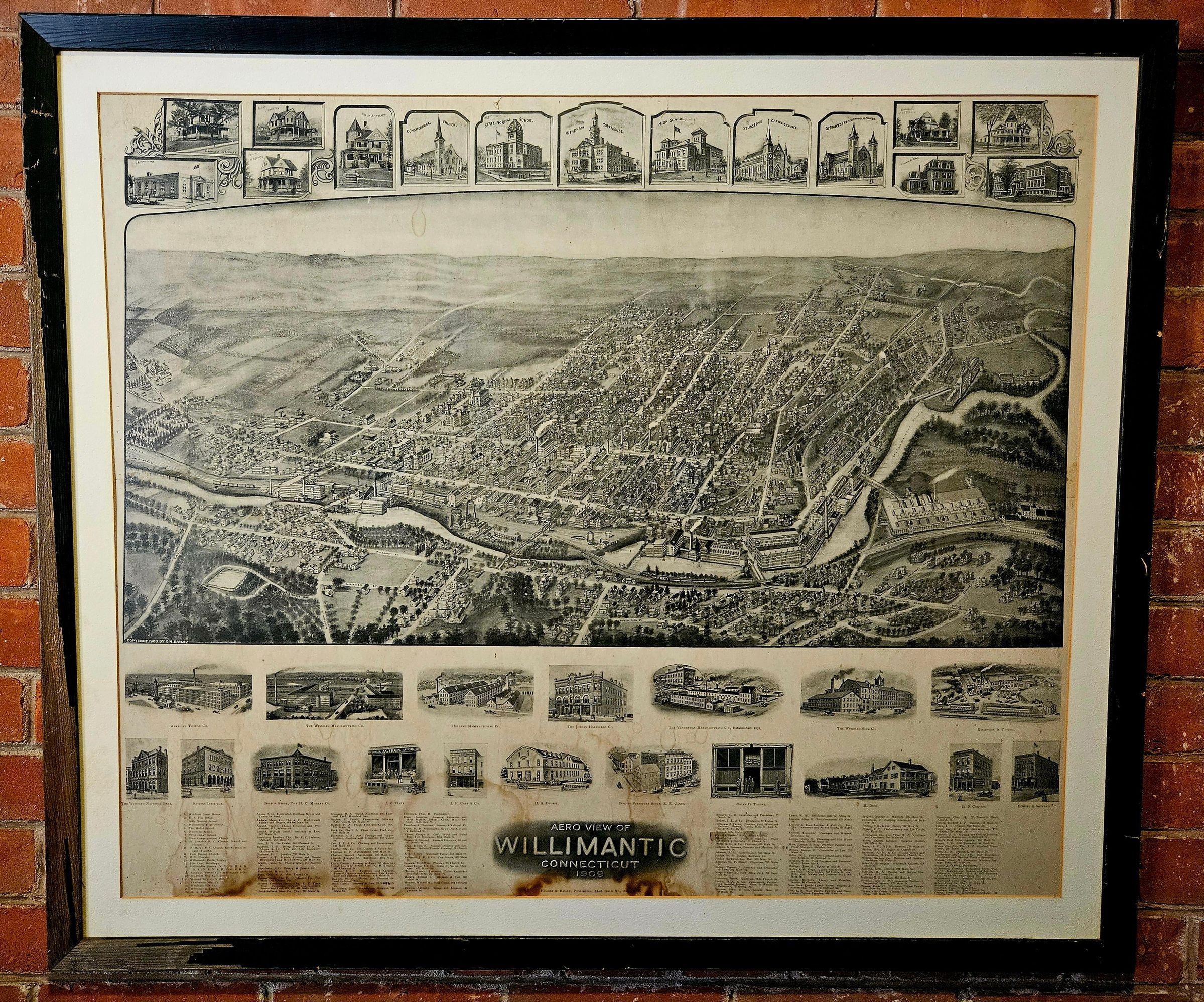
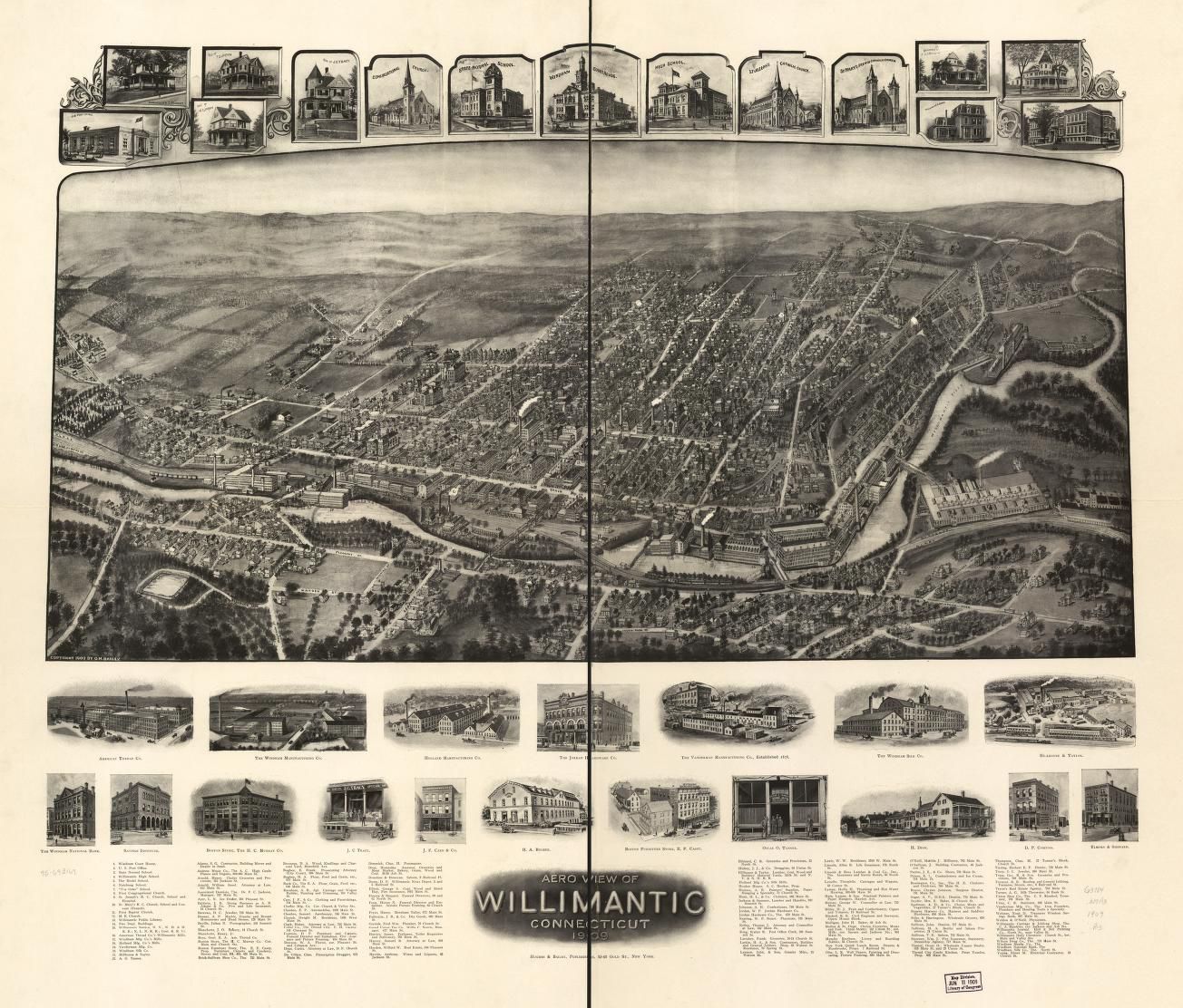
Aero View of Willimantic, Connecticut, 1909.Description
Panoramic (bird's-eye view) black-and-white engraving of Willimantic, CT, in 1909. The panoramic is in the center of the engraving, surrounded by 33 close-up drawings of stores, mills, residences, churches, and other buildings. The panoramic was not drawn in "map view" (i.e., from directly overhead), but rather from an angle, as if from a hot-air balloon hovering over the southern part of the city, looking north. As a result, the south sides of buildings are visible, as are some farms just north of the city. The insets were drawn from approximately street view. A list of sponsors is on the bottom part of the engraving. This is one of two copies of Aero View of Willimantic, Connecticut, 1909, in the Museum's collection. For Library of Congress copy, see https://www.loc.gov/item/75693169/.Context
Panoramics were popular in the late 1800s and early 1900s, and there was at least one printed for most American cities. At least three panoramics were published of Willimantic in different years, of which this was the most recent. Panoramics became obsolete in the 1920s, replaced by aerial photographs.Collection
General CollectionLexicon
Nomenclature 4.0
Nomenclature Secondary Object Term
MapNomenclature Primary Object Term
CartographNomenclature Sub-Class
Graphic DocumentsNomenclature Class
Documentary ObjectsNomenclature Category
Category 08: Communication ObjectsMap Details
Maker or Creator
Hughes and BaileyPlace Published
City
New York, NYRegion
NortheastContinent
North AmericaDate Published
1909 - 1910Publication Language
EnglishCall No.
G3784.W7A3 1909 .B3Location
Location
Exhibit Room
Thread Mill Square* Untyped Location
Main Museum BuildingCategory
ExhibitDate
November 10, 2024Condition
Overall Condition
FairDate Examined
Nov 10, 2024Examined By
Eves, J.Provenance
Provenance Detail
Found ObjectCopyright
Type of License
NoneCopyright Holder
Public DomainCopyright Date
1909Created By
historian@millmuseum.orgCreate Date
November 9, 2024Updated By
historian@millmuseum.orgUpdate Date
November 10, 2024