Name/Title
Map of Willimantic, CT, 1869Entry/Object ID
2024.65.01Description
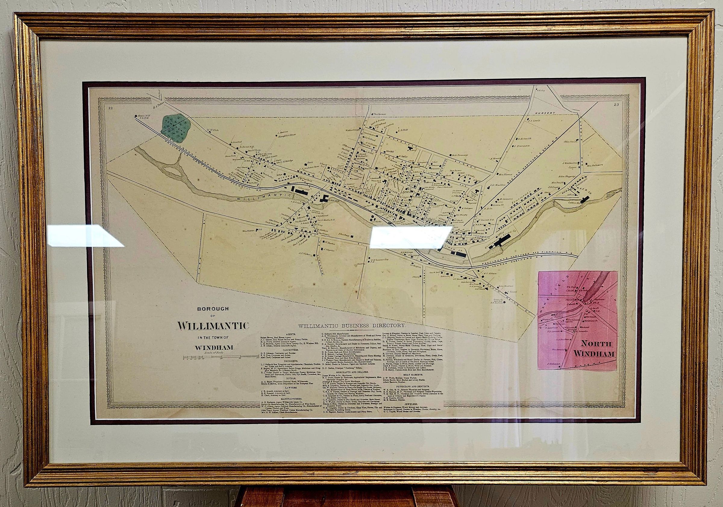
Map of Borough of Willimantic in the Town of Windham [CT], 1869, with an inset of North Windham village in 1869. The map is from Oliver Cromwell Gray and C. G. Keeney, "Atlas of Windham and Tolland Counties" [Hartford: C. G. Keeney, 1869]. It has been removed from the atlas and framed.Context
From Jamie Eves, "Historical Atlas of Windham, CT" (https://millmuseum.org/historical-geography-of-windham/): "The Civil War was a time of rapid growth in Willimantic. The New Willimantic Linen Company took over both the old Jillson Mill (in 1854) and the rebuilt Richmond Mill (1858). In 1857, the Linen Company (which manufactured cotton thread, despite its name) constructed it large gneiss Mill No. 1 just east of the old Jillson Mill, which the Company converted into a spool shop. In 1863 the Company erected its massive gneiss Mill No. 2. The Company had stockpiled cotton before the Civil War (1861-65) and made big profits during the war, when cotton was scarce in the North. In 1864 the Linen Company began construction of the Model Village (also called Iverton, after Lawson Ives, one of the owners of the Linen Company), an extensive neighborhood of company-owned worker row houses across the street from Mill No. 2. The map above is enhanced: the roads and streets that had been there in 1855 are colored black, while new streets are colored yellow. The city had become less linear, as new streets had been added both on the south and (especially) the north, where the new streets had begun to climb the slopes of Prospect Hill. The Old Willimantic Cemetery was depicted on the west end of the borough. A third rail line had come to Willimantic, the Boston, Hartford, and Erie. The New London, Willimantic, and Palmer Railroad has been renamed the New London Northern Railroad."Collection
Magnuson CollectionLexicon
Nomenclature 4.0
Nomenclature Secondary Object Term
MapNomenclature Primary Object Term
CartographNomenclature Sub-Class
Graphic DocumentsNomenclature Class
Documentary ObjectsNomenclature Category
Category 08: Communication ObjectsMap Details
Maker or Creator
Oliver Cromwell Gray and C. G. Keeney, "Atlas of Windham and Tolland Counties" [Hartford: C. G. Keeney, 1869].Place Published
City
Hartford, CTRegion
NortheastContinent
North AmericaDate Published
1869Publication Language
EnglishDimensions
Dimension Description
Includes frame.Height
24 inWidth
35 inLocation
Location
Exhibit Room
Thread Mill Square* Untyped Location
Main Museum BuildingCategory
ExhibitDate
November 30, 2024Condition
Overall Condition
Very GoodDate Examined
Nov 30, 2024Examined By
Eves, J.Copyright
Type of License
NoneCopyright Holder
Public DomainCopyright Date
1869General Notes
Note
The Museum owns two other copies of this map, unframed.Created By
historian@millmuseum.orgCreate Date
November 30, 2024Updated By
historian@millmuseum.orgUpdate Date
November 30, 2024