Name/Title
Ancient Windham CountyEntry/Object ID
2022.7.10Description
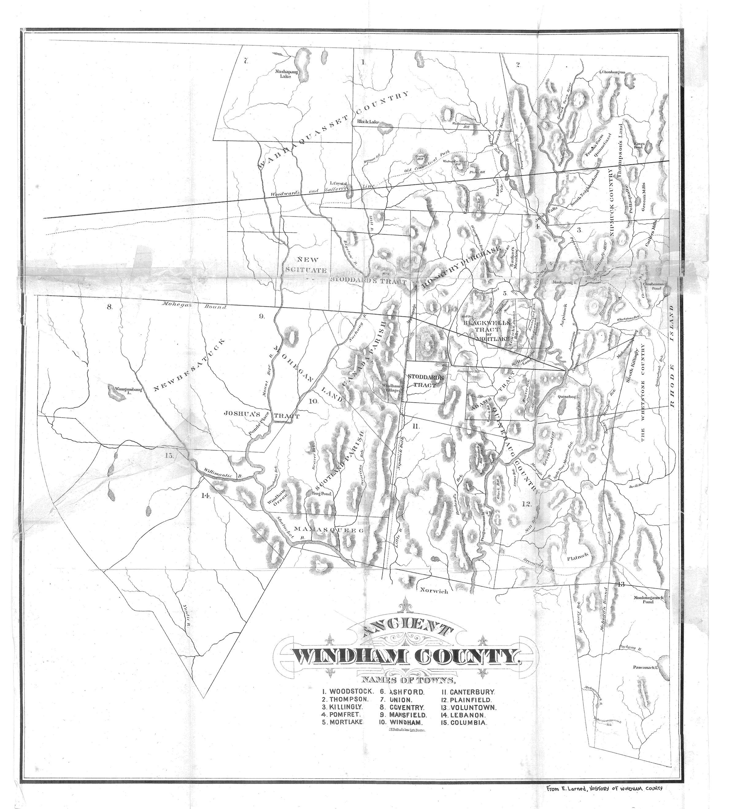
Map of "Ancient Windham County," showing the original settlements and land divisions made by European American settlers in the late 1600s, including Joshua's Tract. Fragile. Printed on thin paper and mended with tape. Printed by J. H. Bufford's Son, Lithographer, Boston, MA. This map was a fold-out that accompanied Ellen Larned, HISTORY OF WINDHAM COUNTY, vol. I (1874)Collection
General CollectionLexicon
Nomenclature 4.0
Nomenclature Secondary Object Term
MapNomenclature Primary Object Term
CartographNomenclature Sub-Class
Graphic DocumentsNomenclature Class
Documentary ObjectsNomenclature Category
Category 08: Communication ObjectsMap Details
Maker or Creator
Larned, Ellen DouglasPrinter
J. H. Bufford's Son, Lithographer, Boston, MADate Printed
1874Publication Language
EnglishLocation
Location
Cabinet
Map CasesRoom
Dunham Hall Library Reading Room* Untyped Location
Main Museum BuildingCategory
PermanentDate
December 10, 2022Provenance
Provenance Detail
Found ObjectCopyright
Copyright Holder
Public DomainCopyright Date
1874Created By
historian@millmuseum.orgCreate Date
December 10, 2022Updated By
historian@millmuseum.orgUpdate Date
December 10, 2022