Name/Title
Street Map of Windham, CTEntry/Object ID
2025.18.03Secondary Title
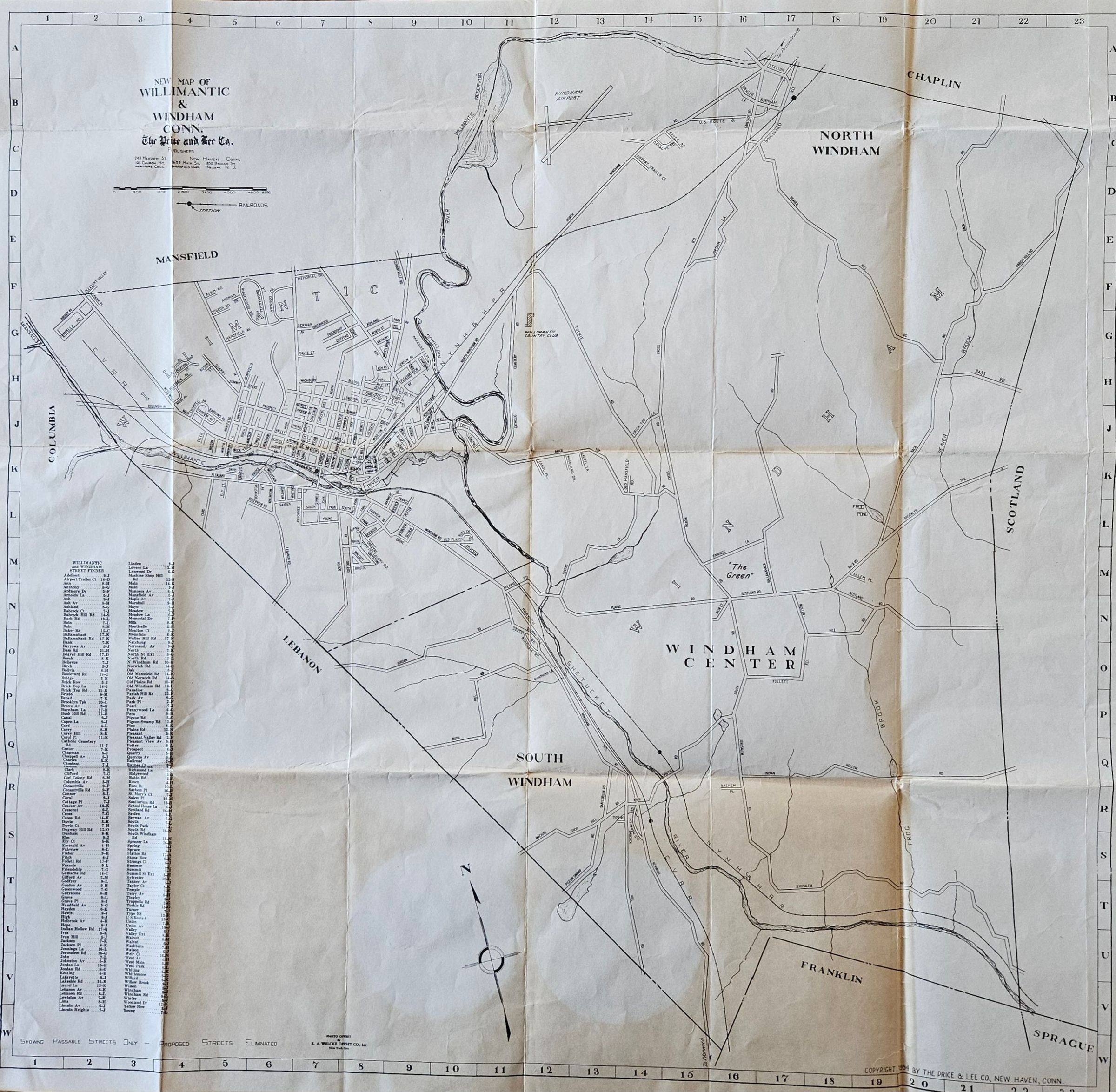
New Map of Willimantic & Windham, Conn.Description
The Price and Lee Co., Publishers. 1954. Black and white. 1600 feet per inch scale. Showing passable streets only -- proposed streets eliminated. Photo offset by R. A. Welcke Offset Co., Inc., New York City. Copyright 1954 by Price & Lee Co., New Haven, Conn.Context
Price and Lee published city directories. This map may have been intended to accompany the 1954 Willimantic directory -- although it is printed on normal weight paper rather than onion skin, as such maps normally were. It reflects a time period when people found their way by using paper maps rather than Google maps.Collection
Cichon CollectionLexicon
Nomenclature 4.0
Nomenclature Tertiary Object Term
Map, RoadNomenclature Secondary Object Term
MapNomenclature Primary Object Term
CartographNomenclature Sub-Class
Graphic DocumentsNomenclature Class
Documentary ObjectsNomenclature Category
Category 08: Communication ObjectsMap Details
Place Published
City
New Haven, CTRegion
NortheastContinent
North AmericaDate Published
1954Printer
R. A. Welcke Offset Co., Inc.Place Printed
City
New York, NYRegion
NortheastContinent
North AmericaDate Printed
1954Location
Location
Cabinet
Map CasesRoom
Dunham Hall Library Reading Room* Untyped Location
Main Museum BuildingCategory
PermanentDate
March 23, 2025Condition
Overall Condition
FairDate Examined
Mar 23, 2025Examined By
Eves, J.Provenance
Provenance Detail
In donor's possession for many years. He does not recall how he obtained them.Notes
Published the same year the donor was born.Copyright
Copyright Holder
Price and Lee CompanyCopyright Date
1954Created By
historian@millmuseum.orgCreate Date
March 23, 2025Updated By
historian@millmuseum.orgUpdate Date
March 23, 2025