Name/Title
Map of South Coventry, Mansfield Centre, and Mansfield c.1905Entry/Object ID
2024.13.1Scope and Content
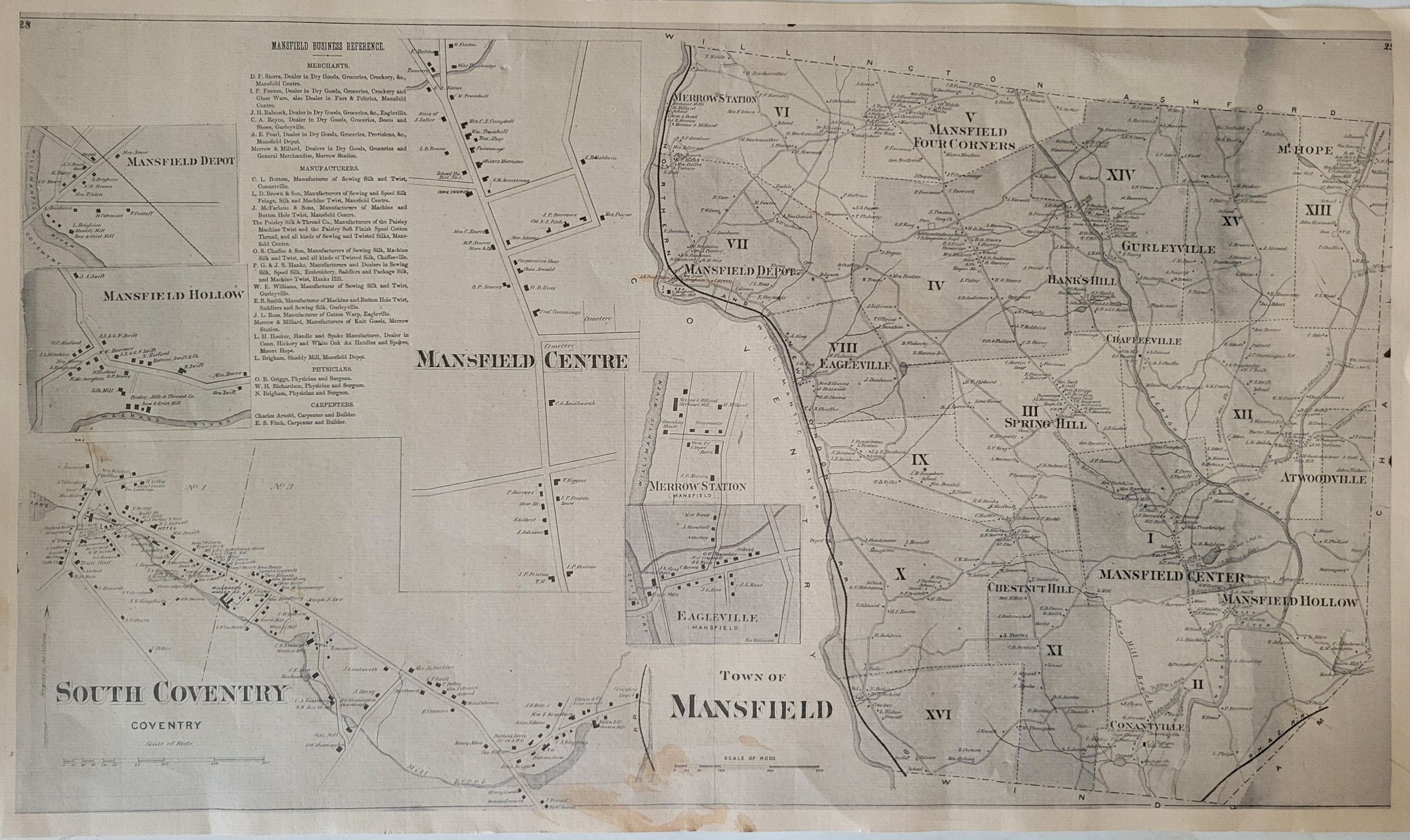
A map of South Coventry, Mansfield Centre [sic], and Mansfield, circa 1905. The map includes a list of local merchants, manufacturers, physicians, and carpenters. It is printed on thick cardstock and is stained at the bottom center.Collection
General CollectionLexicon
Nomenclature 4.0
Nomenclature Secondary Object Term
MapNomenclature Primary Object Term
CartographNomenclature Sub-Class
Graphic DocumentsNomenclature Class
Documentary ObjectsNomenclature Category
Category 08: Communication ObjectsArchive Details
Date(s) of Creation
circa 1905Primary Language
EnglishLocation
Location
Cabinet
Map CasesRoom
Dunham Hall Library Reading Room* Untyped Location
Main Museum BuildingCategory
PermanentDate
August 25, 2024Provenance
Provenance Detail
Found ObjectCreated By
Kearney, QuinlanCreate Date
August 25, 2024Updated By
Kearney, QuinlanUpdate Date
August 25, 2024