Name/Title
Map of Willimantic, CT (1869)Entry/Object ID
2021.15.1Description
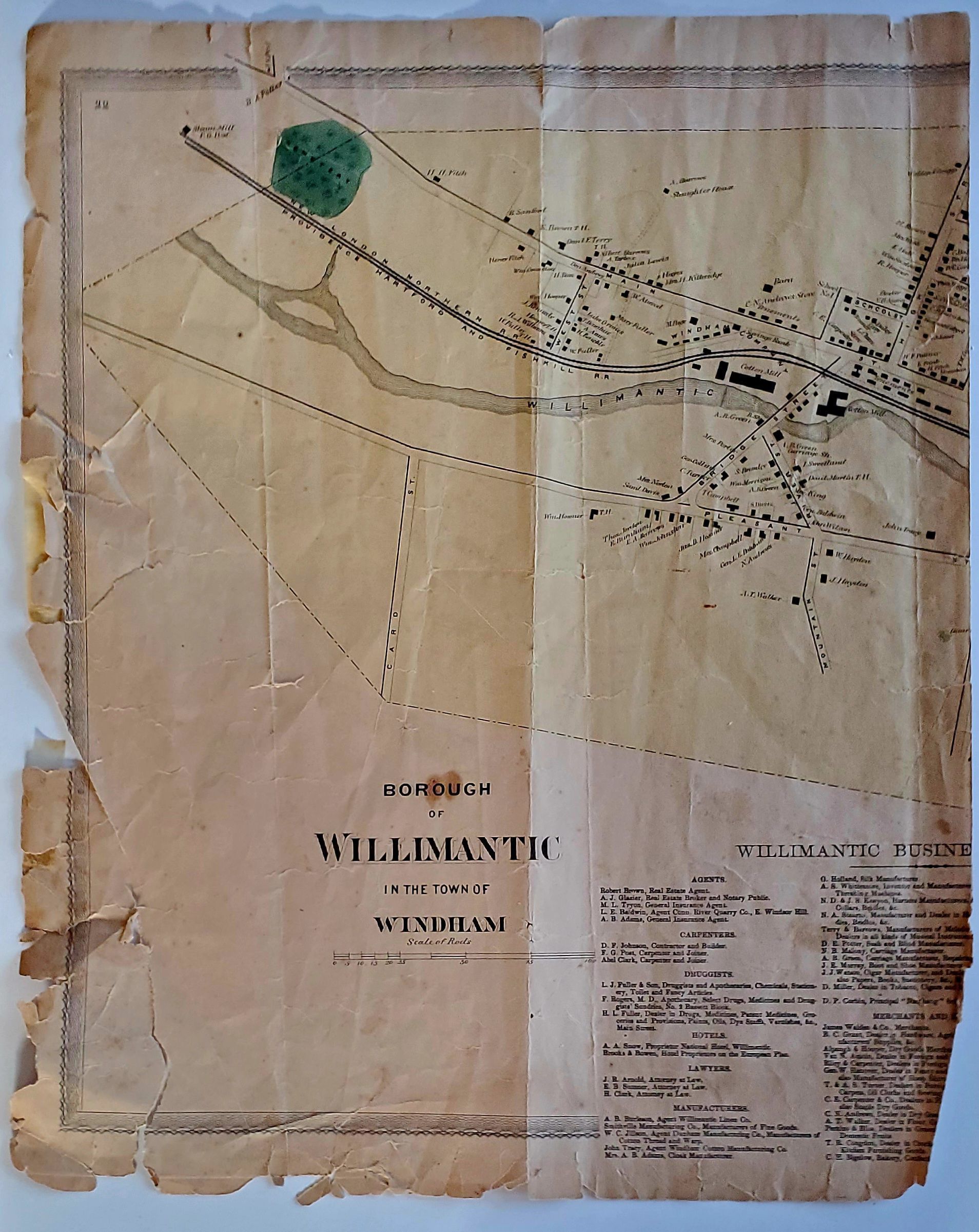
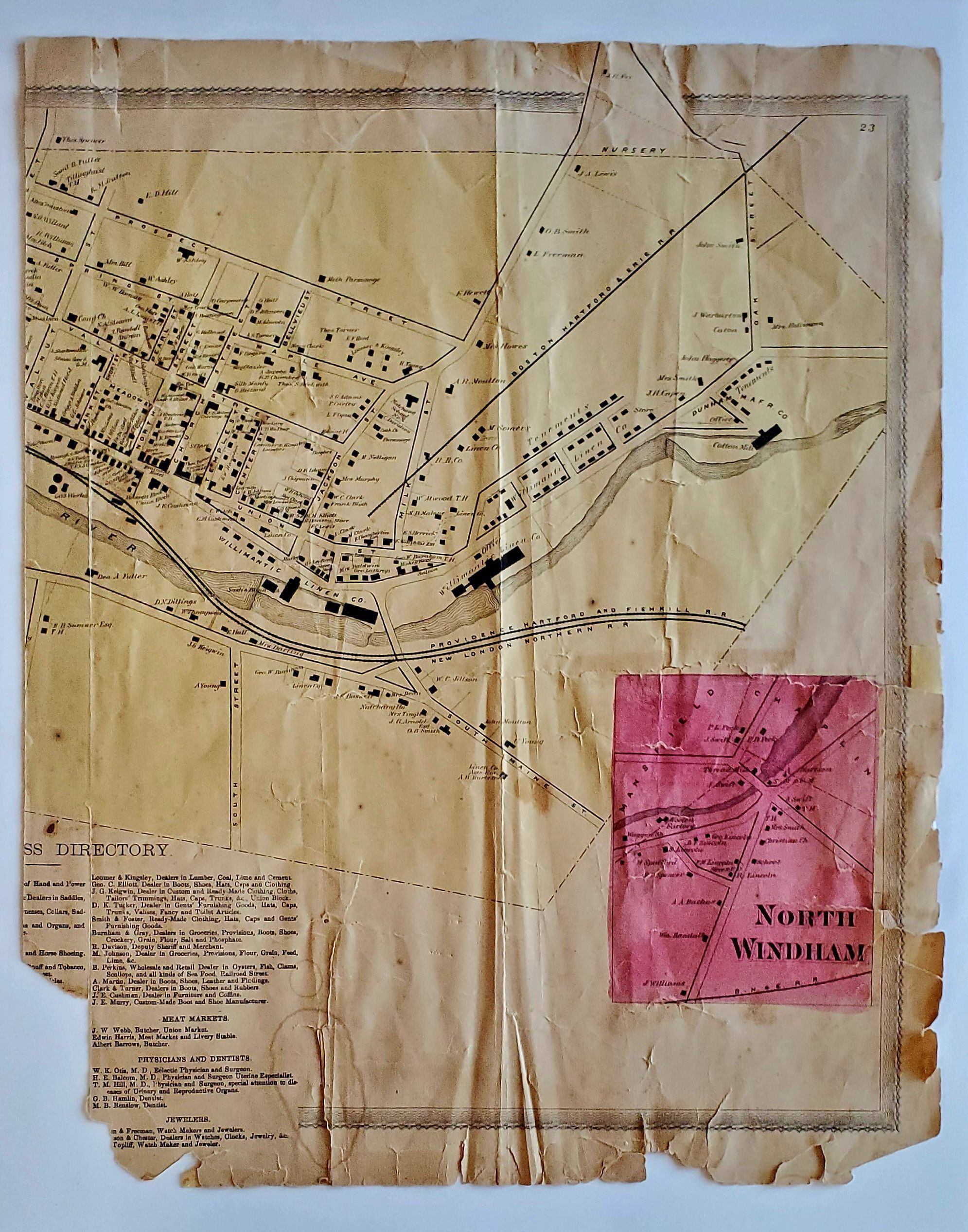
Map of the borough of Willimantic, CT in 1869. Pages 22 and 23 of O. W. Gray, ATLAS OF WINDHAM AND TOLLAND COUNTIES (Hartford, CT: C. G. Keeney, 1869). Includes North Windham. O. W. Gray was a publishing firm based in Philadelphia. Later, they published as O. W. Gray & Son. They published atlases in the late nineteenth century. Gray's National Atlas was one of the most successful commercial ventures of the 1870s and one of the last to employ hand coloring on maps. Donated by Susan Johnson.Collection
General CollectionLexicon
Nomenclature 4.0
Nomenclature Secondary Object Term
MapNomenclature Primary Object Term
CartographNomenclature Sub-Class
Graphic DocumentsNomenclature Class
Documentary ObjectsNomenclature Category
Category 08: Communication ObjectsMap Details
Maker or Creator
Gray, O. W.Place Published
City
Hartford, CTRegion
NortheastContinent
North AmericaDate Published
1869Publication Language
EnglishLocation
Location
Cabinet
Map CasesRoom
Dunham Hall Library Reading Room* Untyped Location
Main Museum BuildingCategory
PermanentMoved By
Eves, J.Date
January 8, 2023Notes
Drawer 10Provenance
Provenance Detail
Johnson, SusanAcquisition Method
GiftAcquisition Date
2021Copyright
Copyright Holder
Public DomainCopyright Date
1869Created By
Knyff, ChelseyCreate Date
August 9, 2021Updated By
historian@millmuseum.orgUpdate Date
January 8, 2023