Name/Title
Streets Maps of Villages of Moosup, Wauregan, Dayville, South Windham, Brooklyn, Plainfield, and Windham Center (c. 1900)Entry/Object ID
2022.7.12Description
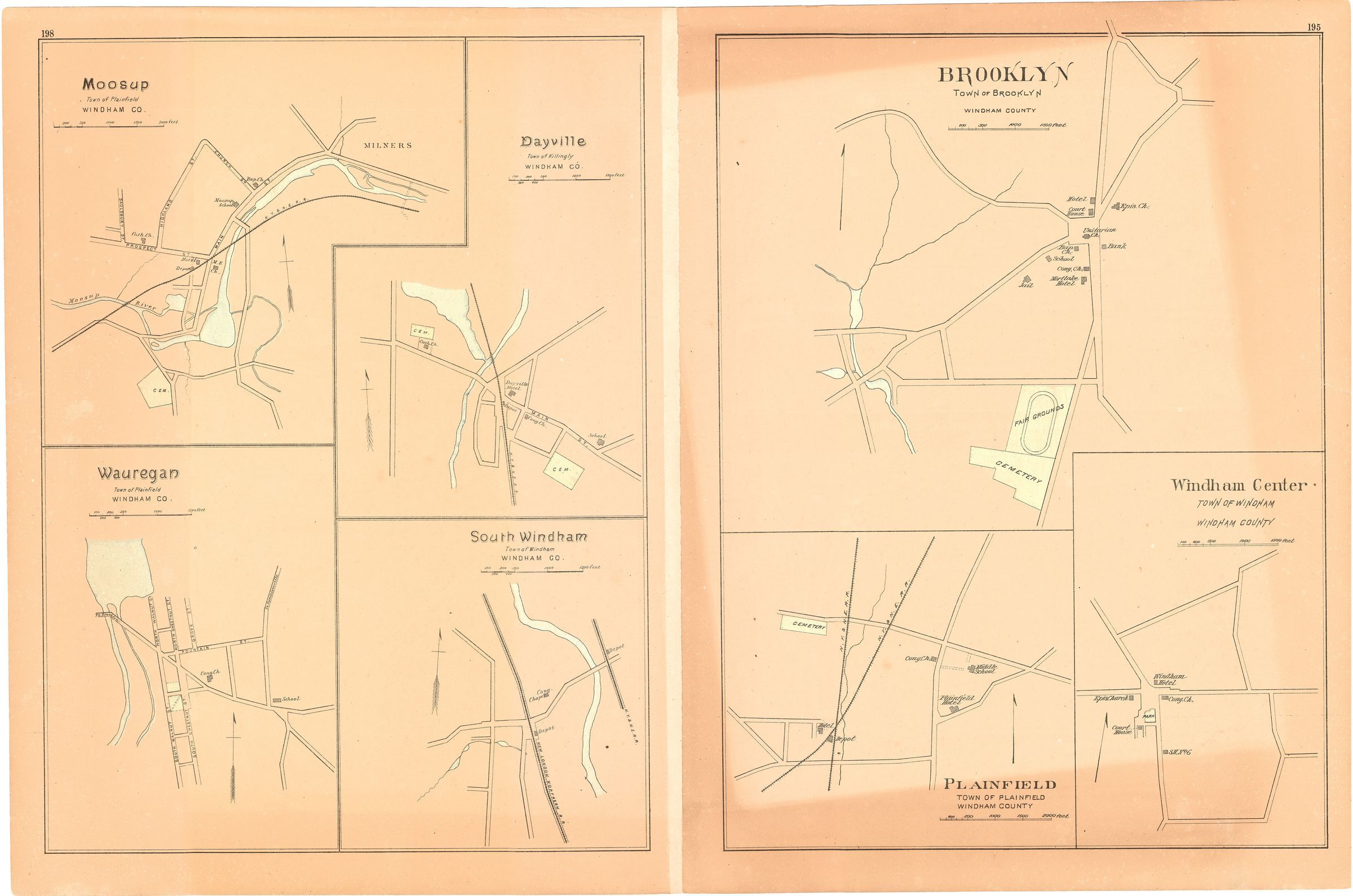
Pages from an atlas of Windham County with inset maps of the villages of Moosup, Wauregan, Dayville, South Windham, Brooklyn, Plainfield, and Windham Center, c. 1900.Collection
General CollectionLexicon
Nomenclature 4.0
Nomenclature Tertiary Object Term
Map, RoadNomenclature Secondary Object Term
MapNomenclature Primary Object Term
CartographNomenclature Sub-Class
Graphic DocumentsNomenclature Class
Documentary ObjectsNomenclature Category
Category 08: Communication ObjectsMap Details
Maker or Creator
UnknownDate Published
circa 1900Publication Language
EnglishLocation
Location
Cabinet
Map CasesRoom
Dunham Hall Library Reading Room* Untyped Location
Main Museum BuildingCategory
PermanentDate
December 10, 2022Provenance
Provenance Detail
Found ObjectCopyright
Copyright Holder
Public DomainCopyright Date
circa 1900Created By
historian@millmuseum.orgCreate Date
December 10, 2022Updated By
historian@millmuseum.orgUpdate Date
December 10, 2022