Map of that part of Orange County lying to the north of the mountains of the highlands showing that Chester is a much more central & convenient spott to all the country whereon to erect the new court house than that vulgarly known by the name of Goshen Town.
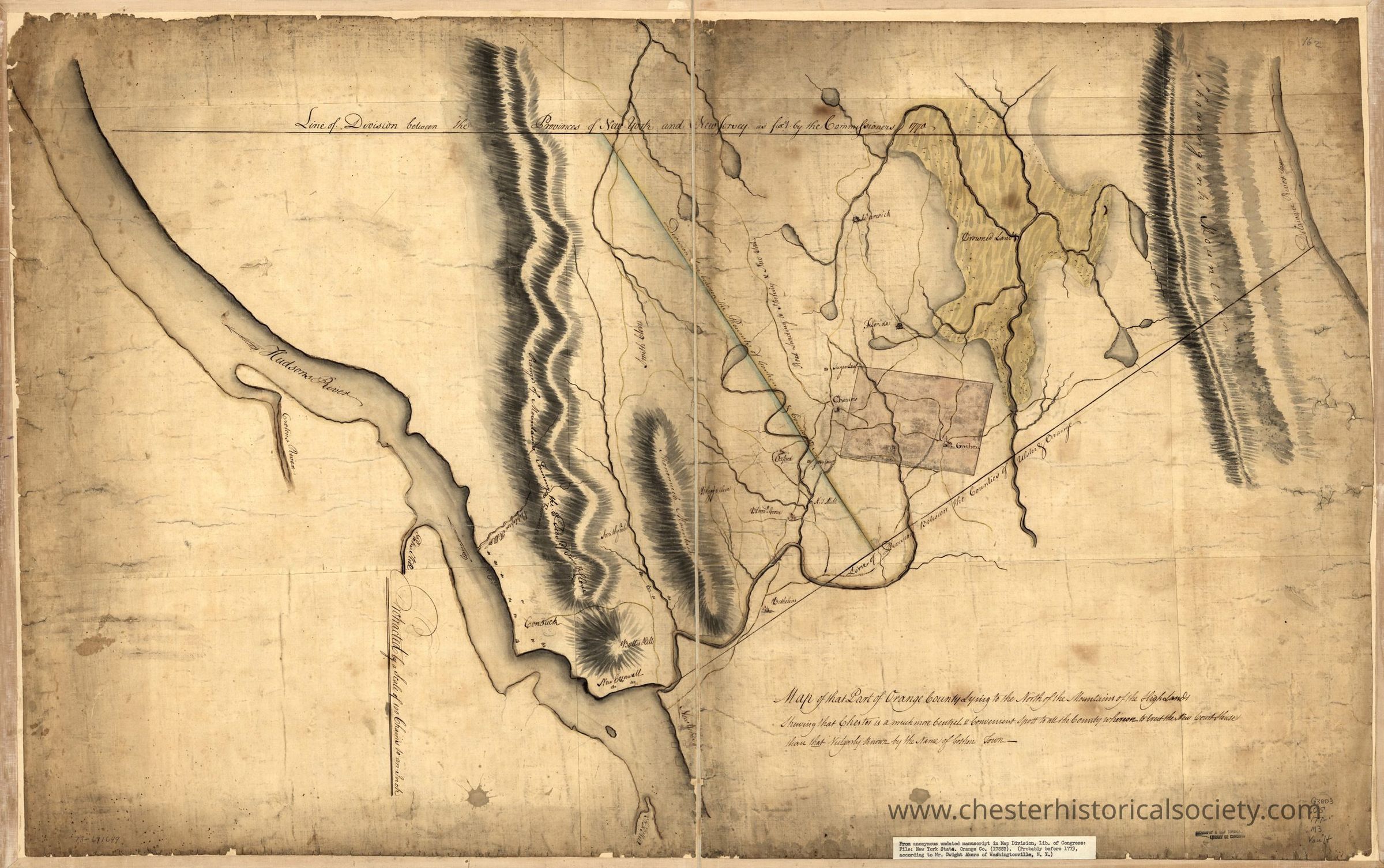
Map of that part of Orange County lying to the north of the mountains of the highlands showing that Chester is a much more central & convenient spott to all the country whereon to erect the new court house than that vulgarly known by the name of Goshen Town.
Map of that part of Orange County lying to the north of the mountains of the highlands showing that Chester is a much more central & convenient spott to all the country whereon to erect the new court house than that vulgarly known by the name of Goshen Town.

Name/Title
Map of that part of Orange County lying to the north of the mountains of the highlands showing that Chester is a much more central & convenient spott to all the country whereon to erect the new court house than that vulgarly known by the name of Goshen Town.Entry/Object ID
chs-011246Tags
MapsDescription
Map of that part of Orange County lying to the north of the mountains of the highlands showing that Chester is a much more central & convenient spott to all the country whereon to erect the new court house than that vulgarly known by the name of Goshen Town. CREATED/PUBLISHED [177-?] NOTES Scale 1:79,200; protracted by a scale of 100 chains to an in. Manuscript, pen-and-ink and watercolor. Oriented with north to the bottom. Relief shown by shading. Reference: LC Maps of North America, 1750-1789, 1089 SUBJECTS Orange County (N.Y.)--Maps, Manuscript--Early works to 1800. United States--New York (State)--Orange County. RELATED TITLES [Peter Force map collection ; 162] MEDIUM col. map 65 x 104 cm. CALL NUMBER G3803.O5 177- .M3 Vault REPOSITORY Library of Congress Geography and Map Division Washington, D.C. 20540-4650 USA DIGITAL ID g3803o ar108900 http://hdl.loc.gov/loc.gmd/g3803o.ar108900Category
Maps