West Point And Vicinity Map with Hunting Areas Delineated
West Point And Vicinity Map with Hunting Areas Delineated
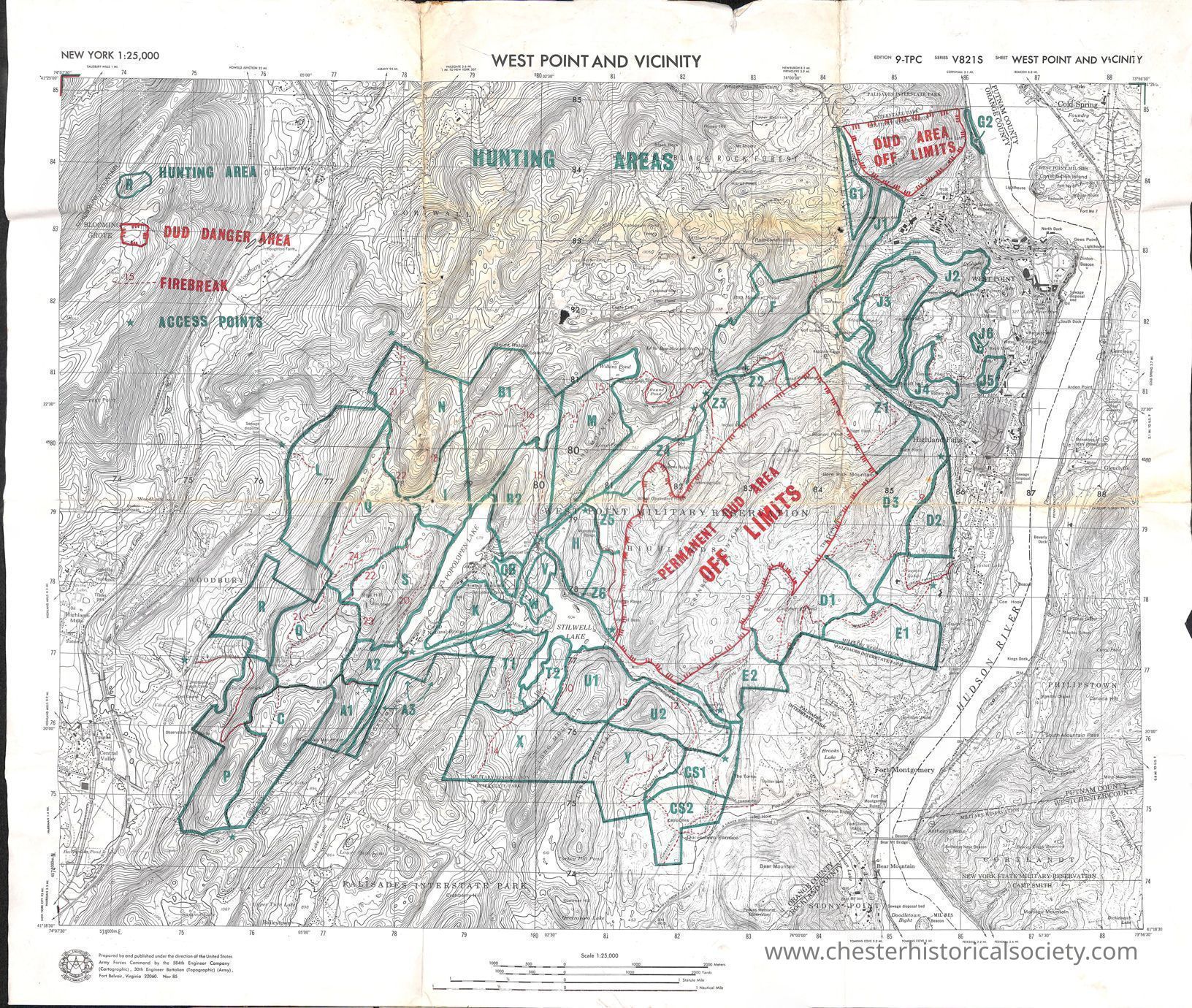
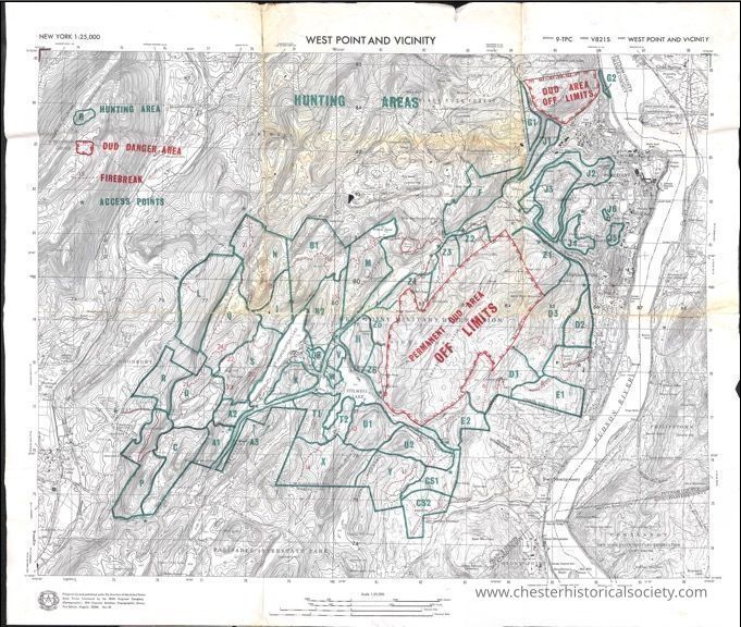
The image is a detailed topographical map of West Point and its vicinity, showing various designated hunting areas outlined in green, alongside clearly marked off-limits DUD zones in red, labeled as permanent danger areas, intersected by access points, firebreaks, and a grid system. The map includes contour lines to indicate elevation changes, and it emphasizes geographical features such as rivers, hills, and man-made structures with a scale of 1:25,000.
Name/Title
West Point And Vicinity Map with Hunting Areas DelineatedEntry/Object ID
chs-015689Description
A detailed topographical map of West Point and its vicinity, showing various designated hunting areas outlined in green, alongside clearly marked off-limits DUD zones in red, labeled as permanent danger areas, intersected by access points, firebreaks, and a grid system. The map includes contour lines to indicate elevation changes, and it emphasizes geographical features such as rivers, hills, and man-made structures with a scale of 1:25,000. West Point and Vicinity Edition 9-TPC Series V821 S Sheet West Point And Vicinity New York 1:25,000 Prepared by and published under the direction of the United States Army Forces Command by the 584th Engineer Company (Cartographic), 30th Engineer Battalion (Topogrophic) (Army), Fort Belvair, Virginia 22060. Nov 85Category
Maps