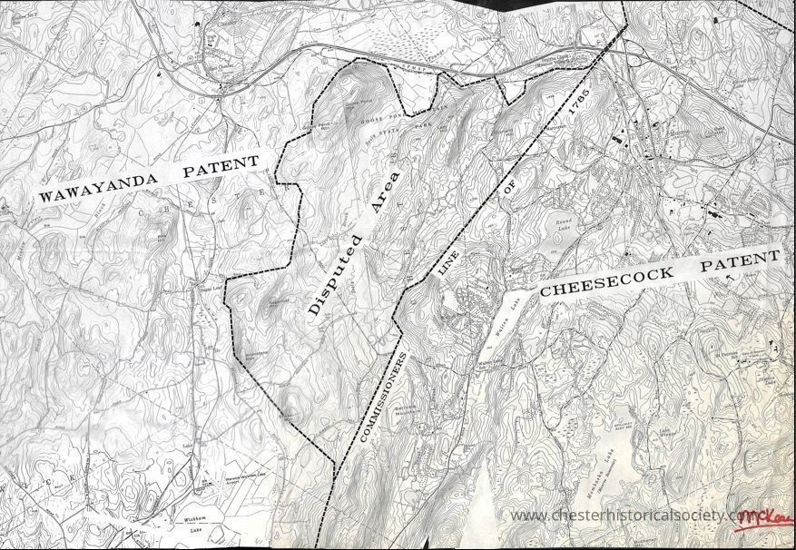
A Map of that Part of the Disputed Lands, between Cheesecocks & Wawayanda, which was set a part by the Commissioners, to the Patentees of Wawayanda
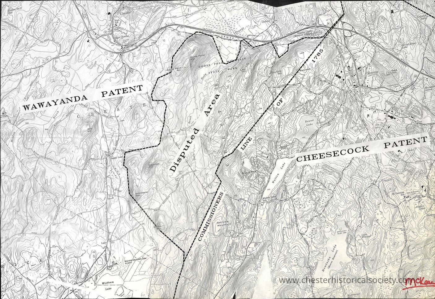
A Map of that Part of the Disputed Lands, between Cheesecocks & Wawayanda, which was set a part by the Commissioners, to the Patentees of Wawayanda
Photocopy of a modern topographic map with that Part of the Disputed Lands, between Cheesecocks & Wawayanda, Patents which was set apart by the Commissioners, to the Patentees of Wawayanda plotted. In the lower right corner "McKean" in red marker.
Name/Title
A Map of that Part of the Disputed Lands, between Cheesecocks & Wawayanda, which was set a part by the Commissioners, to the Patentees of WawayandaEntry/Object ID
chs-015691Description
Photocopy of a modern topographic map with that Part of the Disputed Lands, between Cheesecocks & Wawayanda, Patents which was set apart by the Commissioners, to the Patentees of Wawayanda plotted. In the lower right corner "McKean" in red marker.Category
Chester History