Village of Chester Street Map
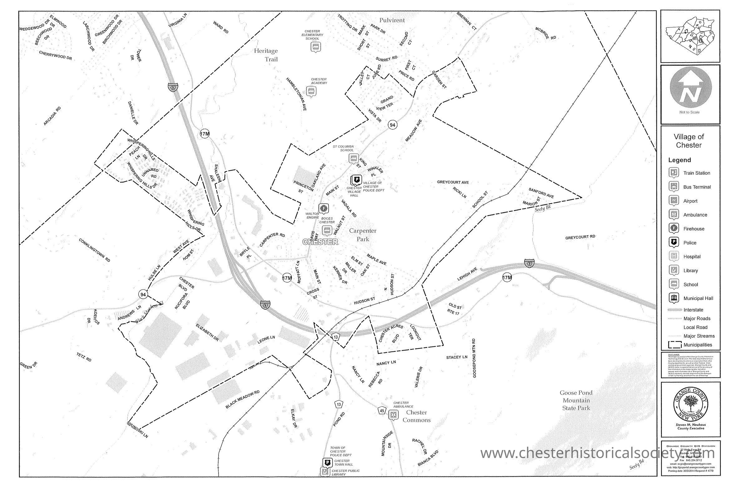
Village of Chester Street Map, March 25, 2014
The street map, dated March 25, 2014, shows the Village of Chester with boundaries, roads, and landmarks like Carpenter Park.
Name/Title
Village of Chester Street MapEntry/Object ID
chs-019537Secondary Title
The street map, dated March 25, 2014, shows the Village of Chester with boundaries, roads, and landmarks like Carpenter Park.Category
Chester, Village of