Name/Title
MapsScope and Content
The GHS Archives has close to 200 maps relating to Grimsby, varying in size and type. The maps include historical and recent street maps, town planning and zoning maps, aerial and topographic maps, and survey plans. These maps give a fascinating view of the evolving development of Grimsby from the time it was only a small village to the large town it is today.
Smaller maps are kept in filing cabinets. Large maps are stored in a special maps cabinet.
Historical Maps
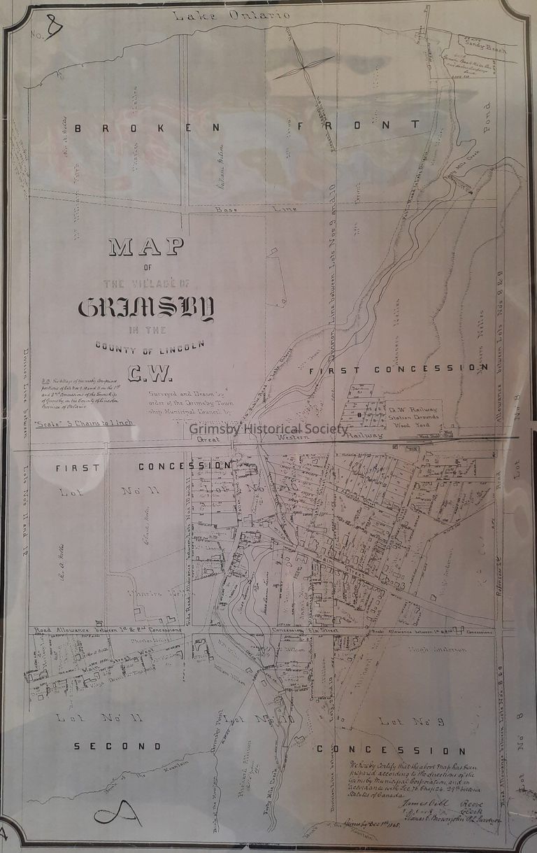
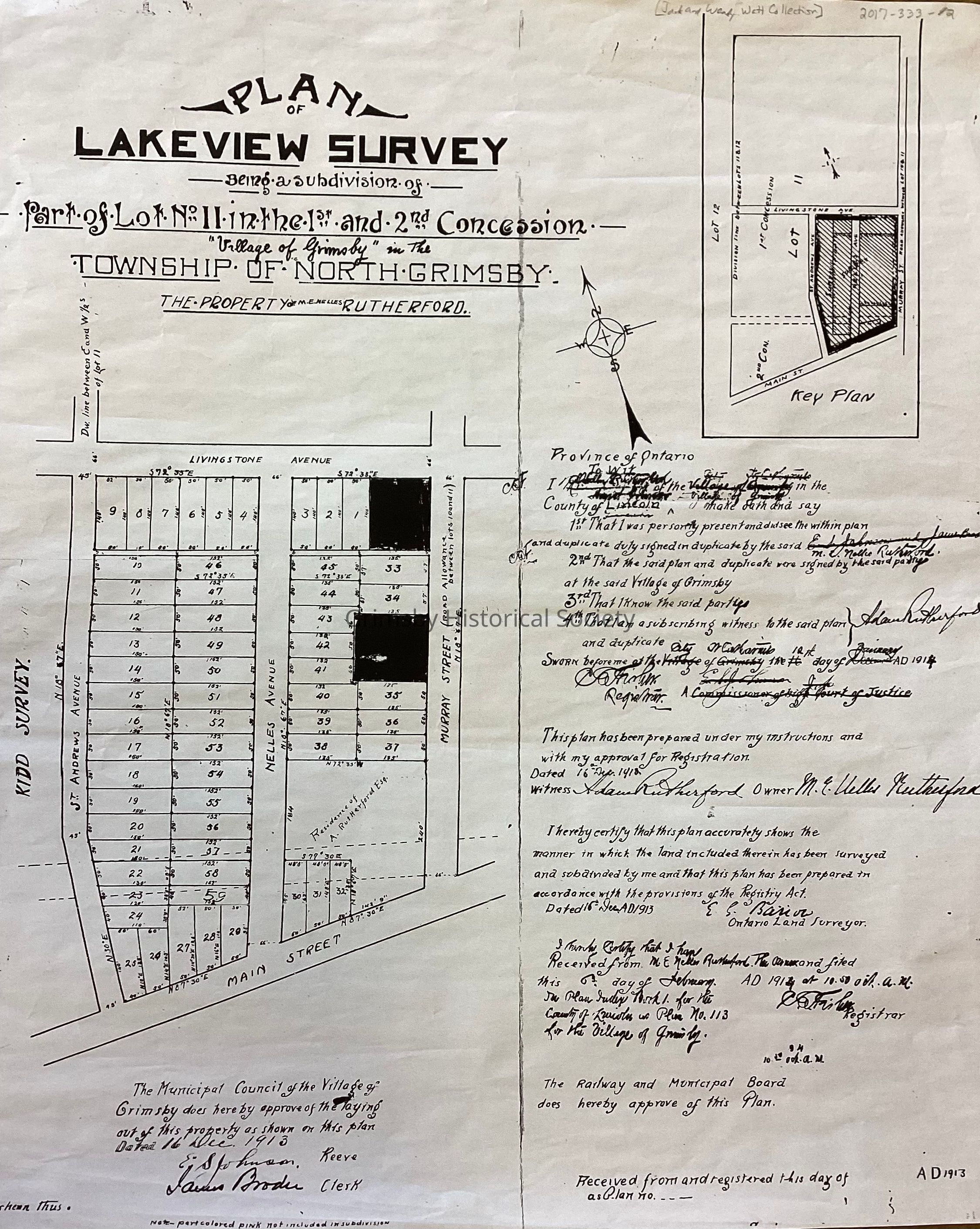
These include maps of early land grants, maps of Grimsby drawn by surveyor Thomas Brownjohn in 1868 and 1877, street maps from the 1960s to the present, and maps contained in the 1876 Illustrated Historical Atlas of the Counties of Lincoln and Welland which show lot and concession numbers.
Town Plans and Zoning Maps
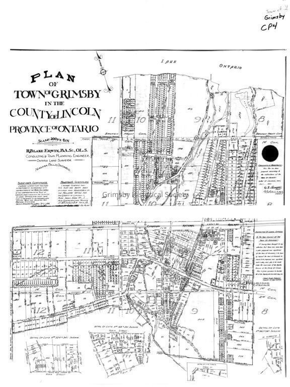
Town plan maps are detailed maps of streets and lots and are part of the town’s official plan. The official plan guides future development of the town and decisions about where and how land can be used. The archives has the town plan map from 1932 and updated maps from 1956 and 1973.
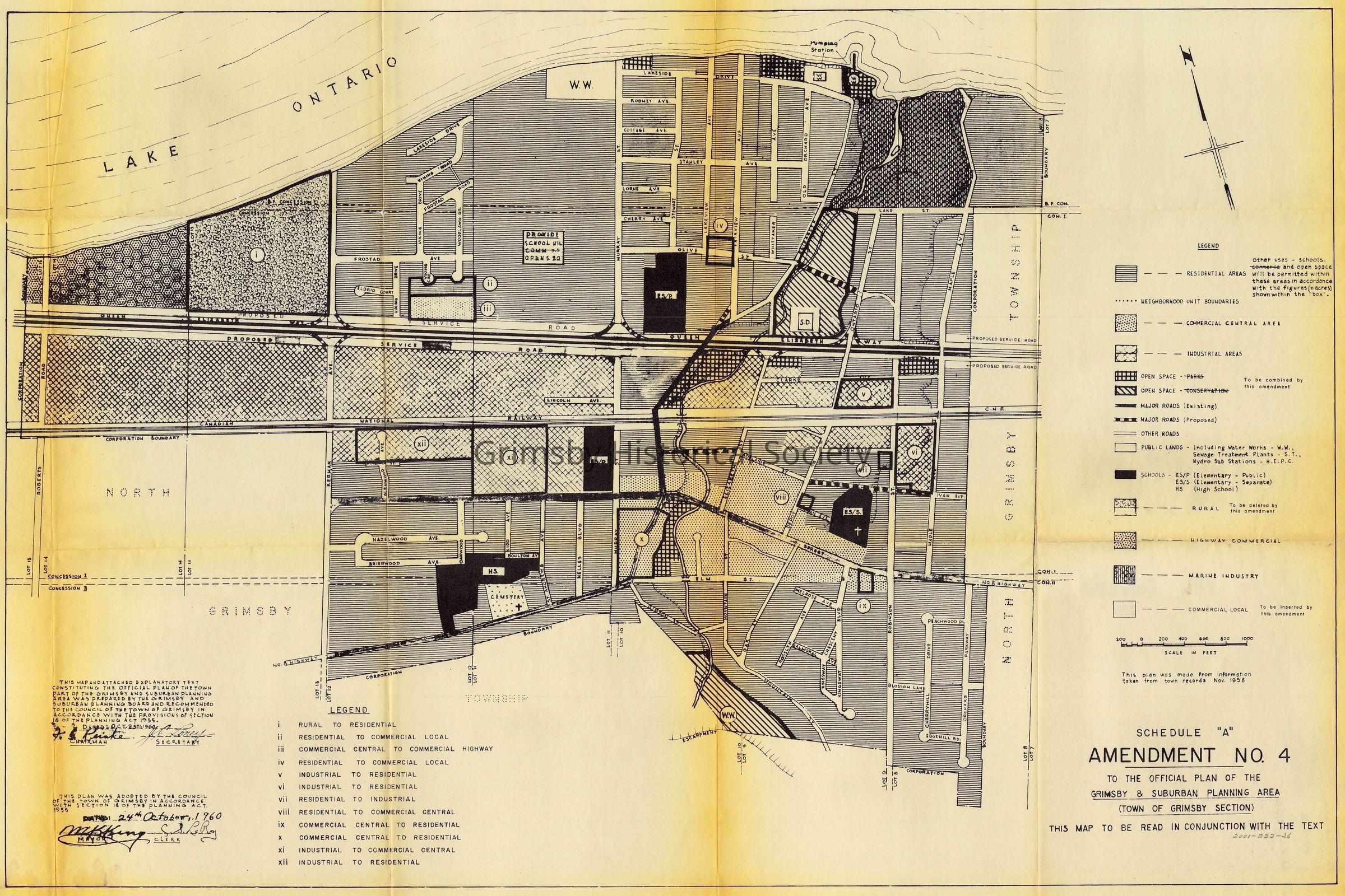
Zoning maps show various land use designations (eg. residential commercial, industrial, recreational), infrastructure (eg. roads, utilities, transit), and areas requiring protection (eg. natural areas, heritage sites). Most of the zoning maps in GHS Archives are dated in the 1960s.
Aerial Maps
Aerial maps are usually taken directly above from airplanes or satellites. They show land cover and landscape features. We have three aerial photos of Grimsby taken by the Photographic Survey Corporation in Toronto. The company operated under this name from 1946-1955 and provided aerial surveys of 125,000 square miles of land in Ontario.
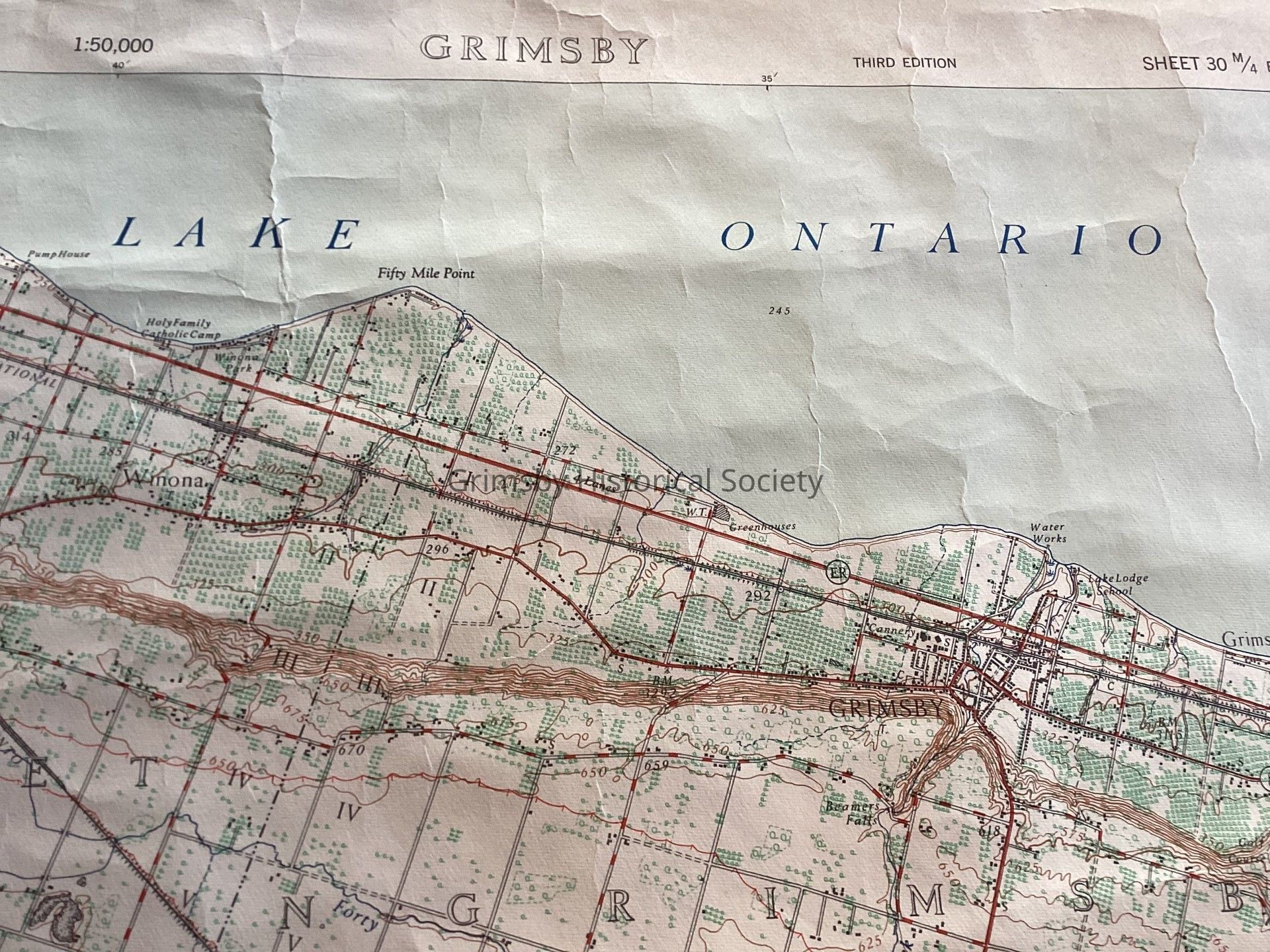
Topographic Maps
These specialized maps give a detailed and accurate picture of natural and man-made land features such as land contours, wooded areas, lakes, rivers, buildings, fences, railways, streets, and roads. The federal government produced a series of detailed topographic maps of the country. We have five of these maps dating from the 1950s to 1990s.