Name/Title
Official Road Maps of Harborcreek Township, 1980 and 1989Entry/Object ID
2022.27.09Scope and Content
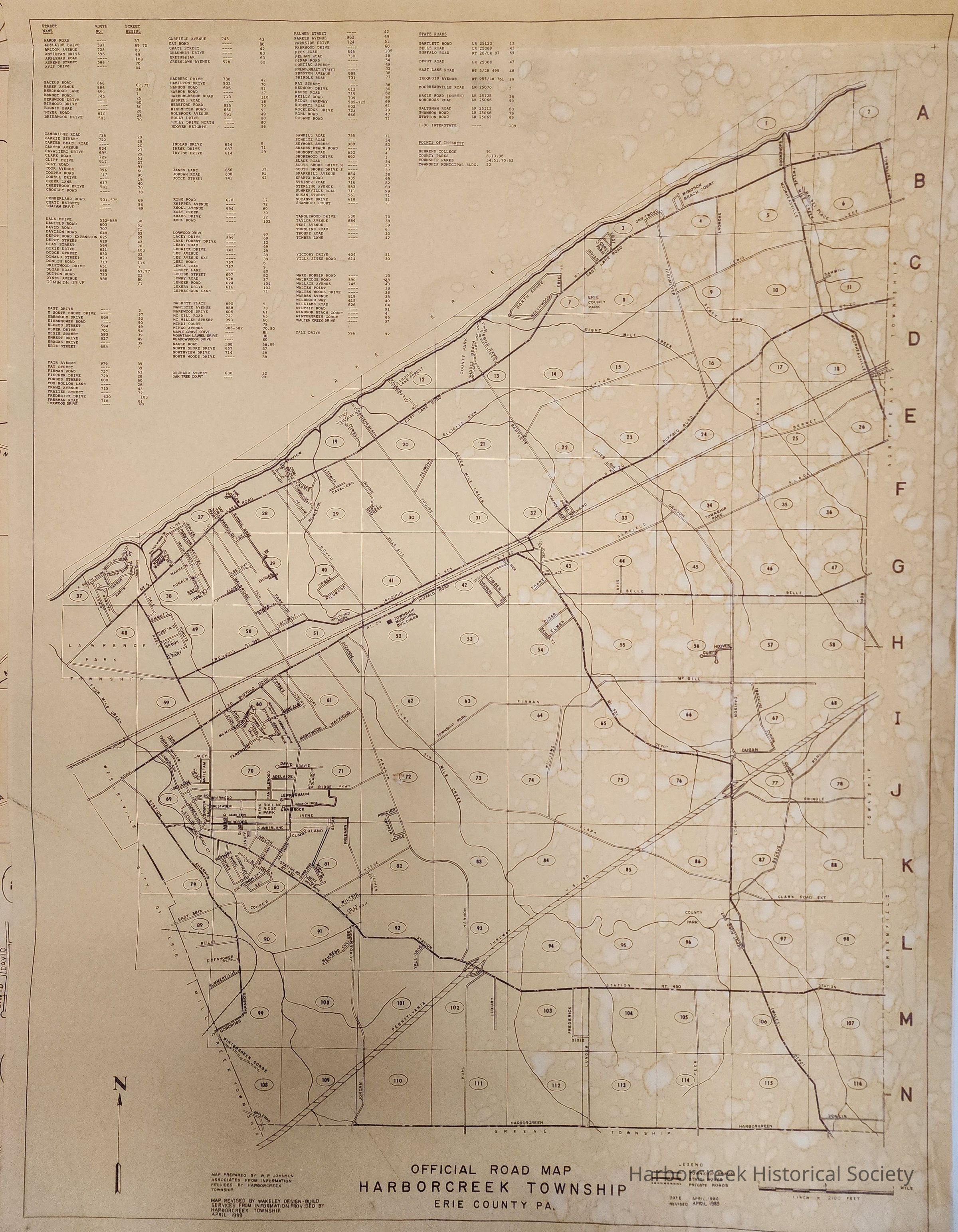
Official road map of Harborcreek Township, prepared by W.P. Johnson Associates, April 1980. Revised by Wakeley Design-Build Services, April 1989. Contains (1) original and (8) duplicates of the 18" x 24" 1980 map; (1) original 18" x 24" 1989 map; and (1) original and (4) duplicates of a 36" x 49" 1989 map.Context
Used by Brookside Fire Company for emergency response.Collection
Rolled Maps & Drawings Collection