Name/Title
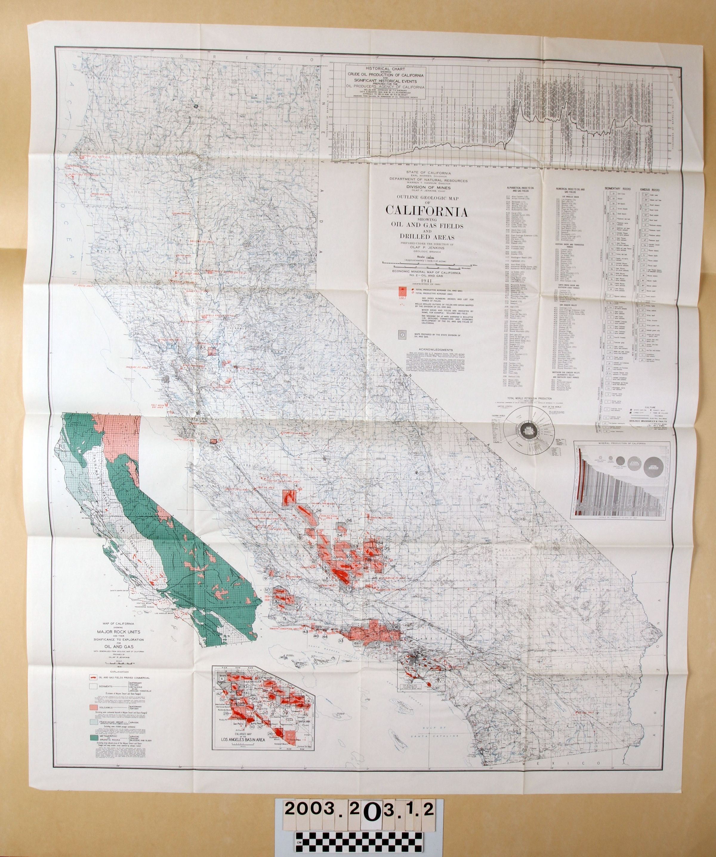
"OUTLINE GEOLOGIC MAP OF CALIFORNIA SHOWING OIL AND GAS FIELDS AND DRILLED AREAS"Entry/Object ID
2003.203.1.2Description
"OUTLINE GEOLOGIC MAP OF CALIFORNIA SHOWING OIL AND GAS FIELDS AND DRILLED AREAS"
Color: Black; Green; Pink; Red; White
"Outline Geologic Map of California Showing Oil and Gas Fields and Drilled Areas," from the bulletin "Geologic Formations and Economic Development of the Oil and Gas Fields of California," compiled by Olaf P. Jenkins, Chief of the State of California, Department of Natural Resources, Division of Mines, 1941. The item has a large state map with indications of major oil fields and many other deatils of the state's physical features. At the top right is a historical chart of important dates in California's oil history. Below that is the tile and legend. Below these is a pie chart of world petroleum production and a chart of the mineral production of California. At the lower left is a smaller state outline with geologic areas indicated in several colors and an accompanying legend. Below this is a specific enlarged map of the Los Angles basin area, including 119/37, Montebello, where the Temple lease was. Other than the original folds, the map has little or no indication of wear and is in good condition.Lexicon
Search Terms
Two-dimensional, Maps, State of California. Department of Natural Resources. Divison of Mines, Petroleum industry--California, Oil prospecting--California, Geology--California