Name/Title
"MAP OF PUBLIC SURVEYS IN CALIFORNIA," 1856Entry/Object ID
2003.225.1.1Description
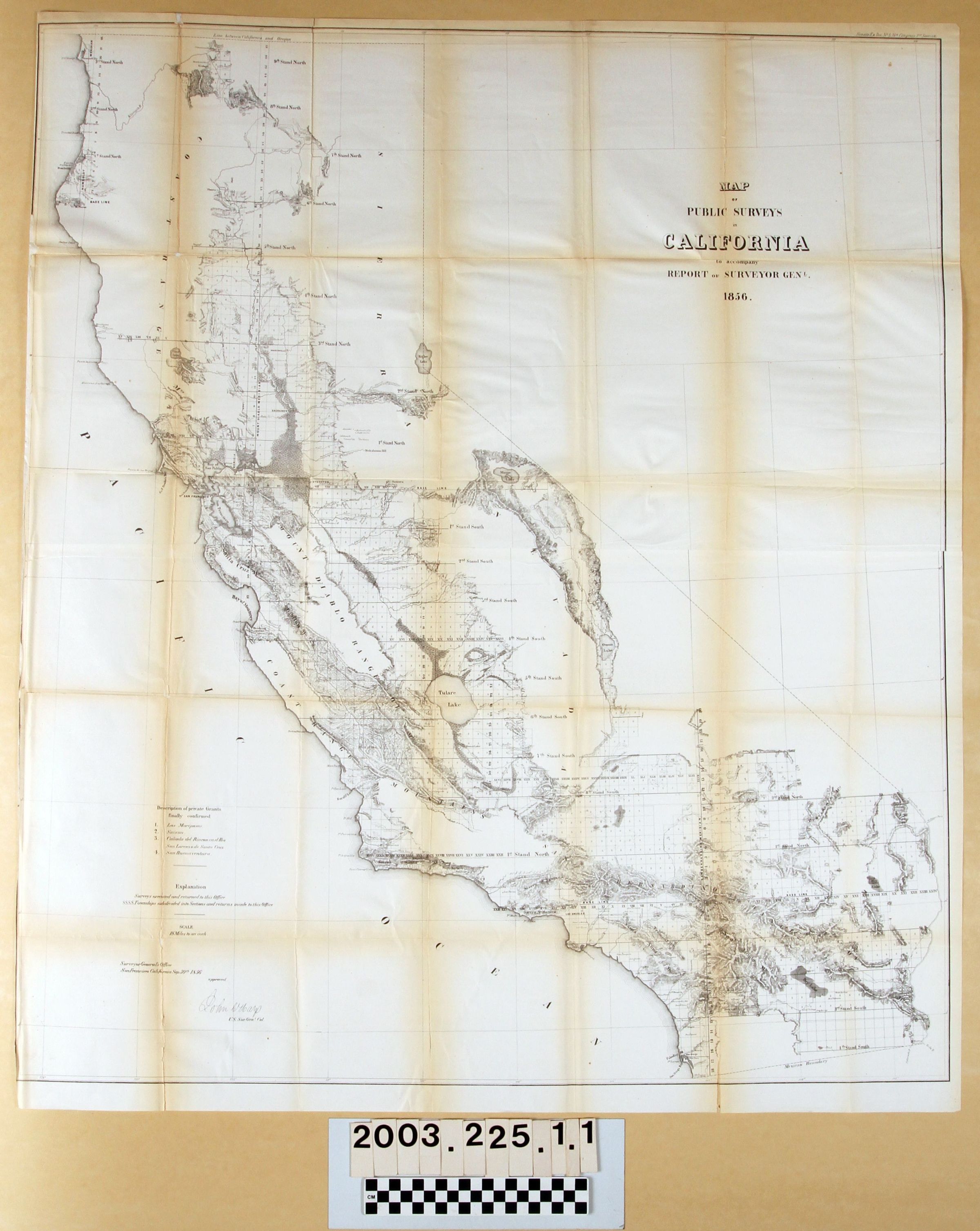
"Map of Public Surveys in California," by the U. S. Surveyor General in California, 30 September 1856. The title is at the top right with the date and indicator that the map accompanied the Surveyor General's report. At the lower left is a description by numerics of four land grants, all in central and northern California, a scale notation of eighteen miles to the inch, the date of approval by the Surveyor General at his office in San Francisco and his signature, and some explanatory notes. The map shows the progress in plotting townships in the state, with most of southern California, most of the central valley, the Bay Area, and little else done to date. Features common to maps, sucha s cities, township, and place names; mountain and hill ranges; bodies of water; rivers and creeks; valleys; and others are included. Of note, however, are the baselies, meridians, stands, and the consequent townships created from them. Also, there is a place name in then vicinity of La Puente described as "Mis[sion] Cranoras," a name seen on an 1874 map in the Museum's collection. With archival tape repairing tears along folds; brittleness; creases; light soiling; yellowing and darkening; many original folds; and some unrepaired tears, the overall condition is fair.Lexicon
Search Terms
Two-dimensional, Maps, U. S. Surveyor General, Land use surveys--California, California--Surveys, Surveys--Plotting