Name/Title
"Geologic Map of the Western Border of San Joaquin Valley, California Between the Coalinga Oil Field and Livermore Pass,"Entry/Object ID
2006.294.1.3Description
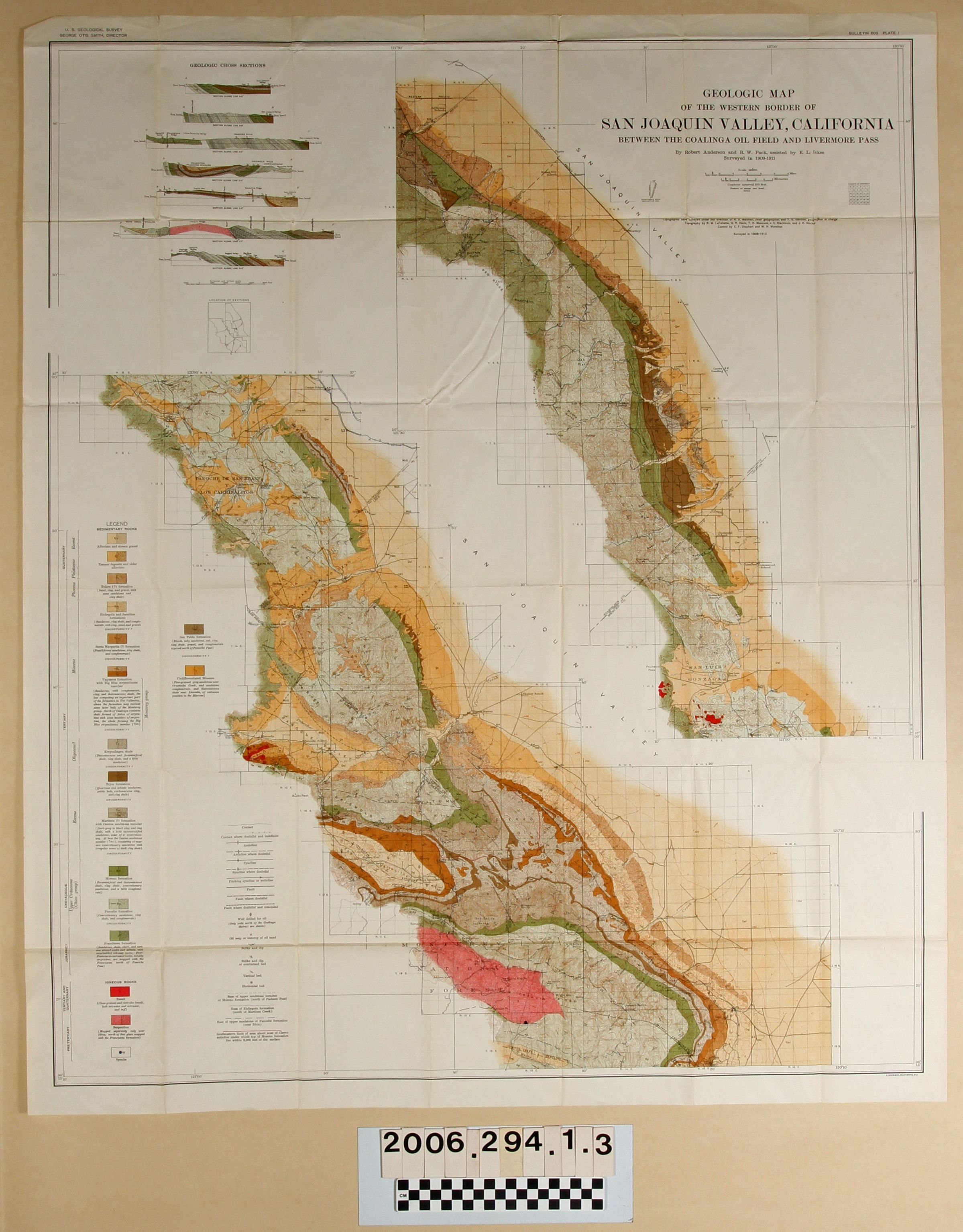
"Geologic Map of the Western Border of San Joaquin Valley, California Between the Coalinga Oil Field and Livermore Pass," by Robert Anderson and R.W. Pack, assisted by E.L. Ickes, plate 1, Bulletin 603, U.S. Geological Service, 1909-1911. The map has colored areas for specified types of igneous rock and includes geologic cross sections, as well. With original folds, creases, and some small tears and discoloration, the overall condition is good.Lexicon
Search Terms
U. S. Geological Survey, United States. Department of the Interior, Petroleum prospecting--California, Oil fields--California, Petroleum industry and trade--California, Petroleum mining--California