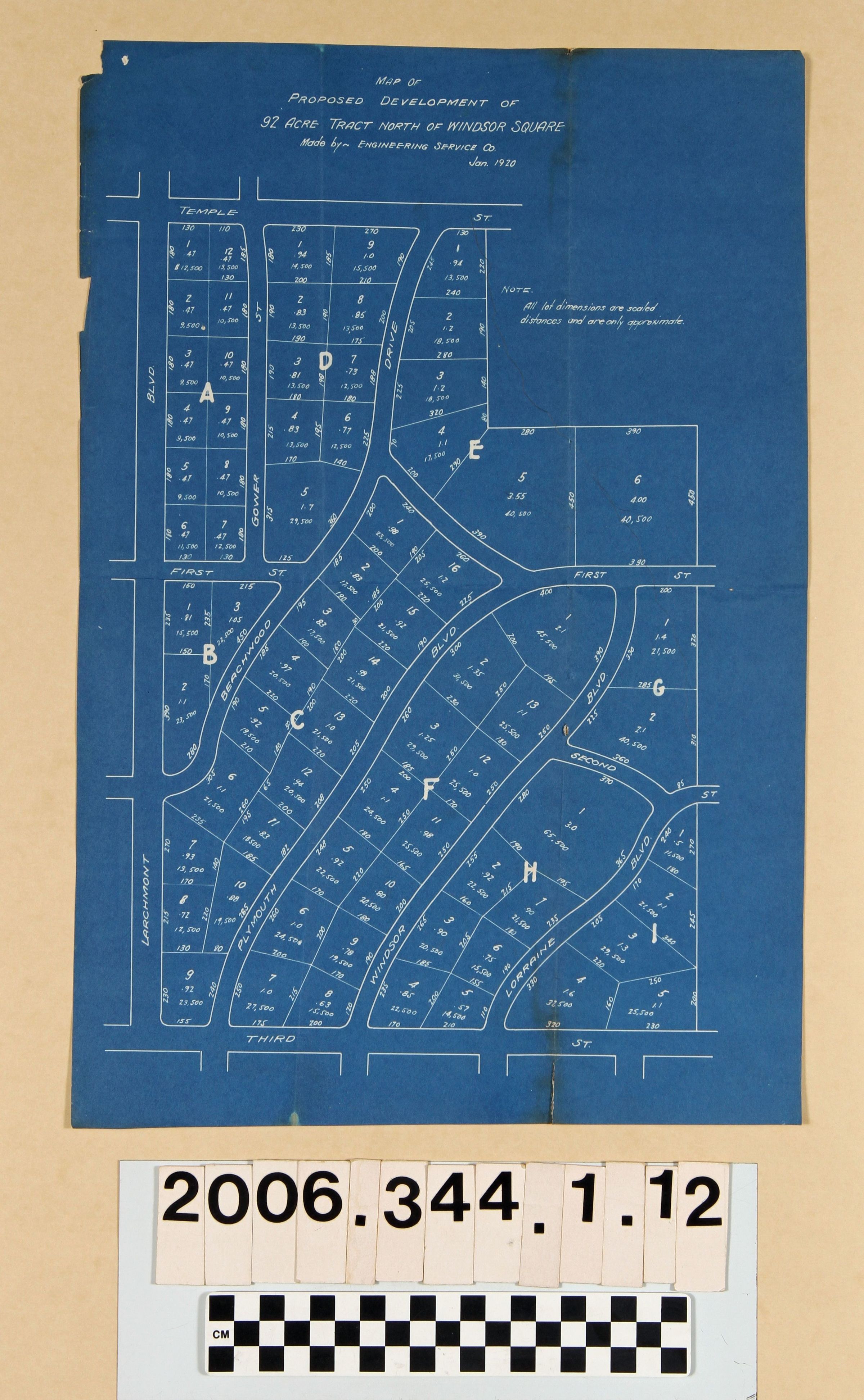
Name/Title
"Map of Proposed Development of 92 Acre Tract North of Windsor Square"Entry/Object ID
2006.344.1.12Description
"Map of Proposed Development of 92 Acre Tract North of Windsor Square," prepared by the Engineering Service Company, January 1920. The map, on blue paper, shows nine lettered blocks with individually-numbered lots within each and also providing lot sizs in feet for fronts and depth, total acreage, and prices. The area shown is from Temple Street (now Beverly Boulevard) on the north to Third Street on the south and from Larchmont Boulevard on the west to east of Lorraine Boulevard on the east. This plat and .13 and .14 are updates to the drafts of .8-.11, which had smaller lots and linear, straight streets. With original folds (including a 2-inch tear at the bottom right), creases and some edge wear, including a tear at the upper part of the left margin and a missing upper left corner, the general condition is good.Lexicon
Search Terms
Engineering Service Company, Real estate subdivisions--California--Los Angeles, Residential neighborhoods--California--Los Angeles