Name/Title
"MAP OF IRRIGATED LANDS, PUMPING PLANTS, AND DISTRIBUTING SYSTEMS IN THE REDONDO QUADRANGLE"Entry/Object ID
2003.286.1.5Description
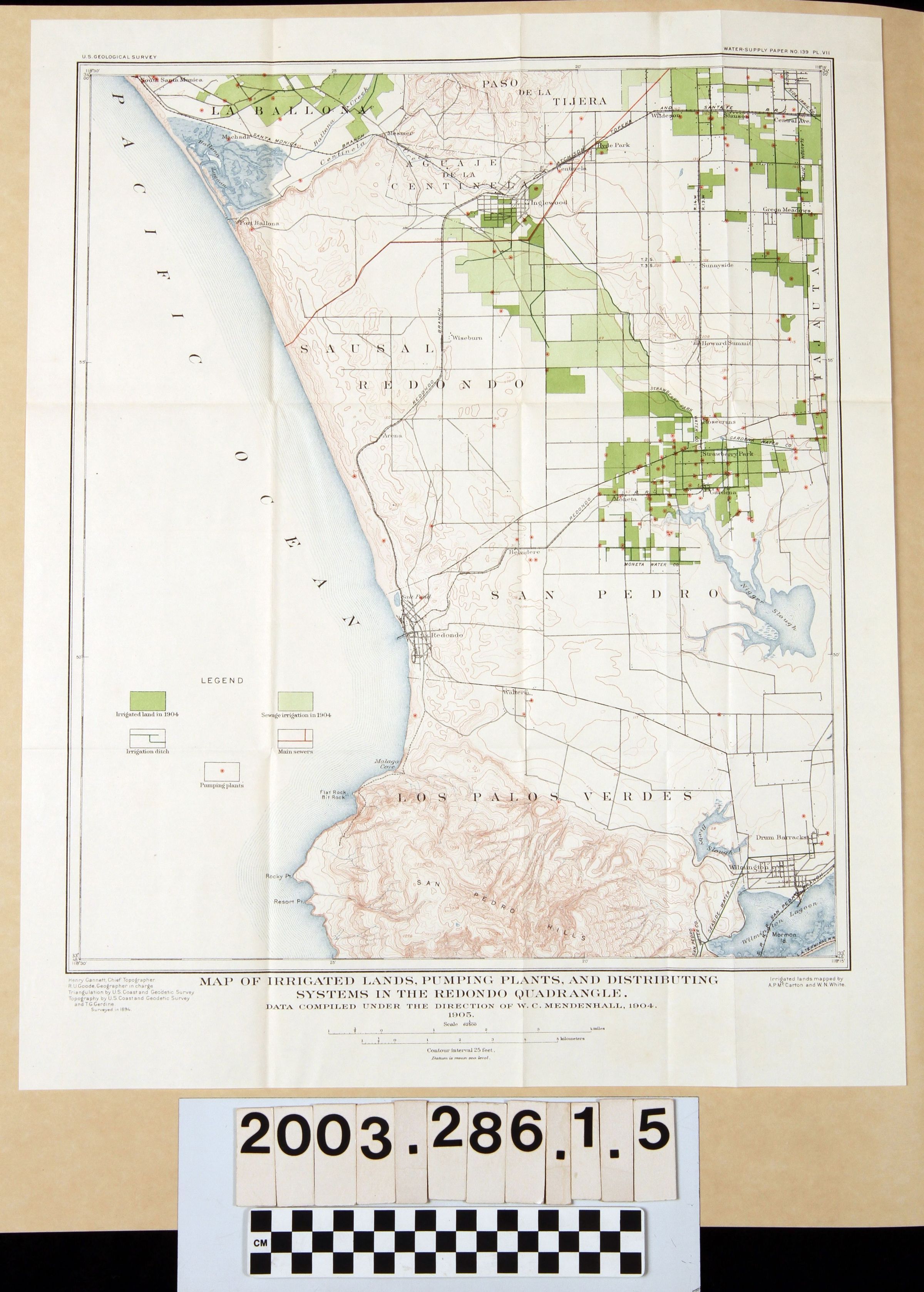
"MAP OF IRRIGATED LANDS, PUMPING PLANTS, AND DISTRIBUTING SYSTEMS IN THE REDONDO QUADRANGLE"
Color: Black; Brown; Gray; White
"Map of Irrigated Lands, Pumping Plants, and Distributing Systems in the Redondo Quadrangle," by the U. S. Geological Survey, 1904. The map shows an area from the Ballona wetlands to Palos Verdes on the west to South-Central Los Angeles and Wilmington on the east and from Inglewood on the north to the San pedro Harbor on the south. Features as cities and towns, historic rancho names, rivers and lakes, mountain and hill ranges, and other physical indicators are given. But, the subject of the map are areas in shades of green indicating regular and sewage irrigated land, irrigation ditches (in blue lines), main sewers (in red lines), and pumping plants (in red circular marks.) At the bottom is the title and scales in miles and kilometers. Other than the original folds and slight paper yellowing, the condition is good.Lexicon
Search Terms
Two-dimensional, Maps, United States. Geological Survey, Artesian basins--California, Southern, Hydrogeology--California, Southern, Hydrography--California, Southern, Irrigation--Los Angeles County (Calif.), Pumping stations--Los Angeles County (Calif.), Sewers--Los Angeles County (Calif.)