Name/Title
"Map of the United States and Canada"Entry/Object ID
2013.921.1.1Description
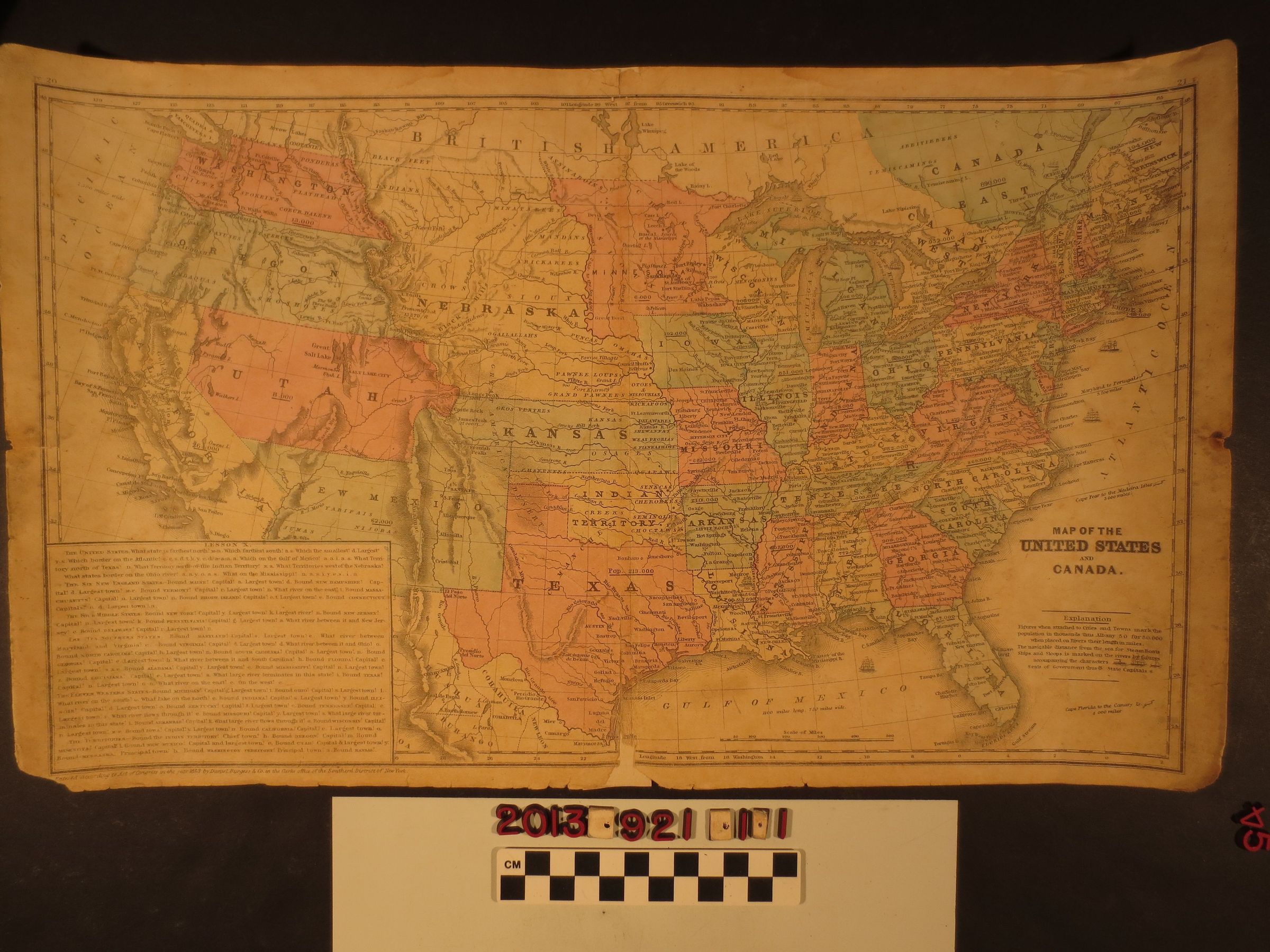
"Map of the United States and Canada," Daniel Burgess and Company, 1853. The item, part of a textbook and having a lesson box at the bottom left, shows the states and territories of the U.S. in several colors, including California and the various western territories (including the "Indian Territory" later Oklahoma) with different boundaries than what developed in succeeding years. Despite the map's title, very little of "British America" or Canada is shown. With edge tears, missing corner pieces and sections at the center fold (at the back of which is archival tape), stains and heavy soiling, the condition is fair overall.Lexicon
Search Terms
Cattle--Marking--Los Angeles County (Calif.), Cattle brands--Los Angeles County (Calif.)