Name/Title
"Los Angeles Harbor and Vicinity"Entry/Object ID
2008.284.1.5Description
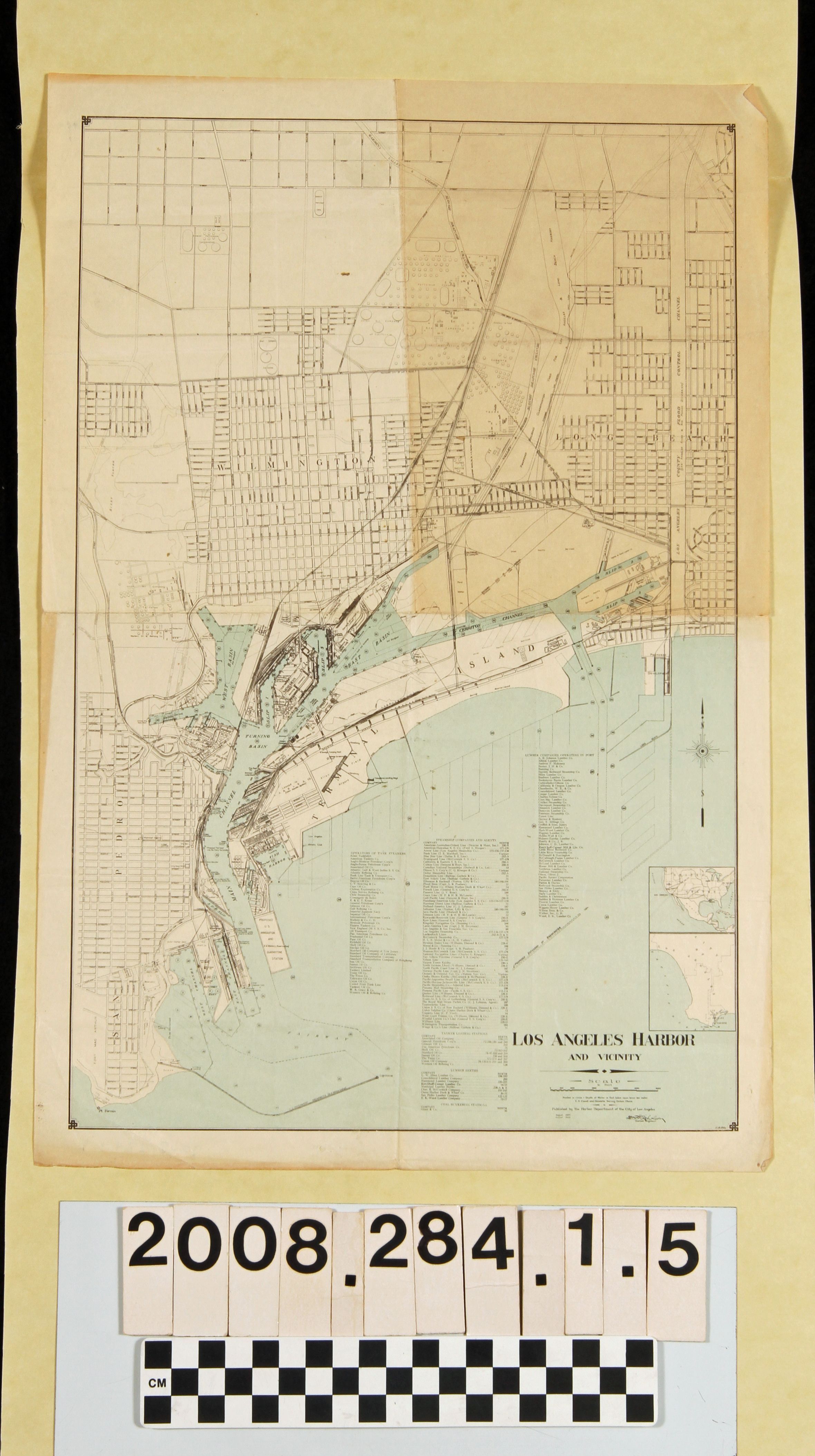
"Los Angeles Harbor and Vicinity," published by the Harbor Department of the City of Los Angeles, corrected to August 1928. The map covers from Carson Street to the north to Point Fermin to the south and from portions of San Pedro on the west to sections of Long Beach on the west. Lists of tank steamer operators, steamship companiesm tanker loading stations, lumber berths and lumber companies are at the lower right along with inset maps of the Los Angeles area and United States trade routes. The title, scale and other information are at the lower right. With soiling, some edge tears, a dogeared upper right corner, and a few small stains, the condition is fair.Lexicon
Search Terms
California. Department of Public Health. Bureau of Child Hygiene, United States. Department of Labor. Children's Bureau.