Name/Title
"COUNTRY BETWEEN SAN DIEGO AND THE COLORADO RIVER"Entry/Object ID
2005.37.1.1Description
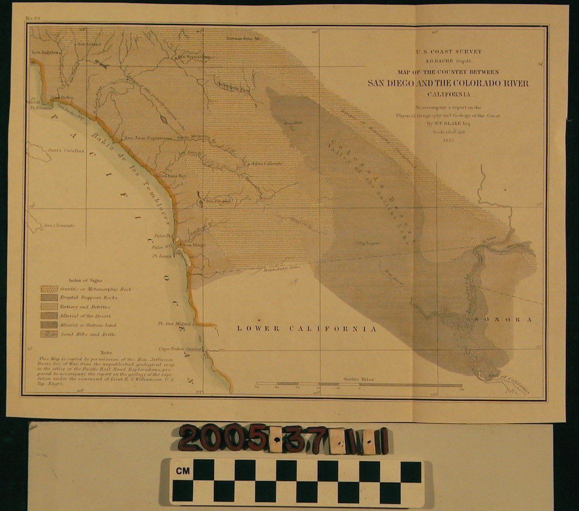
"COUNTRY BETWEEN SAN DIEGO AND THE COLORADO RIVER," 1855.
Color: Green, Yellow, Black
The map is a United States coast survey which seems to have been prepared for the purpose of railroad expansion planning. It covers portions of Southern California with specific areas shown such as Los Angeles, San Bernardino, San Pedro, San Juan Capistrano, San Luis Rey, San Diego, as well as a section of Sonora, Mexico. Jefferson Davis, Secretary of War, granted permission for the copy in which the original was made from the Pacific Railroad Explorations files. A legend is given for the various types of terrain present and a statute mile scale. It is in good condition with only minor paper creases, discoloration and foxing.Lexicon
Search Terms
California, Southern--Description and travel, Surveying--California, Southern