Name/Title

Map

Entry/Object ID

2015.023.077a

Description

Donated by Island Conservation District 
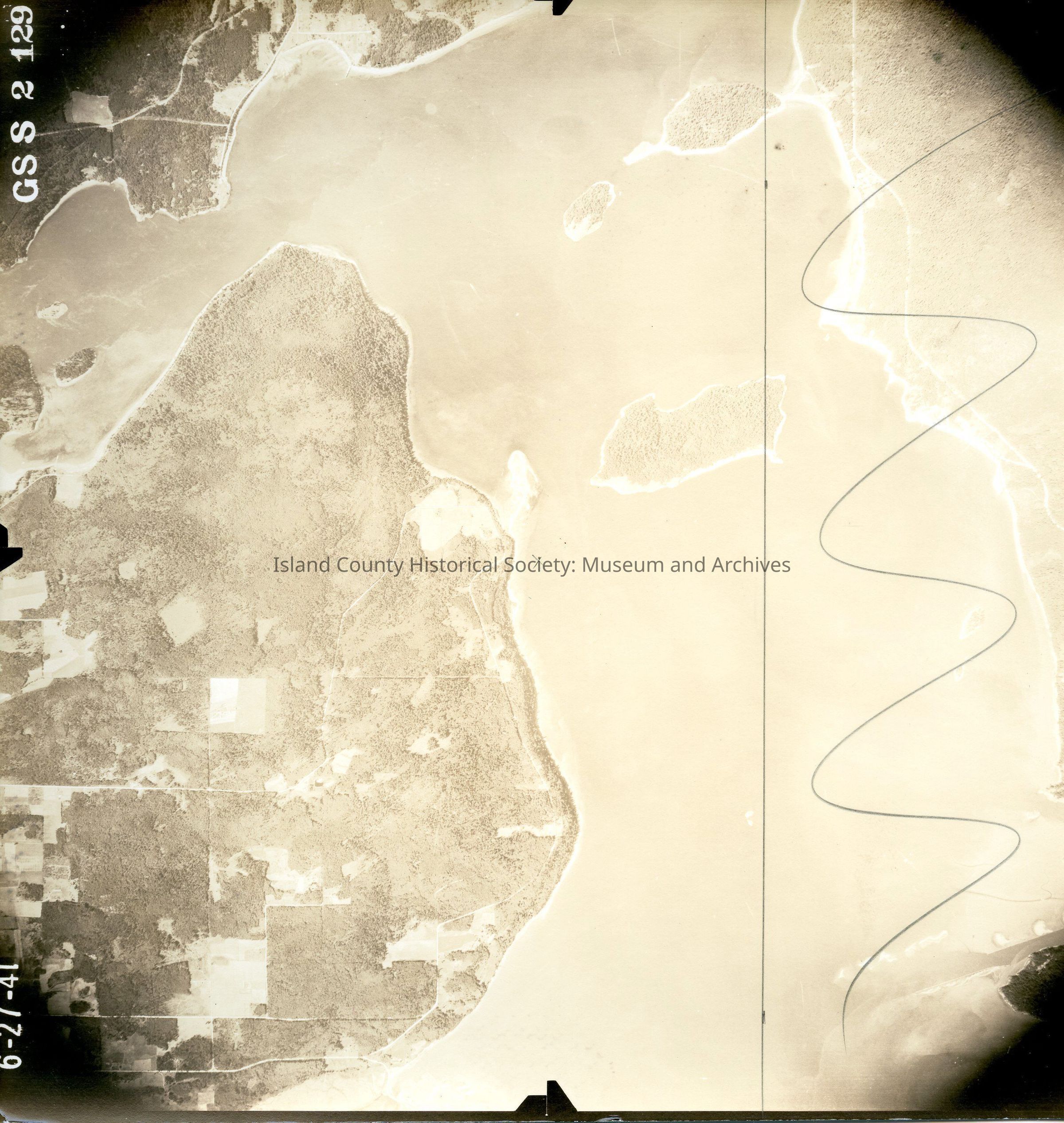
Taken on 27 June 1941 Adjoins 2015.023.076 and 2015.023.078 GSS 2 129 North Whidbey Island at top left, and Swinomish Reservation area at bottom right. Hope Island in middle with Skagit Island and Kiket Island to right. Pencil x in the center; pencil straight and curved lines. Back states "Copied Dec. 20 19(50?)" See GIS for digital copies.

Lexicon

Nomenclature 4.0

Nomenclature Secondary Object Term

Map

Nomenclature Primary Object Term

Cartograph

Nomenclature Sub-Class

Graphic Documents

Nomenclature Class

Documentary Objects

Nomenclature Category

Category 08: Communication Objects

Map Details

Area or Region

Region

Whidbey Island, Cascades and Plateau

State/Province

Washington

Continent

North America

County

Island County

Date Published

Jun 12, 2015

Medium

Photographic Paper

Relationships

Related Publications

Notes

RG 4 Maps