Donated by Island Conservation District
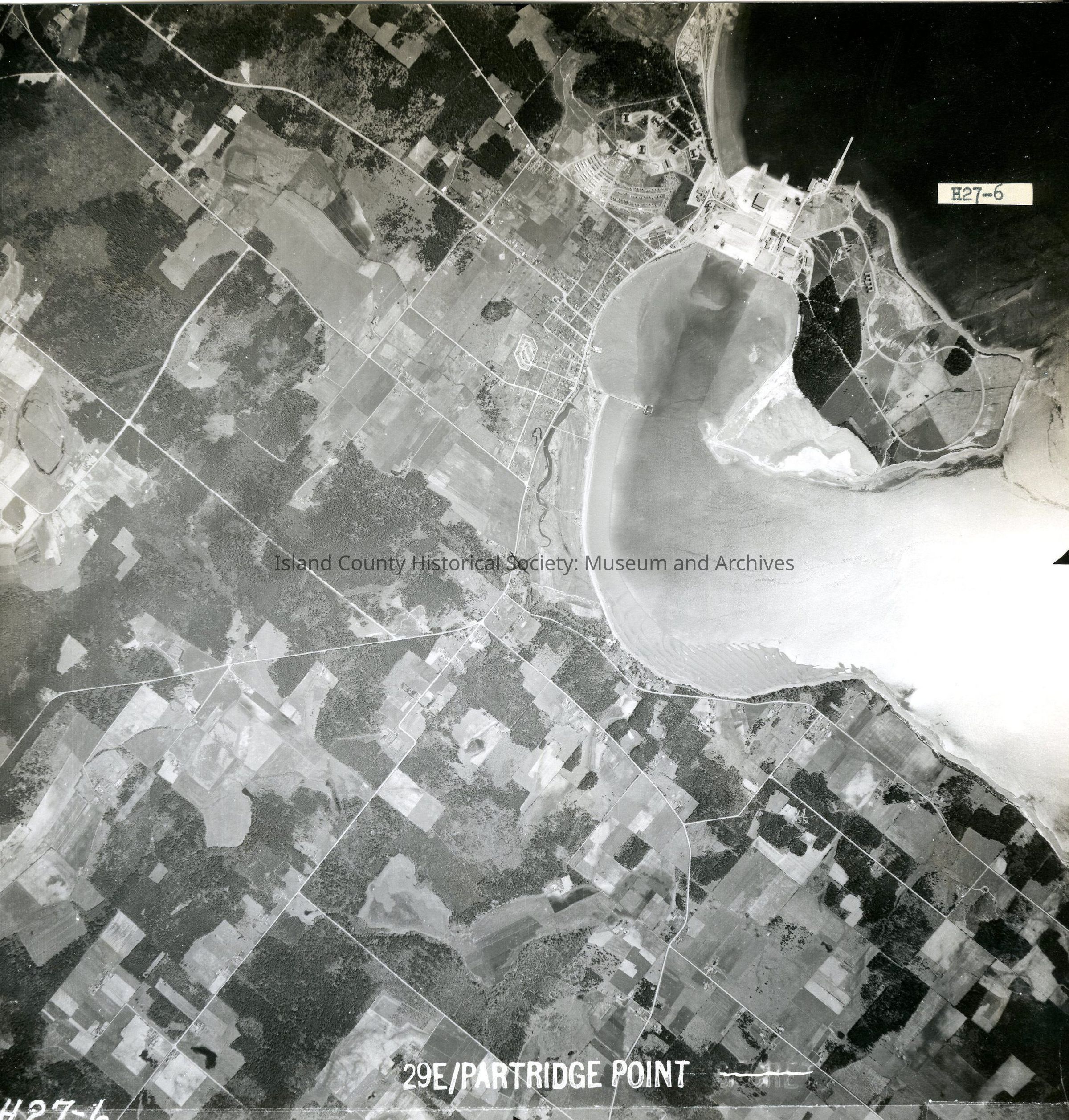
Taken on 11 June 1941
Adjoins to 2015.023.089 and .091
29E/PARTRIDE POINT
H27-6
View of Oak Harbor & adjoining land including SeaPlane Navy facility and Maylors Point.
Back states "Copied Oct. 20 1950"
See GIS for digital copies.