HUB
Collections
Classifications
About
App
Map
Map
-
Island County Historical Society
Name/Title
Map
Entry/Object ID
2015.023.113a
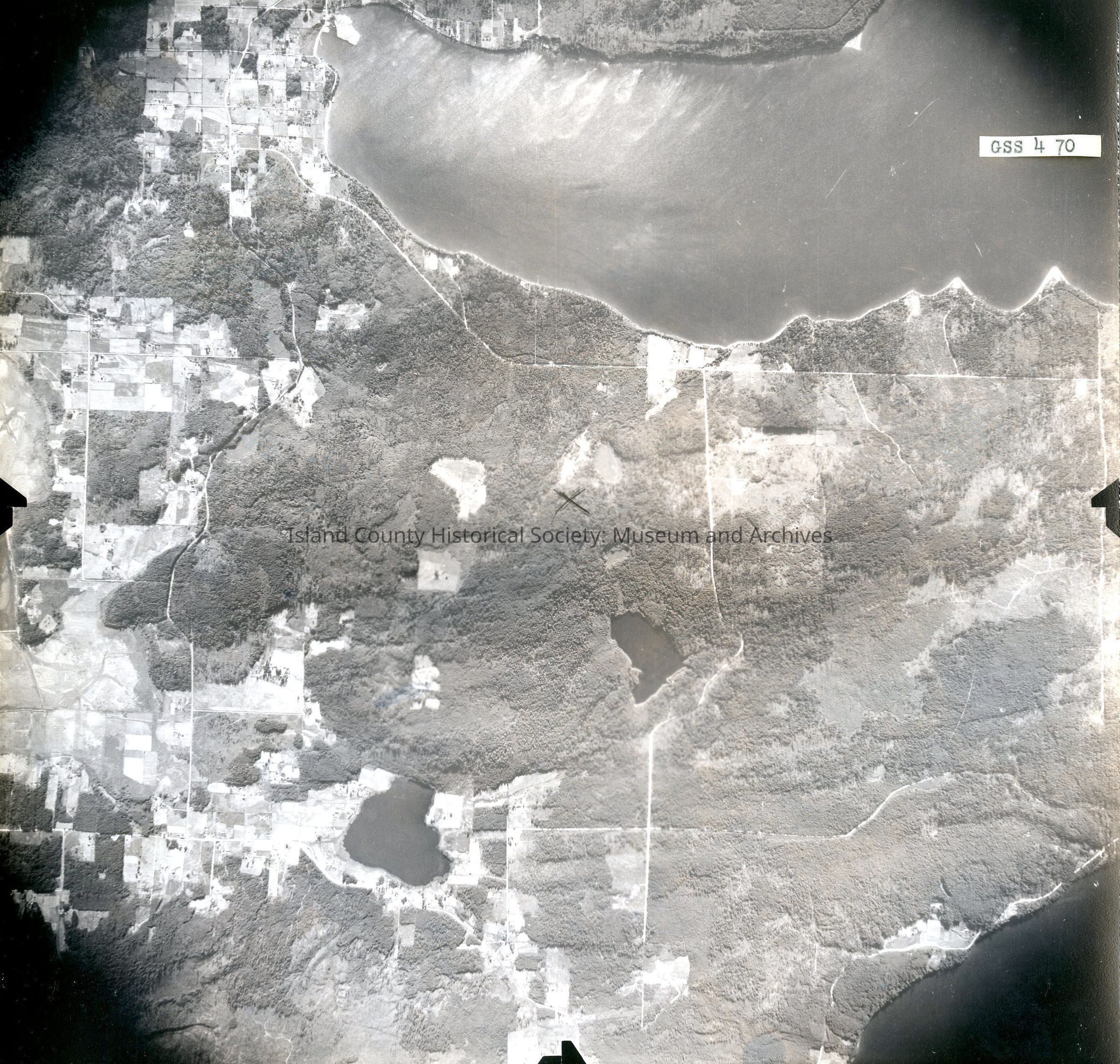
Description
Donated by Island Conservation District Taken on 11 June 1941 7-9-41 GS S 4 70 Image of Freeland and Honeymoon Bay on upper half of image and surrounding land below. On back: "Copied Dec 20 (blurred)" See GIS for digital copies.
Lexicon
Nomenclature 4.0
Nomenclature Secondary Object Term
Map
Nomenclature Primary Object Term
Cartograph
Nomenclature Sub-Class
Graphic Documents
Nomenclature Class
Documentary Objects
Nomenclature Category
Category 08: Communication Objects
Map Details
Area or Region
City
Freeland, Washington
County
Island County
State/Province
Washington
Region
Cascades and Plateau,
Whidbey Island
Continent
North America
Date Published
Jun 18, 2015
Medium
Photographic Paper
Relationships
Related Publications
Notes
RG 4 Maps