HUB
Collections
Classifications
About
App
Map
Map
-
Island County Historical Society
Name/Title
Map
Entry/Object ID
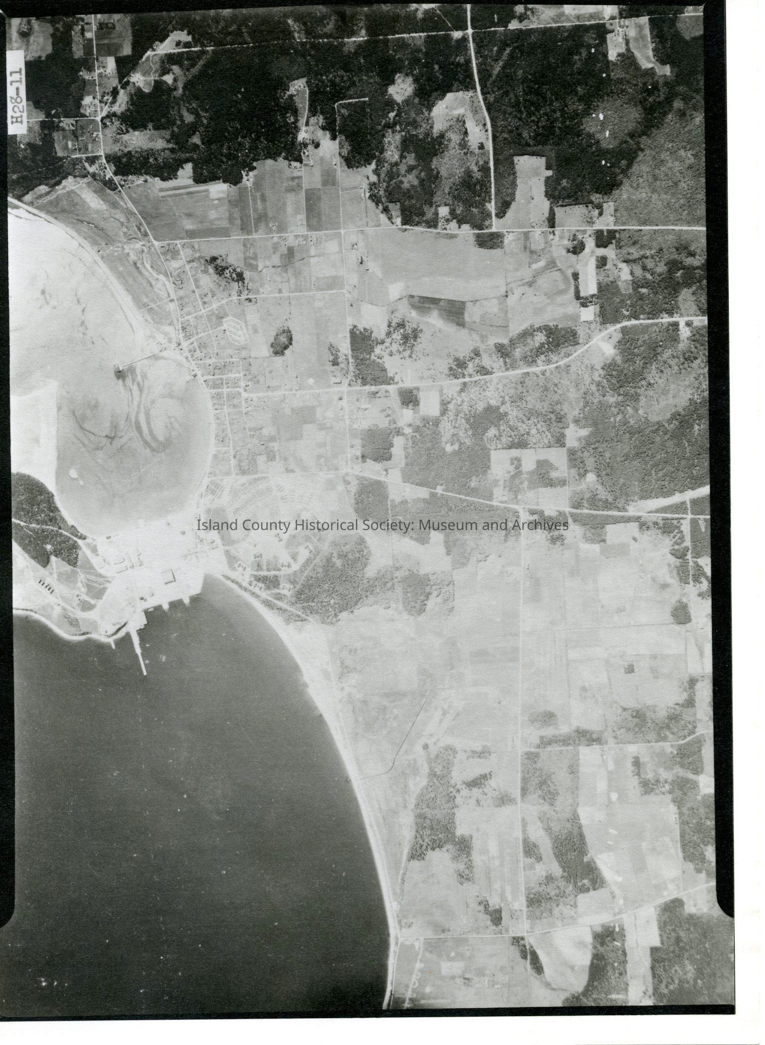
2015.023.093b
Description
Donated by Island Conservation District Taken on 11 June 1941 Adjoins to 2015.023.092 and .094 29E/PARTRIDE POINT H28-11 View of Oak Harbor and Maylors Point, Navy SeaPlane facility, and Crescent Harbor. See GIS for digital copies.
Lexicon
Nomenclature 4.0
Nomenclature Secondary Object Term
Map
Nomenclature Primary Object Term
Cartograph
Nomenclature Sub-Class
Graphic Documents
Nomenclature Class
Documentary Objects
Nomenclature Category
Category 08: Communication Objects
Map Details
Area or Region
City
Oak Harbor, Washington
Region
Whidbey Island,
Cascades and Plateau
State/Province
Washington
Continent
North America
County
Island County
Date Published
Jul 17, 2015
Medium
Photographic Paper
Relationships
Related Publications
Notes
RG 4 Maps