Name/Title

Map

Entry/Object ID

2017.028.054

Scope and Content

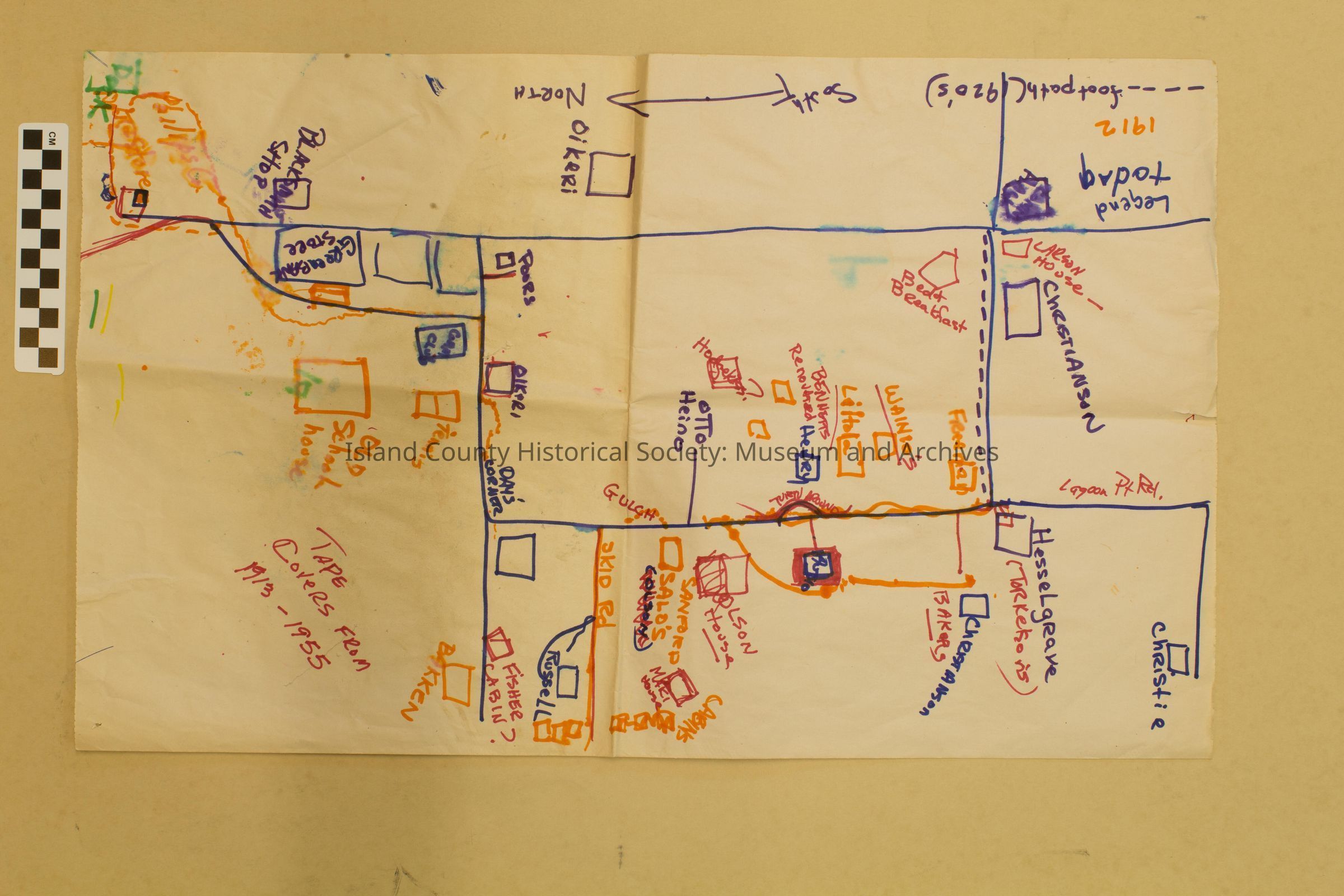
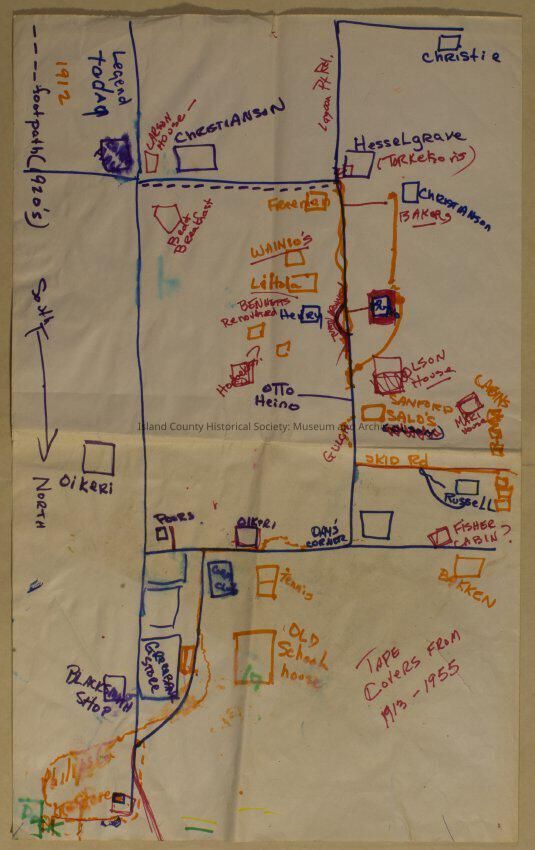
Hand-drawn map of portion of Whidbey Island; Greenbank area. Red, blue and orange felt tips used to sketch out approx. where Nordic families resided in relation to each other in Greenbank during the early 1900s. Includes names of families/persons, road names and other well-known buildings in the vicinity.

Lexicon

Nomenclature 4.0

Nomenclature Secondary Object Term

Map

Nomenclature Primary Object Term

Cartograph

Nomenclature Sub-Class

Graphic Documents

Nomenclature Class

Documentary Objects

Nomenclature Category

Category 08: Communication Objects

Archive Details

Archive Size/Extent

14"x 23"