Name/Title
MapEntry/Object ID
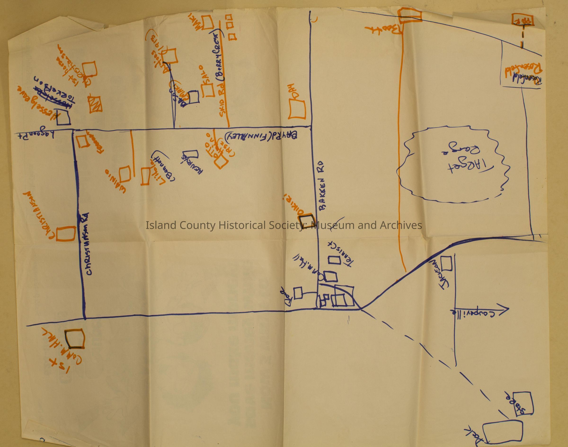
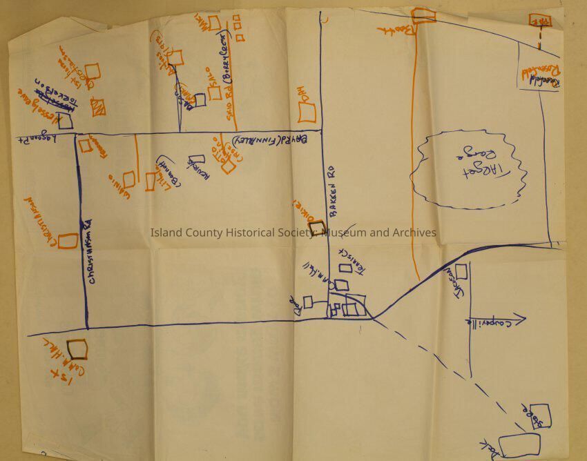
2017.028.079Scope and Content
Hand-drawn map of portion of Whidbey Island; Greenbank area, Finn Alley. Shows houses of Nordic families near Coupeville and Target Range. Drawn in blue and orange felt tip pen. Includes Lagoon Point, Christianson Rd, and Bay Rd (Finn Alley). Houses includes the Christianson houses, the Autio, Liitola, Wainio, Maki and Salo amongst others.Lexicon
Nomenclature 4.0
Nomenclature Secondary Object Term
MapNomenclature Primary Object Term
CartographNomenclature Sub-Class
Graphic DocumentsNomenclature Class
Documentary ObjectsNomenclature Category
Category 08: Communication ObjectsArchive Details
Archive Size/Extent
28"x 22"