HUB
Collections
Classifications
About
App
Map - Freeland
Map
-
Island County Historical Society
Name/Title
Map - Freeland
Entry/Object ID
2015.023.251
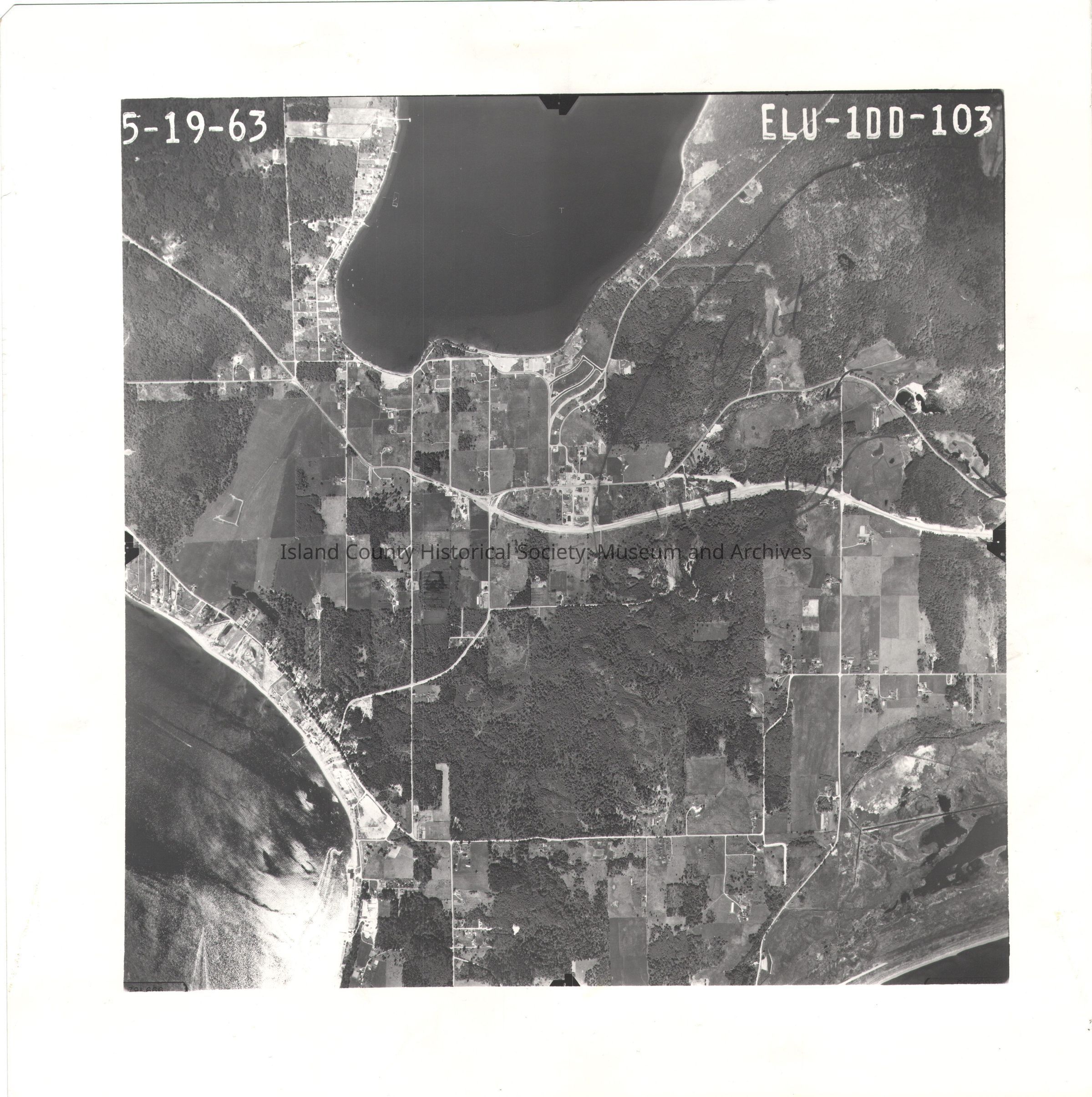
Description
Donated by Island Conservation Adjacent to 2015.023.250 and .252 5-19-63 ELU-1DD-103 Photo taken 19 May 1963 Holmes Harbor Freeland Mutiny Bay Pencil lines drawn around Freeland and the roads. See GIS for digital copies.
Lexicon
Nomenclature 4.0
Nomenclature Secondary Object Term
Map
Nomenclature Primary Object Term
Cartograph
Nomenclature Sub-Class
Graphic Documents
Nomenclature Class
Documentary Objects
Nomenclature Category
Category 08: Communication Objects
Map Details
Area or Region
Region
Whidbey Island,
Cascades and Plateau
State/Province
Washington
Continent
North America
County
Island County
Date Published
Jul 24, 2015
Medium
Photographic Paper
Relationships
Related Publications
Notes
RG 4 Maps