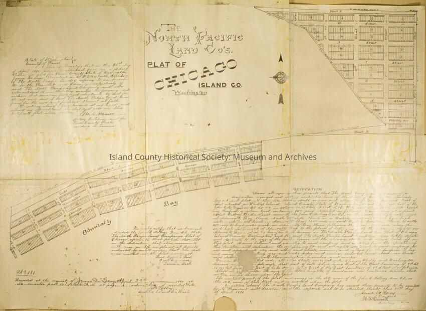
The North Pacific Land Company Plat of Chicago Island of Washington
Entry/Object ID
2017.047.002
Scope and Content
This is a map of the 1890 platted town of Chicago which was developed by the North Pacific Land Company. The map shows areas that were be developed for homes, businesses, bridge and a hotel. The map which was originally white has now yellowed due to age. Admiralty bay is distinguishable on the map as well as writing but most is undistinguishable.