HUB
Collections
Classifications
About
App
Map
Archive
-
Island County Historical Society
Name/Title
Map
Entry/Object ID
2015.005.047
Scope and Content
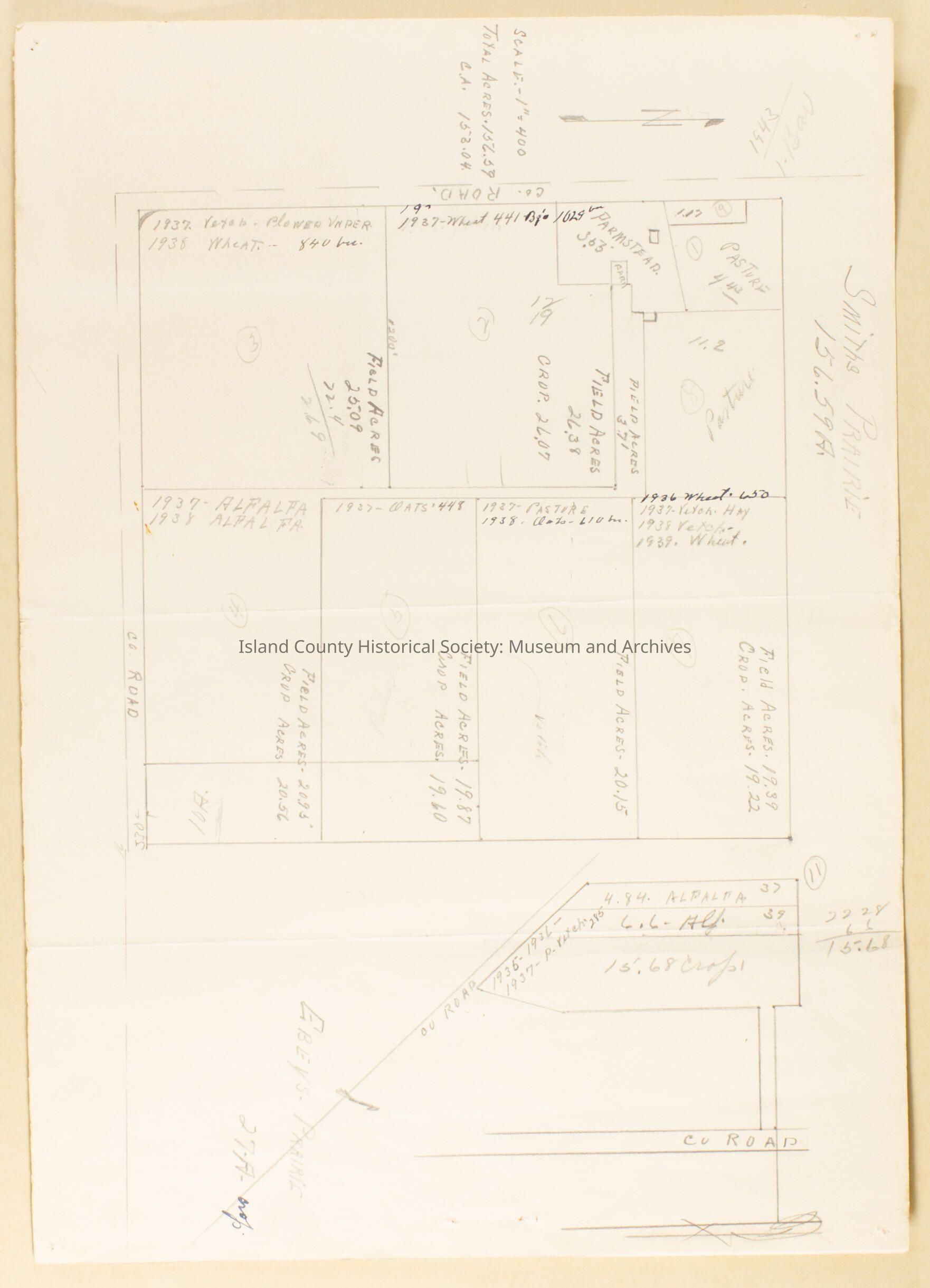
Smith's Prairie map showing crops grown on each plot and the acreage. 1936-1939. Front & back.
Lexicon
Nomenclature 4.0
Nomenclature Secondary Object Term
Map
Nomenclature Primary Object Term
Cartograph
Nomenclature Sub-Class
Graphic Documents
Nomenclature Class
Documentary Objects
Nomenclature Category
Category 08: Communication Objects
Archive Details
Date(s) of Creation
1936 - 1939