HUB
Collections
Classifications
About
App
Map
Archive
-
Island County Historical Society
Name/Title
Map
Entry/Object ID
2019.FIC.046
Scope and Content
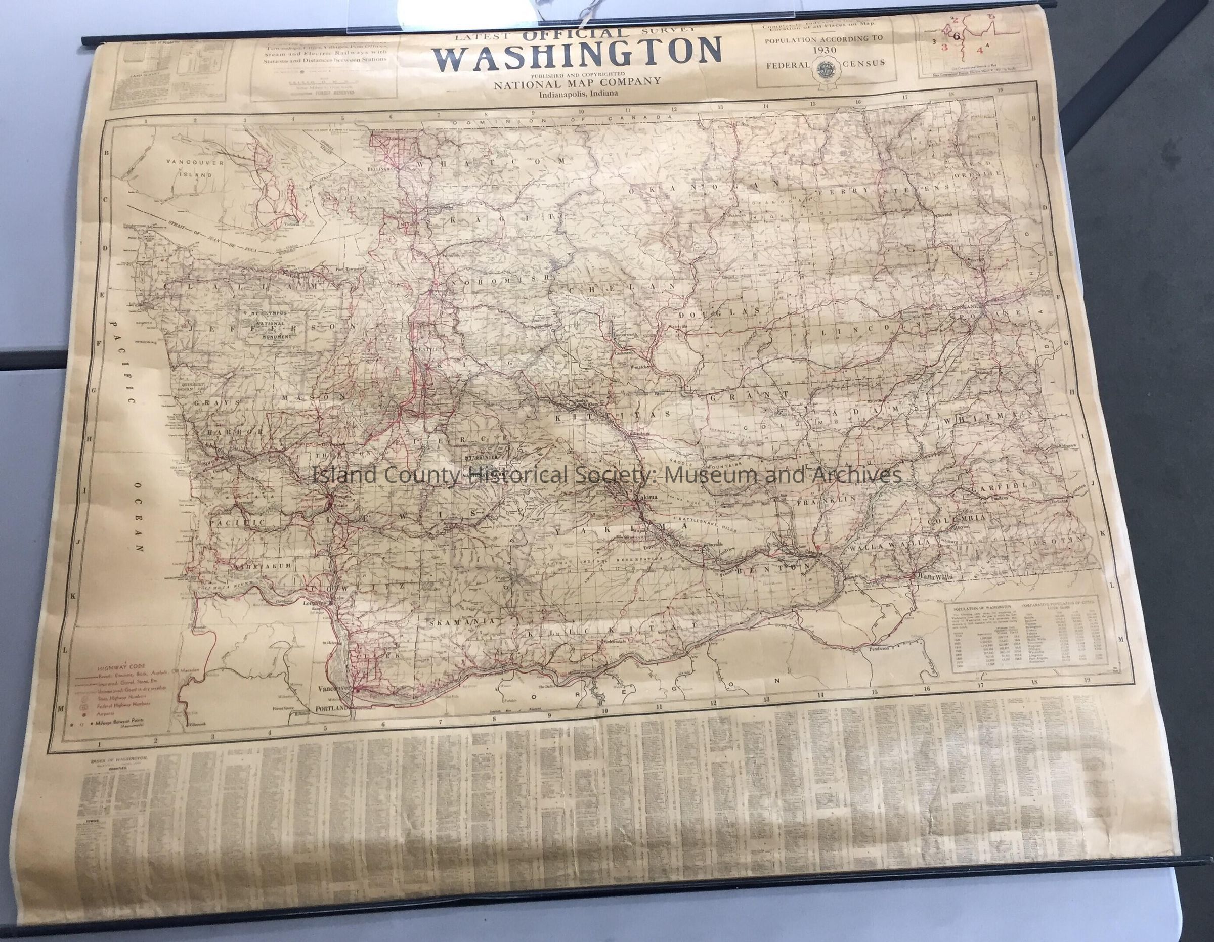
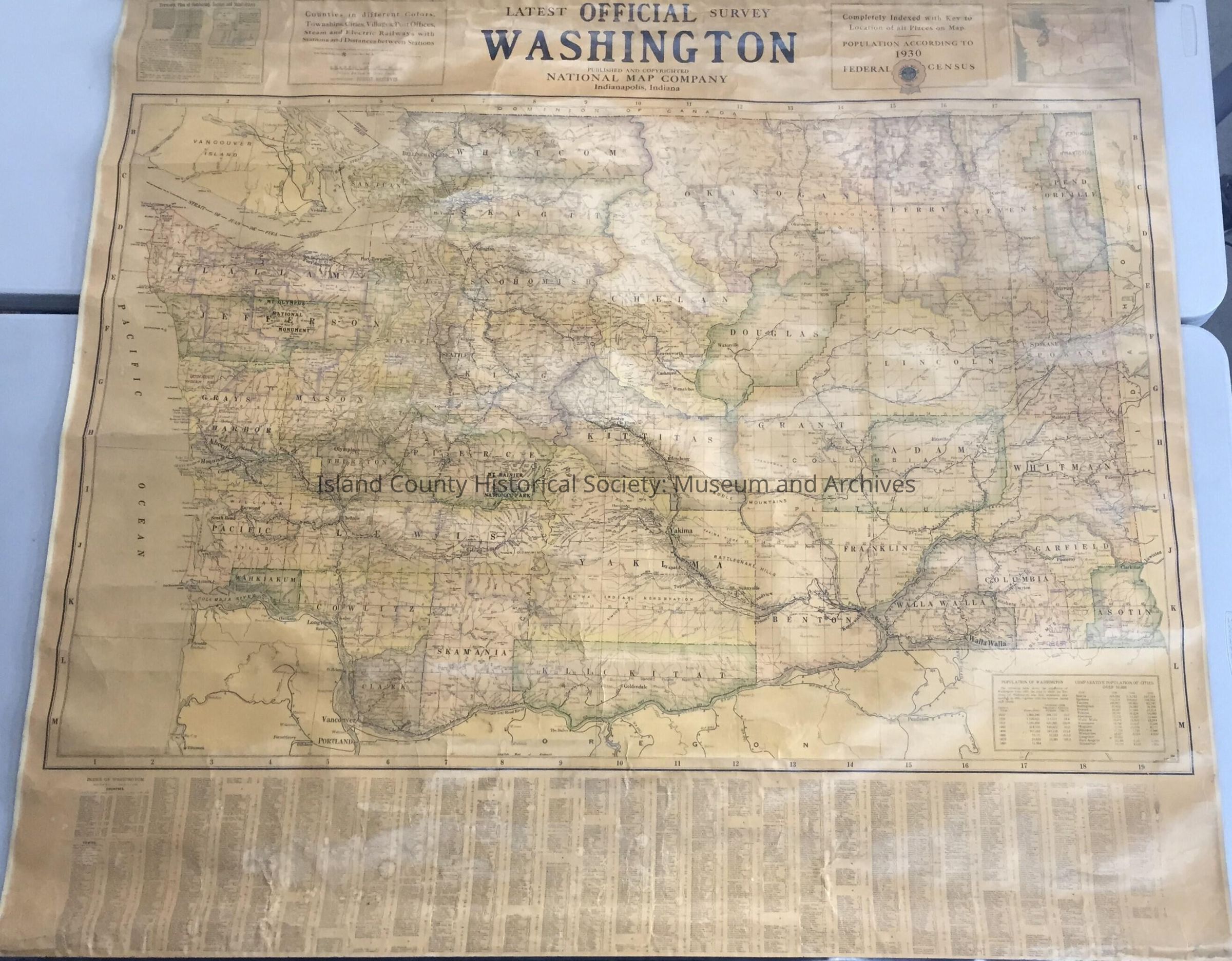
Map of Washington, 1930 Latest Official Survey Washington National Map Company, Indigenousapolis, Indigenousa Two-sided map, one side has roads and railways marked in red, the other is more political and geographic. 4'4"W x 3'9"H
Lexicon
Nomenclature 4.0
Nomenclature Secondary Object Term
Map
Nomenclature Primary Object Term
Cartograph
Nomenclature Sub-Class
Graphic Documents
Nomenclature Class
Documentary Objects
Nomenclature Category
Category 08: Communication Objects