Name/Title
Postcard, Photographic, PhotographicEntry/Object ID
2013.049.056Description
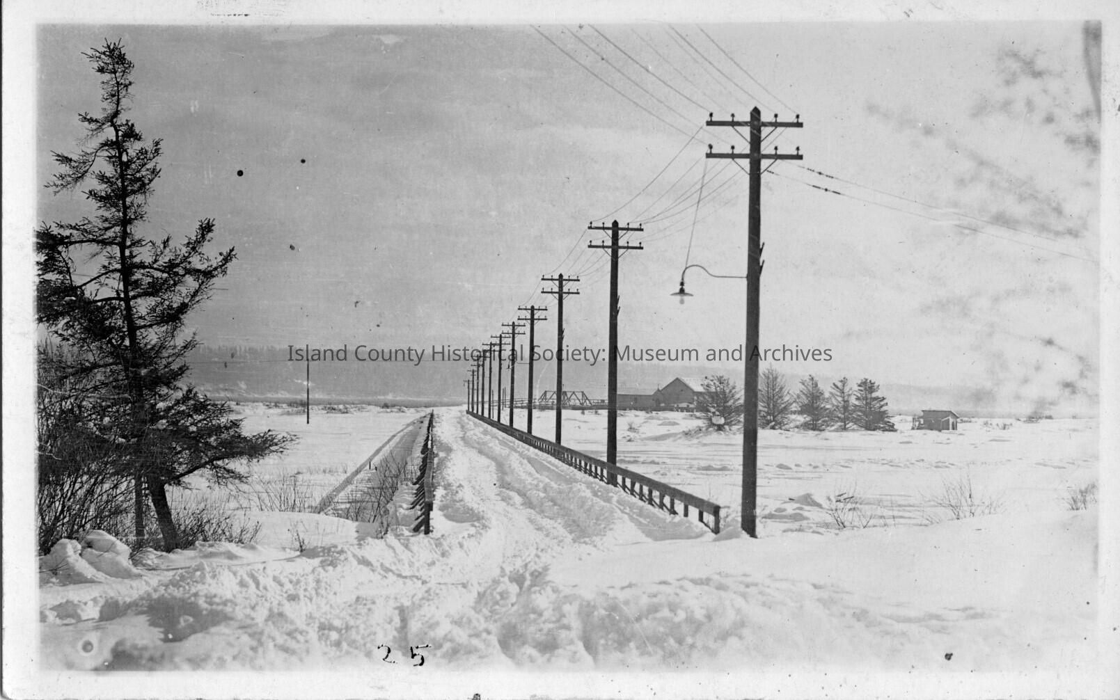
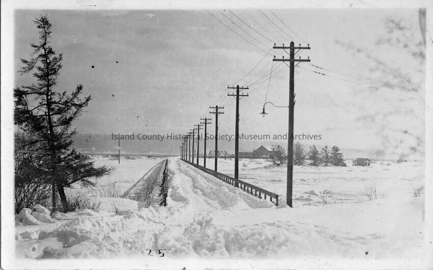
Deep snow on a Whidbey Island road. This is the bridge that crosses Crockett Lake from Ft. Casey to to Keystone beach. The picture was taken in January of 1916- the big snow on Whidbey Island.
3/23/2016 Update: The location of the camera is facing east south east. The current location is in front of the Ft Casey Power House. The bridge crosses a wetland and curves south to the Quartermaster Wharf. Keystone Harbor wasn't constructed or named until 1948. Keystone was a small village and the Ferry Landing on the east end of Crockett Lake. SJKMade/Created
Date made
Jun 24, 2013Place
Region
Whidbey Island, Cascades and PlateauState/Province
WashingtonContinent
North AmericaCounty
Island CountyNotes
Medium: PostcardRelationships
Related Person or Organization
Person or Organization
Steiner, Joe Mrs