Name/Title

Photograph

Entry/Object ID

2019.034.143

Description

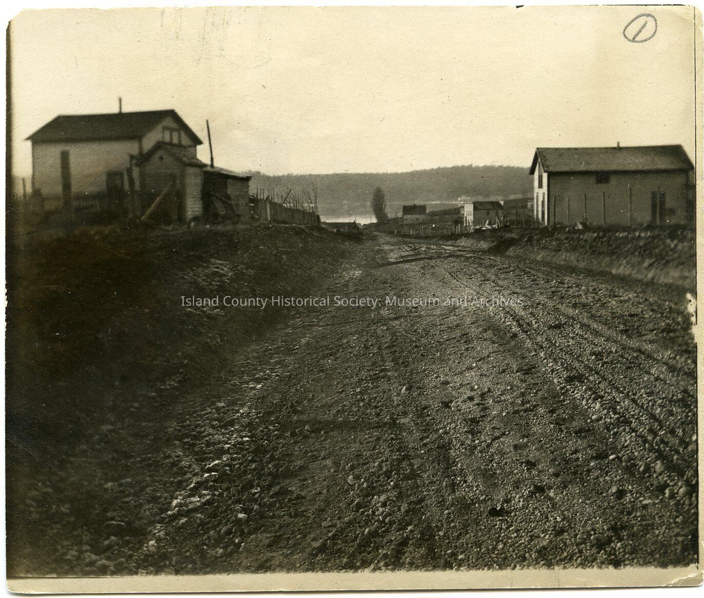
Photo of a two-lane dirt road with a couple buildings on either side. Cove in the distance. Probably the Holbrook house in the distance. This is probably along what is now (2019) SR 20 descending the hill in San de Fuca towards the curve around the Cove. Written on the back: West end of road. Looking down hill in San de Fuca. Trees at end of road are in what is now Standard Oil Co. tank yard. This road began near store in San de Fuca and ran to Watson's Corner. It is now part of Secondary State Highway No 1-D. B.B. 9-29-51 From accession book: Roads built by Burwell Bantz near San de Fuca 1913 (71-100A-J) From folder: San de Fuca General Photos

Made/Created

Date made

1950

Place

City

San de Fuca, Washington

Region

Whidbey Island, Cascades and Plateau

State/Province

Washington

Continent

North America

County

Island County

Notes

Medium: Photographic Paper

Lexicon

Nomenclature 4.0

Nomenclature Primary Object Term

Photograph

Nomenclature Sub-Class

Graphic Documents

Nomenclature Class

Documentary Objects

Nomenclature Category

Category 08: Communication Objects

Relationships

Related Person or Organization

Person or Organization

Holbrook

Person or Organization

Bantz, Burwell

Related Publications

Notes

RG 10