Name/Title
PhotographEntry/Object ID
2019.042.024Description
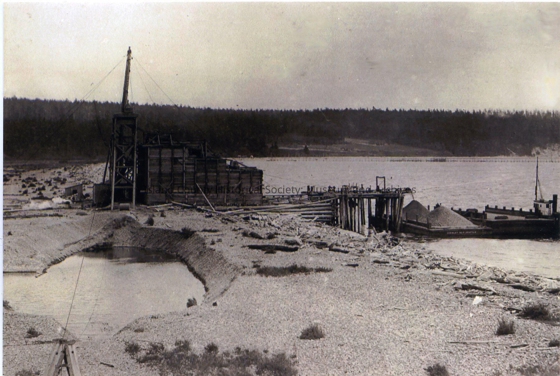
Photo of the Keystone area near the ferry landing. A boat/tug is on the right next to a low wharf with gravel pouring from a higher wharf. There are two gravel piles. A wood structure with a tall pole is on the left. a printed copy of the photo with text: 1913. Early Keystone Bunkers: sand, gravel, tug and scow. First hole. Fish trap before 1934. Doc Sargent farm in background. Sold by Wylie Hesselgrave to Pioneer Sand and Gravel Co. of Seattle, 1928. Courtesy of Michael F. Clark, 1995
From folder: Coupeville, Business, Keystone Sand and GravelMade/Created
Place
City
Coupeville, WashingtonCounty
Island CountyState/Province
WashingtonRegion
Cascades and Plateau, Whidbey IslandContinent
North AmericaNotes
Medium: Photographic PaperLexicon
Nomenclature 4.0
Nomenclature Primary Object Term
PhotographNomenclature Sub-Class
Graphic DocumentsNomenclature Class
Documentary ObjectsNomenclature Category
Category 08: Communication Objects