Name/Title
Maylor's PointEntry/Object ID
2014.011.091Description
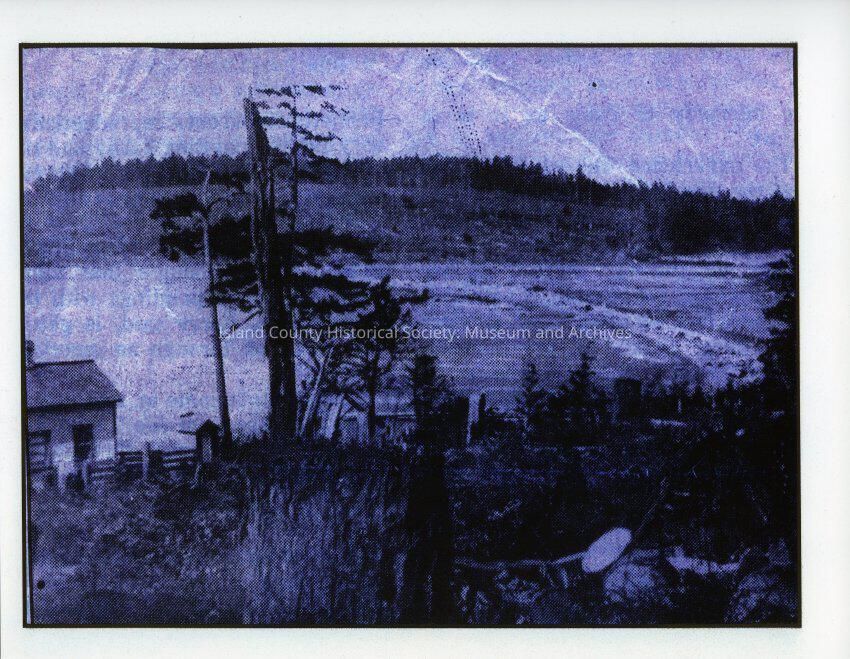
View pictured from Maylor's Point, with Paul Maylor's cabin at lower left. Looking north, the land, now occupied by the Oak Harbor Marina, with the Seaplane Base to the right... The partly wooded hill is now Saratoga Heights housing. At the bottom of the bluff, in background, was The Big Spring, where Indigenous Peoples stopped for water.Made/Created
Date made
Sep 22, 2014Place
City
Oak Harbor, WashingtonRegion
Whidbey Island, Cascades and PlateauState/Province
WashingtonContinent
North AmericaCounty
Island CountyNotes
Medium: Photographic PaperLexicon
Nomenclature 4.0
Nomenclature Secondary Object Term
Print, PhotographicNomenclature Primary Object Term
PhotographNomenclature Sub-Class
Graphic DocumentsNomenclature Class
Documentary ObjectsNomenclature Category
Category 08: Communication ObjectsRelationships
Related Person or Organization
Person or Organization
Maylor, PaulRelated Publications
Notes
RG32/ Oak Harbor/ Historical Photos/ Box 7