HUB
Collections
Classifications
About
App
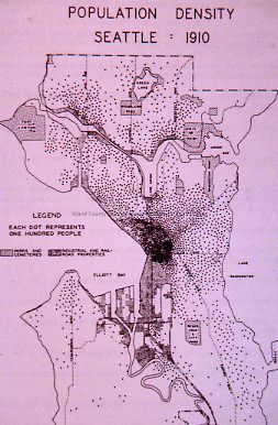
Seattle Population Density Map
Photograph
-
Island County Historical Society
Name/Title
Seattle Population Density Map
Entry/Object ID
2025.001.063
Description
Photograph of a diagram showing Seattle's population density in 1910.
Photograph Details
Subject Place
City
Seattle
State/Province
Washington
Country
United States of America
Continent
North America
Relationships
Related Places
Place
City
Seattle
State/Province
Washington
Country
United States of America
Continent
North America